
Hide
--- TEST SYSTEM --- TEST SYSTEM --- TEST SYSTEM ---
Hide
Rennington
hide
Hide
hide
Hide
Hide
Hide
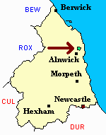
"RENNINGTON is a chapelry, township, and village, the property of the Duke of Northumberland, and comprises 1,812 acres, of which the rateable value is £2,069 18s. Its population in 1801, was 252; in 1811, 270; in 1821, 272; in 1831, 273; in 1841, 245; and in 1851, 269 souls. THE VILLAGE of Rennington occupies a sheltered situation three and three quarter miles north-east by north of Alnwick. THE CHAPEL, dedicated to All Saints, is an ancient edifice, the register of which commences in 1768." [From History, Topography, and Directory of Northumberland, Whellan, 1855].
"RENNINGTON, a chapelry in the parish of EMBLETON, southern division of BAMBROUGH ward, county of NORTHUMBERLAND, ...." [Samuel Lewis Topographical Dictionary of England 1831 © Mel Lockie]
Hide
- Northumberland County Record Office holds copies of Census Returns 1841 - 1891 and provides a useful User Guide
- The 1851 Census Index (microfiche CN33)
- 1891Census Northumberland – Embleton (Edlingham, Eglingham, Longhoughton, Craster, Dunstan, Embleton, Newton by the Sea, Rock and Rennington (PRO piece RG12/4265) (Type B) (Book) (Volume 75) Both published by the https://www.ndfhs.org.uk/ may be of value to researchers interested in this parish.
- Rennington - Church Records - links and information.
- This area is within Northumberland North Second Registration District.
- Certificates of birth, death and marriage can be ordered from Northumberland County Council.
- The section of The National Gazetteer (1868) relating to this parish - transcribed by Colin Hinson.
- Ask for a calculation of the distance from Rennington to another place.
You can see maps centred on OS grid reference NU213185 (Lat/Lon: 55.459889, -1.664723), Rennington which are provided by:
- OpenStreetMap
- Google Maps
- StreetMap (Current Ordnance Survey maps)
- Bing (was Multimap)
- Old Maps Online
- National Library of Scotland (Old Ordnance Survey maps)
- Vision of Britain (Click "Historical units & statistics" for administrative areas.)
- English Jurisdictions in 1851 (Unfortunately the LDS have removed the facility to enable us to specify a starting location, you will need to search yourself on their map.)
- Magic (Geographic information) (Click + on map if it doesn't show)
- GeoHack (Links to on-line maps and location specific services.)
- All places within the same township/parish shown on an Openstreetmap map.
- Nearby townships/parishes shown on an Openstreetmap map.
- Nearby places shown on an Openstreetmap map.