
Hide
--- TEST SYSTEM --- TEST SYSTEM --- TEST SYSTEM ---
Hide
West Torrington
hide
Hide
hide
Hide
hide
Hide
Hide
“WEST TORRINGTON, a parish in the W. division of Wraggoe wapentake, parts of Lindsey, county Lincoln, 3 miles N.E. of Wragby, its post town, and 4 N.E. of Snelland railway station. The living is a vicarage annexed to the rectory of East Torrington, in the diocese of Lincoln. The church is dedicated to St. Mary. The register dates from 1638. A free school has recently been erected. The Free and Reformed Methodists have each a chapel.
”
from The National Gazetteer of Great Britain and Ireland - 1868
Hide
- The parish was in the Wragby sub-district of the Horncastle Registration District.
- Check our Census Resource page for county-wide resources.
- The table below gives census piece numbers, where known:
| Census Year | Piece No. |
|---|---|
| 1841 | H.O. 107 / 647 |
| 1861 | R.G. 9 / 2365 |
| 1871 | R.G. 10 / 3378 |
| 1891 | R.G. 12 / 2597 |
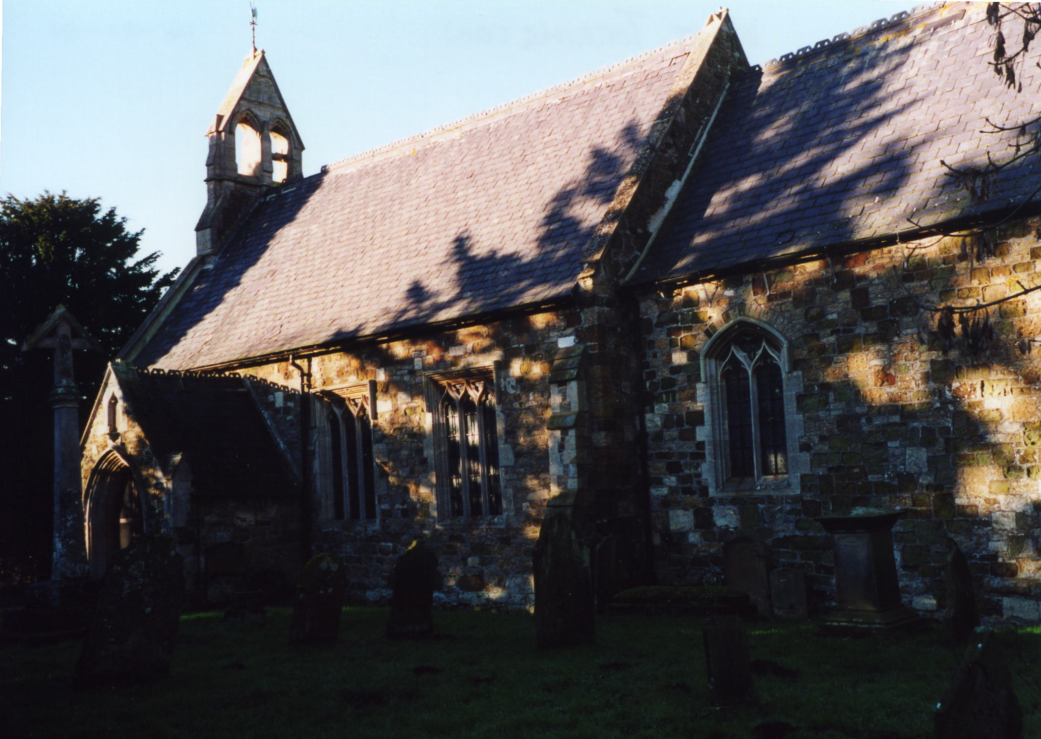
- The Anglican parish church is dedicated to Saint Mary.
- The church was rebuilt by local subscription in 1862.
- This small church seats about 116.
- At last report (in 2012), this church was no longer holding services but is still cared for.
- Richard CROFT has a photograph of St. Mary's church on Geo-graph, taken in February, 2011. Note: The photographer has it as St. Mark's, and another source has All Saints. But it is St. Mary's.
- J. HANNAH-BRIGGS has a photograph of the church interior on Geo-graph, taken in July, 2011.
- Here is a photo of St. Mary's Church, taken by Ron COLE (who retains the copyright):
- The Anglican parish register dates from 1638.
- The LFHS has published several marriage and burial indexes for the Westwold Deanery to make your search easier.
- The Anglican church is currently part of The Barkwith Group of the West Wold Deanery.
- The Wesleyan Methodists built a chapel here in 1859, as did the United Methodists. For information and assistance in researching these chapels, see our non-conformist religions page.
- Jonathan THACKER has a photograph of the Former Methodist Chapel on Geo-graph, taken in February, 2011.
- Check our Church Records page for county-wide resources.
- The parish was in the Wragby sub-district of the Horncastle Registration District.
- Check our Civil Registration page for sources and background on Civil Registration which began in July, 1837.
West Torrington is both a village and a parish in the Wolds, 13 miles northeast of Horncastle and 3 miles north of Wragby parish. The parish covers about 1,100 acres.
West Torrington village lies just north of the old Louth Road (now the A157) to Lincoln. If you are planning a visit:
- Visit our touring page for more sources.
The National Gazetteer of Great Britain and Ireland - 1868
- Ask for a calculation of the distance from West Torrington to another place.
- See our Maps page for additional resources.
You can see maps centred on OS grid reference TF137821 (Lat/Lon: 53.323748, -0.294399), West Torrington which are provided by:
- OpenStreetMap
- Google Maps
- StreetMap (Current Ordnance Survey maps)
- Bing (was Multimap)
- Old Maps Online
- National Library of Scotland (Old Ordnance Survey maps)
- Vision of Britain (Click "Historical units & statistics" for administrative areas.)
- English Jurisdictions in 1851 (Unfortunately the LDS have removed the facility to enable us to specify a starting location, you will need to search yourself on their map.)
- Magic (Geographic information) (Click + on map if it doesn't show)
- GeoHack (Links to on-line maps and location specific services.)
- All places within the same township/parish shown on an Openstreetmap map.
- Nearby townships/parishes shown on an Openstreetmap map.
- Nearby places shown on an Openstreetmap map.
- This place was an ancient parish in Lincoln county and became a modern Civil Parish when those were established.
- The parish was in the ancient Wraggoe Wapentake in the East Lindsey district and parts of Lindsey.
- For today's district governance, see the East Lindsey District Council.
- Bastardy cases would be heard in the Wragby petty session hearings on the first Thursday of the month.
- There was a single, undated charity in the parish that awarded 26 shillings each year (circa 1911) to the oldest widow.
- As a result of the 1834 Poor Law Amendment Act, the parish became part of the Horncastle Poor Law Union.
Year Inhabitants 1801 70 1811 77 1821 133 1831 126 1841 138 1851 133 1871 190 1881 159 1891 160 1911 125 1991 81
- A Public Elementary School was first built here in 1859 to hold 70 children.
- For more on researching school records, see our Schools Research page.