
Hide
--- TEST SYSTEM --- TEST SYSTEM --- TEST SYSTEM ---
Hide
Knaith
hide
Hide
hide
Hide
hide


Hide
Hide
hide
Hide
Knaith, par., Lincolnshire, in NW. of co., 3 miles SE. of Gainsborough, 1,640 ac., pop. 88; contains the seat of Knaith Hall.
From: John BARTHOLOMEW's "Gazetteer of the British Isles (1887)"
Hide
The Gainsborough Library is an excellent resource with both a Local History section and a Family History section.
Burial register entries for St. Mary (1821) are included in the National Burial Index (NBI).
| St Mary, Knaith, Church of England |
- The parish was in the Marton sub-district of the Gainsborough Registration District.
- Check our Census Resource page for county-wide resources.
- Below are the census Piece Numbers, where known:
| Census Year | Piece Numbers |
|---|---|
| 1851 | H.O. 107 / 2120 |
| 1861 | R.G. 9 / 2411 |
| 1871 | R.G. 10 / 3449 |
| 1891 | R.G. 12 / 2637 |
| St Mary, Knaith, Church of England |
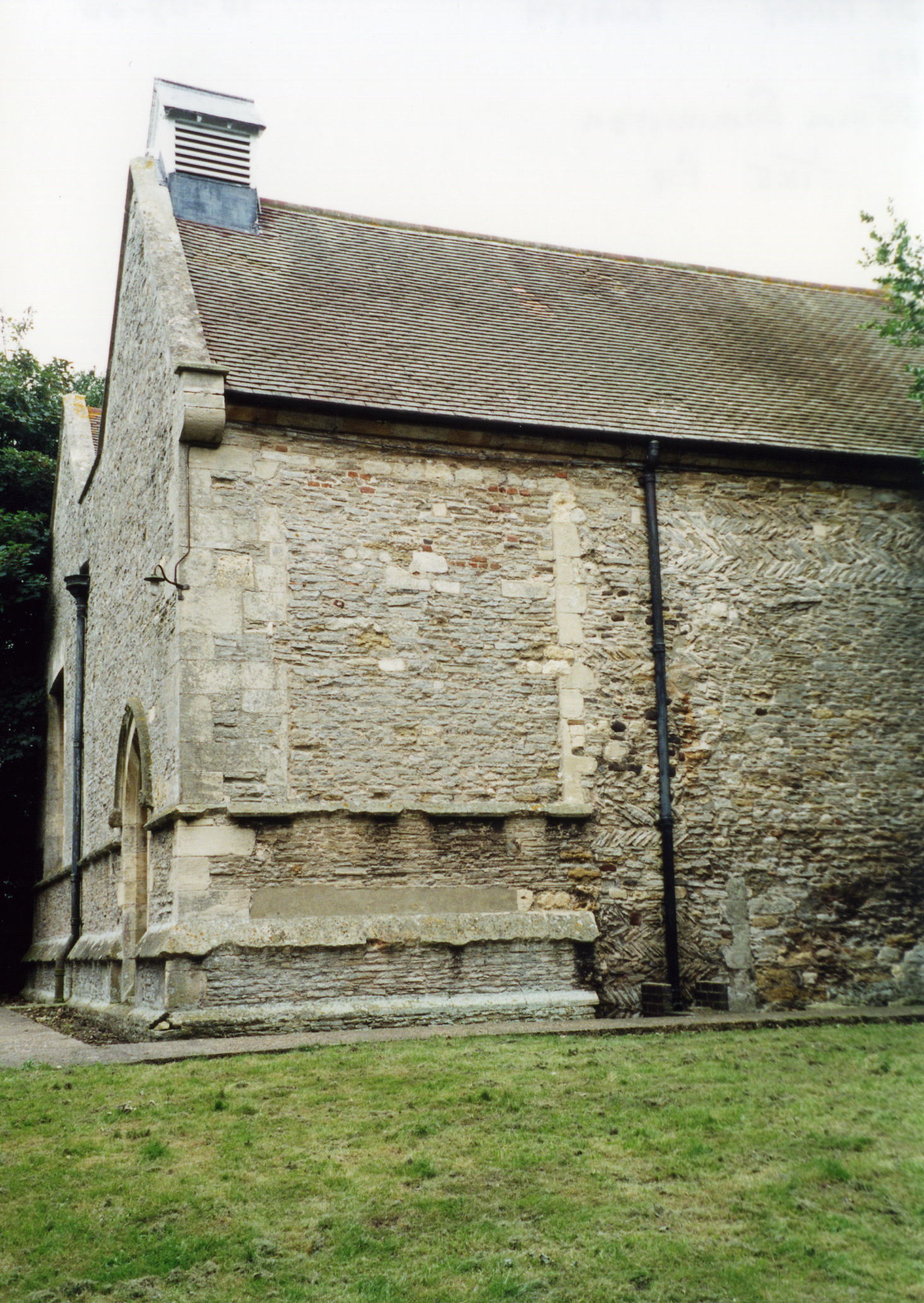
- The Anglican parish church is dedicated to Saint Mary.
- The church is in the "Late Decorated style".
- The church shares a hillside by the river with the old Hall.
- The church tower is a fragment of the church of the Cistercian nunnery (see below).
- The parish church also encloses a part of the Church of Heynings Nunnery, a Cistercian house founded in 1180 and dissolved in 1539. Much of the present structure dates from the 14th century.
- The church chancel was destroyed at the dissolution and the church was reformed in 1630.
- The church was restored in 1894.
- The church is a Grade 2 listed building with British Heritage.
- The church only seats 90.
- Richard CROFT has a photograph of St. Mary's Church on Geo-graph, taken in 2005.
- Here is a photo of St. Mary's Church, taken by Ron COLE (who retains the copyright):
- The Anglican parish register dates from 1575.
- We have a handful of entries in our parish register extract text file. Your additions to this are welcome.
- The Lincolnshire FHS has published several marriage and burial indexes for the Corringham Deanery to make your search easier.
- Check our Church Records page for county-wide resources.
- The parish was in the Marton sub-district of the Gainsborough Registration District.
- Check our Civil Registration page for sources and background on Civil Registration which began in July, 1837.
Knaith is both a village and parish in the north of Lincolnshire. The parish lies 3 miles south of Gainsborough. Willingham by Stow parish lies to the east and the Trent River to the west. Nottinghamshire is on the other side of the River Trent. The parish covers about 1,400 acres.
If you are planning a visit:
- The railway came to Knaith in 1849, but passenger service ended in 1957 and goods service ended in 1963.
- Visit our touring page for more sources.
The National Gazetteer of Great Britain and Ireland - 1868
- Ask for a calculation of the distance from Knaith to another place.
- The Old Hall, on the banks of the Trent, in 1949 was described as "charming with black-and-white walls and clustering old chimneys". It was the birthplace of Thomas SUTTON, who was Queen Elizabeth's Master of Ordnance in the north. In his old age he founded the Charterhouse School and Hospital in London.
- The Hall was also the home of Lord Willoughby of Parham, leader of the Parliamentarian troops in Lincolnshire during the Civil War.
- In 1896 through 1900, the Hall was the home of Major Henry Charles Hynman ALLANBY. ALLANBY was born in Louth, LIN, in May, 1853, son of Henry Hynman ALLENBY and his wife Eliza. H. C. H. ALLENBY married Mary Florence GARFIT on 10 Jun 1879 in Stamford, LIN. He died on 28 December 1935, in Scotland.
- The Hall is a Grade 2 listed building with British Heritage.
- Richard CROFT has a photograph of Knaith Hall on Geo-graph, taken in August, 2005.
- See our Maps page for additional resources.
You can see maps centred on OS grid reference SK828846 (Lat/Lon: 53.351814, -0.757548), Knaith which are provided by:
- OpenStreetMap
- Google Maps
- StreetMap (Current Ordnance Survey maps)
- Bing (was Multimap)
- Old Maps Online
- National Library of Scotland (Old Ordnance Survey maps)
- Vision of Britain (Click "Historical units & statistics" for administrative areas.)
- English Jurisdictions in 1851 (Unfortunately the LDS have removed the facility to enable us to specify a starting location, you will need to search yourself on their map.)
- Magic (Geographic information) (Click + on map if it doesn't show)
- GeoHack (Links to on-line maps and location specific services.)
- All places within the same township/parish shown on an Openstreetmap map.
- Nearby townships/parishes shown on an Openstreetmap map.
- Nearby places shown on an Openstreetmap map.
John D'ARCY, 1st Baron D'arcy de Knayth was an English peer born in Knaith circa 1280, the son of Roger D'ARCY and Isabel de ATON. He was created 1st Baron DARCY in 1317. He fought at the Battle of Crecy in 1346. He died 30 May 1347.
- This place was an ancient parish in the county of Lincoln and became a modern Civil Parish when those were established.
- The parish was in the ancient Well Wapentake (Well Hundred) in the West Lindsey district in the parts of Lindsey.
- On 24 March, 1884, the parish was reduced in size by transferring Thurlby Wood to Upton Civil Parish.
- Today's district governance is provided by the West Lindsey District Council.
- Bastardy cases would be heard in the Gainsborough petty session hearings.
- As a result of the 1834 Poor Law Amendment Act, the parish became part of the Gainsborough Poor Law Union.
- The author of this page has found no mention of a school in Knaith.
- For more on researching school records, see our Schools Research page.