
Hide
--- TEST SYSTEM --- TEST SYSTEM --- TEST SYSTEM ---
Hide
Willingham
hide
Hide
hide
Hide
hide


Hide
Hide
hide
- Maps
- Medical Records
- Migration, Internal◬
- Military History◬
- Military Records◬
- Names, Geographical◬
- Names, Personal◬
- Naturalisation & Citizenship◬
- Newspapers◬
- Occupations◬
- Politics & Government
- Poor Houses, Poor Law
- Population
- Postal & Shipping Guides◬
- Probate Records◬
- Public Records◬
- Schools
- Societies◬
- Voting Registers◬
Hide
Willingham (by Gainsborough), par. and vil., Lincolnshire - par., 2,170 ac., pop. 460; vil., 5½ miles SE. of Gainsborough; P.O.
From: John BARTHOLOMEW's "Gazetteer of the British Isles (1887)"
Hide
Note Bene: There is a Willingham parish in Cambridgeshire, also. Make sure that you are working in the right parish.
Hide
The Gainsborough Library is an excellent resource with both a Local History section and a Family History section.
Charles ANDERSON advises that the parish also has a Civic Cemetery out on Marton Road, west of the village.
Jonathan THACKER has a photograph of this cemetery on Geo-graph, taken in October, 2016.
The National Burial Index lists 650 burials between 1813 and 1900.
- The parish was in the Willingham sub-district of the Gainsborough Registration District.
- In an 1890 re-organization, the parish was placed in the Marton subdistrict of the Gainsborough Registration District.
- Check our Census Resource page for county-wide resources.
- The table below gives the Census Piece Numbers for the parish, where known.
| Census Year | Piece No. |
|---|---|
| 1851 | H.O. 107 / 2120 |
| 1861 | R.G. 9 / 2410 |
| 1871 | R.G. 10 / 3447 |
| 1891 | R.G. 12 / 2636 |
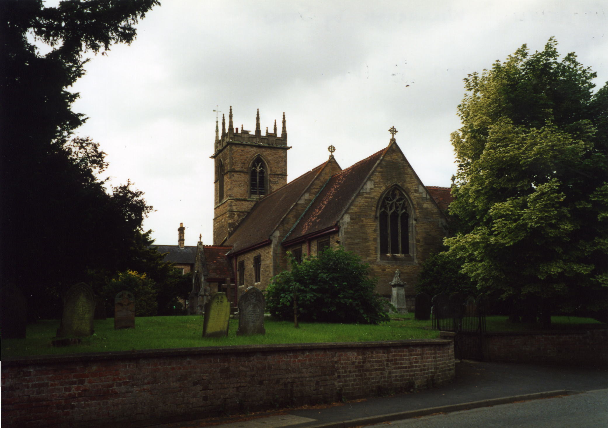
- The Anglican parish church is dedicated to Saint Helen.
- The body of the church dates from the 11th century and the tower from the 14th.
- The body of the church was rebuilt in 1880.
- The church seats 200.
- There is a photograph of St. Helen's Church on the Wendy PARKINSON web site under "Yet More Lincolnshire".
- Richard CROFT has a photograph of St. Helen's Church on Geo-graph, taken in 2006.
- Here is a photo of St. Helen's Church, taken by Ron COLE (who retains the copyright):
- The Anglican parish register dates from 1562.
- The Lincolnshire FHS has published several marriage and burial indexes for the Corringham Deanery to make your search easier.
- A Wesleyan Methodist chapel was built here prior to 1841 and later joined by a Primitive Methodist chapel. For more on researching these chapel records, see our non-conformist religions page.
- Jonathan THACKER has a photograph of the Methodist Church on Geo-graph, taken in May, 2012.
- Check our Church Records page for county-wide resources.
- The parish was in the Willingham sub-district of the Gainsborough Registration District.
- In an 1890 re-organization, the parish was placed in the Marton subdistrict of the Gainsborough Registration District.
- Check our Civil Registration page for sources and background on Civil Registration which began in July, 1837.
Willingham is both a parish and a village about 6 miles south-east of Gainsborough and 11 miles south of Scunthorpe. The parish itself is bordered on the north by Upton parish, on the east by Fillingham parish, to the south by Stow parish. The parish covers just over 2,200 acres.
Willingham village is near the River Till, which passes near the east end of the village. If you are planning a visit:
- Take the B1241 trunk road at Lea off of the A156 trunk road south out of Gainsborough and head east about two miles, then follow that road as it turns south for about a mile.
- Visit our touring page for more sources.
The National Gazetteer of Great Britain and Ireland - 1868
- Ask for a calculation of the distance from Willingham to another place.
Stephen McKAY has a phtograph of the Half Moon Inn on Geo-graph, taken in January, 2012. The Inn opened around 1855.
- See our Maps page for additional resources.
You can see maps centred on OS grid reference SK876846 (Lat/Lon: 53.350859, -0.68553), Willingham which are provided by:
- OpenStreetMap
- Google Maps
- StreetMap (Current Ordnance Survey maps)
- Bing (was Multimap)
- Old Maps Online
- National Library of Scotland (Old Ordnance Survey maps)
- Vision of Britain (Click "Historical units & statistics" for administrative areas.)
- English Jurisdictions in 1851 (Unfortunately the LDS have removed the facility to enable us to specify a starting location, you will need to search yourself on their map.)
- Magic (Geographic information) (Click + on map if it doesn't show)
- GeoHack (Links to on-line maps and location specific services.)
- All places within the same township/parish shown on an Openstreetmap map.
- Nearby townships/parishes shown on an Openstreetmap map.
- Nearby places shown on an Openstreetmap map.
- There was a "cottage" hospital here, erected in 1880, but it only had room for 9 patients. No records of admissions are known.
- This place was an ancient parish in Lincoln county and became a modern Civil Parish when those were established.
- The parish was in the ancient Well Wapentake (Well Hundred) in the West Lindsey district in the parts of Lindsey.
- Today's district governance is provided by the West Lindsey District Council.
- Bastardy cases would be heard in the Gainsborough petty session hearings.
- The Common Lands were enclosed here in 1780.
- As a result of the 1834 Poor law Amendment, the parish became part of the Gainsborough Poor Law Union .
- A school was built here in 1818 and enlarged in 1880.
- Richard CROFT has a photograph of the Old School on Geo-graph, taken in May, 2008.
- A School Board was formed here in Feb., 1876.
- For more on researching school records, see our Schools Research page.