
Hide
--- TEST SYSTEM --- TEST SYSTEM --- TEST SYSTEM ---
Hide
Kirkby Green
hide
Hide
hide
Hide
hide


Hide
Hide
“KIRKBY GREEN, a parish in the wapentake of Langoe, parts of Kesteven, county Lincoln, 8 miles N.E. of Sleaford, its post town. The village is very small, consisting of a few scattered houses. The tithes have been commuted for a rent-charge of £67 14s. 6d. The living is a vicarage in the diocese of Lincoln, value £180, in the patronage of the lord chancellor. The church, dedicated to the Holy Cross, is a modern structure built on the site of an older one. The register dates from 1722. The Wesleyans have a chapel. Henry Chaplin, Esq., is lord of the manor."
”
from The National Gazetteer of Great Britain and Ireland - 1868
Hide
- The parish was in the Billinghay sub-district of the Sleaford Registration District.
- Check our Census Resource page for county-wide resources.
- The table below gives census piece numbers, where known:
| Census Year | Piece No. |
|---|---|
| 1841 | H.O. 107 / 620 |
| 1851 | H.O. 107 / 2100 |
| 1861 | R.G. 9 / 2341 |
| 1871 | R.G. 10 / 3348 |
| 1891 | R.G. 12 / 2577 |
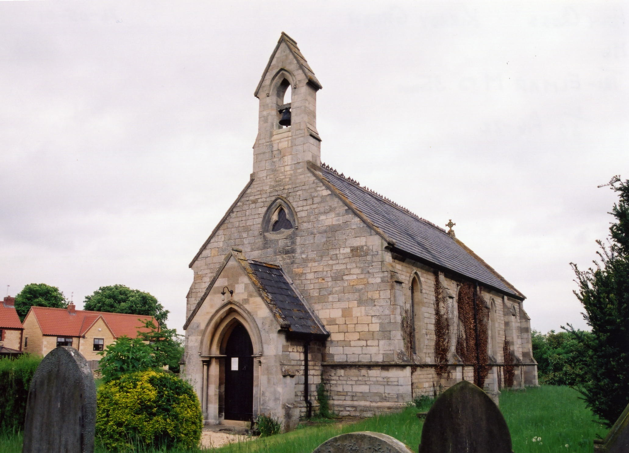
- The Anglican parish church is dedicated to Holy Cross.
- There had been an older church, centuries old, in the parish, but it was torn down in 1848 and a new church, built of stone, was erected on the same site.
- The church seats about 100.
- Roger GEACH has a photograph of Holy Cross Church on Geo-graph, taken in March, 2010.
- Here is a photo of Holy Cross Church, taken by Ron COLE (who retains the copyright):
- Anglican parish register entries only exist from 1722, but Bishop's transcripts go back to 1562.
- The parish lies in the Graffoe Deanery, for which several marriage indexes exist.
- The Wesleyan Reform chapel was built here in 1856. For information and assistance in researching these chapels, see our non-conformist religions page.
- Check our Church Records page for county-wide resources.
- The parish was in the Billinghay sub-district of the Sleaford Registration District.
- Check our Civil Registration page for sources and background on Civil Registration starting in July 1837.
This village and parish is 8 miles north of Sleaford and 12 miles south-east of Lincoln. The parish is small, covering only some 440 acres. The Scopwick Beck runs through the parish. Martin parish lies to the north, Timberland to the southeast and Scopwick lies to the west. Currently, Kirkby Green is a civil parish within the ecclesiastical parish of Scopwick.
The small village of Kirkby Green is the center of the parish and sits on a slight rise. Modern-day visitors come for the country walks in the area. The "Kirkby Green Walk" takes one from Kirkby Green to Scopwick along hedgerow-lined footpaths. If you are planning a visit:
- Kirkby Green is on the B1191 between Woodhall Spa and Scopwick, easily reached off the A15 trunk road north out of Sleaford.
- Visit the working narrow-gauge railway in the parish.
- Visit our touring page for more sources.
The National Gazetteer of Great Britain and Ireland - 1868
- Ask for a calculation of the distance from Kirkby Green to another place.
- The parish has been occupied for over 1,500 years. The parish is listed in the 1086 Domesday Book.
- In 1871, Sir Henry CHAPLIN, M.P., owned the greater part of the land. Most of the remainder was owned by Mr. Thomas YOUNG.
- In 1913, the principal land holder was the Earl of Londesborough.
- See our Maps page for resources.
You can see maps centred on OS grid reference TF085579 (Lat/Lon: 53.107114, -0.38126), Kirkby Green which are provided by:
- OpenStreetMap
- Google Maps
- StreetMap (Current Ordnance Survey maps)
- Bing (was Multimap)
- Old Maps Online
- National Library of Scotland (Old Ordnance Survey maps)
- Vision of Britain (Click "Historical units & statistics" for administrative areas.)
- English Jurisdictions in 1851 (Unfortunately the LDS have removed the facility to enable us to specify a starting location, you will need to search yourself on their map.)
- Magic (Geographic information) (Click + on map if it doesn't show)
- GeoHack (Links to on-line maps and location specific services.)
- All places within the same township/parish shown on an Openstreetmap map.
- Nearby townships/parishes shown on an Openstreetmap map.
- Nearby places shown on an Openstreetmap map.
- The name Kirkby Green is a combination of Old Scandinavian and Old English kirkju+by Green, or "village with a church on the green". The name Kirkby is common in the former Danelaw region of England. The parish is listed in the Domesday Book of 1086.
[A. D. Mills, "A Dictionary of English Place-Names," Oxford University Press, 1991]
- Here's a partial list of surnames found in the parish in 1871: BLAKEWELL, BYRON, COULSON, GARRETT, RIDLEY, TURNELL, WILLSON, WOOLFITT and YOUNG.
- Kelley's 1913 Directory lists these surnames: BAUMBER, BRADSHAW, FOX, KIRK, MOODY, TODD and YOUNG.
- This place was an ancient parish in county Lincoln and became a modern Civil Parish when those were established.
- The parish was in the first division of the ancient Langoe Wapentake in the North Kesteven district in the parts of Kesteven.
- This Civil Parish was abolished in April, 1931, and the land amalgamated with Scopwick Civil Parish.
- For today's district governance, see the North Kesteven District Council.
- Bastardy cases would be heard in the Sleaford petty session hearings every Monday.
- After the 1834 Poor Law Amendment Act reforms, the parish became part of the Sleaford Poor Law Union.
- The children of this parish attended school in nearby Scopwick.
- For more on researching school records, see our Schools Research page.