
Hide
--- TEST SYSTEM --- TEST SYSTEM --- TEST SYSTEM ---
Hide
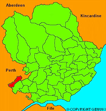
Coupar Angus
hide
Hide
"CUPAR ANGUS, (or Coupar-angus), is a considerable town and parish in the valley of Strathmore, and though designated in Angus, by far the greater part is situated in the county of Perth. The town is situated in the on the Isla, and is divided by a rivulet into two parts; that part which lies south of that rivulet being all that belongs to the county of Angus. The streets are well paved and lighted, and the town has much improved of late years; thereis a town-house and steeple on the spot where the prison of the court of regality stood. The linen manufacture is carried on to a considerable extent, nearly 200,000 yards of different kinds of cloth being stamped here. There is also a considerable tannery, and in the immediate neighbourhood a large leachfield has been laid out. Besides the town of Cupar, there are several villages, of which the largest contains about 100 inhabitants."
The Gazetteer of Scotland, W Chalmers, Dundee 1803.
Hide
- The transcription of the section for Cupar Angus from the National Gazetteer (1868) provided by Colin Hinson.
- Ask for a calculation of the distance from Coupar Angus to another place.
You can see maps centred on OS grid reference NO222401 (Lat/Lon: 56.546424, -3.266958), Coupar Angus which are provided by:
- OpenStreetMap
- Google Maps
- StreetMap (Current Ordnance Survey maps)
- Bing (was Multimap)
- Old Maps Online
- National Library of Scotland (Old Ordnance Survey maps)
- Vision of Britain (Click "Historical units & statistics" for administrative areas.)
- Magic (Geographic information) (Click + on map if it doesn't show)
- GeoHack (Links to on-line maps and location specific services.)
- All places within the same township/parish shown on an Openstreetmap map.
- Nearby townships/parishes shown on an Openstreetmap map.
- Nearby places shown on an Openstreetmap map.