
Hide
--- TEST SYSTEM --- TEST SYSTEM --- TEST SYSTEM ---
Hide
Bicknollar
hide
Hide
hide
Hide
hide
Hide
Hide
"BICKNOLLER, a parish in the hundred of Williton and Freemanners, in the county of Somerset, 14 miles to the N. of Taunton, its post town. It is pleasantly situated at the west foot of the Quantock hills, about 3 miles from the coast of Bridgwater Bay. The living is a vicarage in the diocese of Bath and Wells, value £124, in the patronage of the Vicar of Stogumber. On the Quantock Hill, not far from the church, are remains of two old encampments, named Trendle Castle and Turk's Castle. There is a beacon on another point of the same hill. Many Roman coins and other relics have been discovered in the neighbourhood." From The National Gazetteer of Great Britain and Ireland (1868) Transcribed by Colin Hinson © 2003
Hide
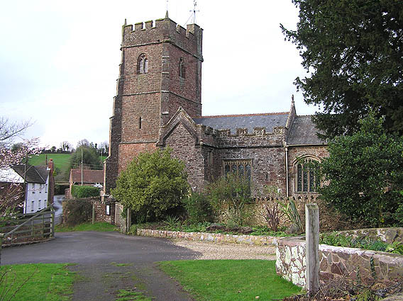
| St George, Bicknoller |
Bicknoller Baptisms 1649-1669 provided by Paul Mansfield.
Bicknoller Baptisms 1723-1735 provided by Paul Mansfield.
Bicknoller Baptismal, Marriage and Burial Transcripts provided by Martin Southwood.
Bicknoller Apprentice Indenture extracts 1682-1805 provided by Paul Mansfield.
Bicknoller Overseers Accounts extracts provided by Paul Mansfield.
Bicknoller Settlements, Removal Orders etc. extracts 1603-1858 provided by Paul Mansfield.
- Ask for a calculation of the distance from Bicknollar to another place.
You can see maps centred on OS grid reference ST111395 (Lat/Lon: 51.147748, -3.272467), Bicknollar which are provided by:
- OpenStreetMap
- Google Maps
- StreetMap (Current Ordnance Survey maps)
- Bing (was Multimap)
- Old Maps Online
- National Library of Scotland (Old Ordnance Survey maps)
- Vision of Britain (Click "Historical units & statistics" for administrative areas.)
- English Jurisdictions in 1851 (Unfortunately the LDS have removed the facility to enable us to specify a starting location, you will need to search yourself on their map.)
- Magic (Geographic information) (Click + on map if it doesn't show)
- GeoHack (Links to on-line maps and location specific services.)
- All places within the same township/parish shown on an Openstreetmap map.
- Nearby townships/parishes shown on an Openstreetmap map.
- Nearby places shown on an Openstreetmap map.
You can also see Family History Societies covering the nearby area, plotted on a map. This facility is being developed, and is awaiting societies to enter information about the places they cover.