
Hide
--- TEST SYSTEM --- TEST SYSTEM --- TEST SYSTEM ---
Hide
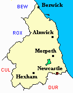
Whalton
hide
Hide
hide
Hide
Hide
Hide
"WHALTON is a parish comprising the townships of Newham, Ogle, Riplington, and Whalton. It is bounded on the north by Meldon parish, on the west by Tindale Ward, on the south by Newburn Parish, and on the east by Ponteland. It comprises an area of 5,918 acres, and its population in 1801, was 470; in 1811, 541; in 1821, 534; in 1831, 548; in 1841, 531; and in 1851, 461 souls. The decrease of population in Whalton, which is an agricultural parish, is attributed to the employment of single men instead of married labourers as formerly. The rivers Blyth and Howburn intersect this parish." [From History, Topography, and Directory of Northumberland, Whellan, 1855].
Hide
- Northumberland County Record Office holds copies of Census Returns 1841 - 1891 and provides a useful User Guide
- The 1851 Census Index (microfiche CN14) published by the https://www.ndfhs.org.uk/may be of value to researchers interested in this parish.
- 1891 Census Ponteland 1A (Ponteland, High and Little Callerton, Darras Hall, Coldcoats, Milbourne, Belsay, Whalton, Ogle, Twizell, Shilvington, part of Stannington, North and South Gosforth and Coxlodge) (PRO piece RG12/4240) (Type B) (Book) (Volume 50) published by the https://www.ndfhs.org.uk/ may be of value to researchers interested in this parish.
- 1891 Census Ponteland 1B (Coxlodge, Fawdon, East and West Brunton, Kenton, Dinnington, Mason, Brenkley, Prestwick, Woolsington, Horton Grange, Kirley and Berwick Hill) (PRO piece RG12/4241) (Type B) (Book) (Volume 51) published by thehttps://www.ndfhs.org.uk/ may be of value to researchers interested in this parish.
- Whalton - Church Records - links and information.
- This area is within Northumberland Central Registration District.
- Certificates of birth, death and marriage can be ordered from Northumberland County Council.
- Photographs of Whalton from Les Bell's Northumberland Cam website.
- The section of The National Gazetteer (1868) relating to this parish - transcribed by Colin Hinson.
- Ask for a calculation of the distance from Whalton to another place.
- The history of Whalton Parish is included in:- Hodgson, J., History of Northumberland, Part 2, Volume 1. Newcastle, 1827. (Available on fiche from Ancestral Indexes).
You can see maps centred on OS grid reference NZ123787 (Lat/Lon: 55.102918, -1.808624), Whalton which are provided by:
- OpenStreetMap
- Google Maps
- StreetMap (Current Ordnance Survey maps)
- Bing (was Multimap)
- Old Maps Online
- National Library of Scotland (Old Ordnance Survey maps)
- Vision of Britain (Click "Historical units & statistics" for administrative areas.)
- English Jurisdictions in 1851 (Unfortunately the LDS have removed the facility to enable us to specify a starting location, you will need to search yourself on their map.)
- Magic (Geographic information) (Click + on map if it doesn't show)
- GeoHack (Links to on-line maps and location specific services.)
- All places within the same township/parish shown on an Openstreetmap map.
- Nearby townships/parishes shown on an Openstreetmap map.
- Nearby places shown on an Openstreetmap map.