
Hide
--- TEST SYSTEM --- TEST SYSTEM --- TEST SYSTEM ---
Hide
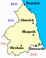
Wallsend
hide
Hide
hide
Hide
Hide
Hide
"WALLSEND parish comprises the townships of Howden Pans, Wallsend and Willington, whose united area amounts to 2,787 acres. It is bounded on the north and west by Long Benton parish, on the south, by the river Tyne, and on the east by the parish of Tynemouth. The population in 1801, was 3,120; in 1811, 3,584; in 1821, 5,103; in 1831, 5,510; in 1841, 4,758; and in 1851, 5,721 souls. This parish stretches along the north bank of the Tyne, and is intersected by the Newcastle and South Shields Railway. Extensive coal mines exist in the neighbourbood, and the place formerly gave its name to an excellent variety of coal, but now the designation "Wallsend" is applied to all coal which passes over a sieve, whose meshes are five-eights of an inch asunder, without falling through." [From History, Topography, and Directory of Northumberland, Whellan, 1855].
Hide
Research your family history at Discover North Tyneside. North Shields Customer First Centre Northumberland Square North Shields NE30 1QU Telephone: 0191 643 5270
North Tyneside Libraries have the following Census Returns Parish and Nonconformist registers Monumental Inscriptions the IGI, GRO indexes free public access to Ancestry, Find My Past and The British Newspaper Archive via any People's Network computer As well as downloadable pdf files covering Parish Registers Trade Directories Electoral Registers Local Newspapers http://my.northtyneside.gov.uk/category/1017/local-studies-and-information
- Wallend, Ken Hutchinson 2005
- Wallsend through time, Ken Hutchinson 2009
- Wallend History Tour, Ken Hutchinson 2015
- Wallsend Pubs and Clubs Steve Boundy 2010
- Wallsend Remembered, Steve Boundy 2012 and volume 2, 2014
- Wallsend then and now, Rob Kirkup 2014
- Wallsend reflections, jean Smith Ken Smith 2005
- History of the Parish of Wallsend, William Richardson 1923, and reprint 1998
- Wallsend shops past and present, Steve Boundy 2011
- Wallsend Colliery Pit disaster 18 June 1935, Ken and Pauline Hutchinson 1994
- Tynemouth and Wallsend at war 1939-1945 Craig Armstrong 2017
- Wallsend shipyards Andrew Clark 1999
- Wallsend Best, a personal experience of the Rising Sun Colliery 1941 - 1967 Ron Curran 2009
Wallsend Shipyards
a useful publication is Wallsend Shipyards by Andrew Clark published in 1999
Holy Cross Cemetery - Saint Peter Road Wallsend NE28 7 HQ The cemetery was established in 1918 to replace Church Bank. The Cemetery is maintained by North Tyneside Council https://my.northtyneside.gov.uk
A Link to burials at the Cemetery (not complete) compiled by Margaret Hall can be found here http://www.interment.net/data/eng/tyne_wear/holy_cross/index.htm
Burials at Holy Cross Cemetery, Wallsend 1918-1932 Transcribed by Margaret Hall
Church Bank Cemetery - 98 Church Bank Wallsend NE28 7LH This cemetery is also maintained by North Tyneside Council
Margaret Hall has plans of the layout of cemeteries in the North Tyneside area on her website http://www.margaret-hall-genealogy.com/page8.htm
- Northumberland County Record Office hold copies of Census Returns 1841 - 1891 and provides a useful User Guide
- The 1851 Census Index (microfiche CN6) Wallsend, Willington and Howdon (PRO piece HO107/2409 folios 1-183) (Type B) (Book) published by the Northumberland and Durham Family History Society may be of value to researchers interested in this parish.
- Tyne and Wear Archives have Census returns for 1891 and 1901 but only Street indexes for earlier years They have a full subscription to Findmypast which can be used by visitors to the archives. A link to User Guides is available here https://twarchives.org.uk/collection/user-guides-and-information
- 1891 Census Wallsend 1A (PRO piece RG12/4220) (Type B) (Book) (Volume 30) published by the https://www.ndfhs.org.uk/ may be of value to researchers interested in this parish.
- 1891 Census Wallsend 1B (PRO piece RG12/4221) (Type B) (Book) (Volume 31) published by the https://www.ndfhs.org.uk/ may be of value to researchers interested in this parish.
- 1891 Census Wallsend 1C (PRO piece RG12/4222) (Type B) (Book) (Volume 32) published by the https://www.ndfhs.org.uk/ may be of value to researchers interested in this parish.
| Good Shepherd, Battle Hill, Methodist |
- Wallsend, St Peter was built about 1809 to replace the medieval church of Holy Cross.
- The Ancestral Indexes website provides information about Wallsend, St Luke, Willington Quay, St Paul and Willington, St Mary.
- Wallsend - Church Records - links and information.
- This area is within North Tyneside Registration District
- Certificates of birth, death and marriage can be ordered by post.North Tyneside Registrar, Maritime Chambers Howard Street North Shields NE30 1LZ Tel: 0191 6436164
In about 1635, John Cosyn, draper of Newcastle, became a lease holder in Wallsend and built a large country home called Cosyn's Hall. This was known to have incorporated several Roman sculptured stones including an altar. The hall passed through the hands of the Lawson and Hewbank families before being sold to Robert Carr who renamed it Carville Hall. It can be seen in its own spacious grounds on the 1st edition Ordnance Survey map. On the same map, the line of Hadrian's Wall is shown as a strip of land about 20 metres wide dividing two fields. This strip was partly occupied by a drive leading to Carville Hall. A sketch by J Irwin Coates executed in 1879 shows the drive apparently on the line of the Wall with the ditch to the north. By the time of the second edition map the site had been covered with terraced housing. The drive to the hall had been incorporated into this development and renamed 'Roman Wall'. The Hall itself was demolished in 1898.
Further information can be found in the following publication - A history of Carville Hall by A T Croom 2015
- The section of The National Gazetteer (1868) relating to this parish - transcribed by Colin Hinson.
- Ask for a calculation of the distance from Wallsend to another place.
- The history of Wallsend Parish is included in:- Northumberland County History Committee, History of Northumberland, Volume 13. Newcastle, A. Reid, 1930. (Available on fiche from Ancestral Indexes).
- Wallsend - Maps - links and information.
You can see maps centred on OS grid reference NZ310676 (Lat/Lon: 55.001861, -1.516843), Wallsend which are provided by:
- OpenStreetMap
- Google Maps
- StreetMap (Current Ordnance Survey maps)
- Bing (was Multimap)
- Old Maps Online
- National Library of Scotland (Old Ordnance Survey maps)
- Vision of Britain (Click "Historical units & statistics" for administrative areas.)
- English Jurisdictions in 1851 (Unfortunately the LDS have removed the facility to enable us to specify a starting location, you will need to search yourself on their map.)
- Magic (Geographic information) (Click + on map if it doesn't show)
- GeoHack (Links to on-line maps and location specific services.)
- All places within the same township/parish shown on an Openstreetmap map.
- Nearby townships/parishes shown on an Openstreetmap map.
- Nearby places shown on an Openstreetmap map.
- Wallsend Parish was part of Tynemouth Poor Law Union. The Union Workhouse was located in Preston Lane, North Shields. Some useful records are held at Tyne and Wear Archives, Blandford Sqare Newcastle on Tyne NE1 4JA Tel: 0191 2772248
A full list of Grand Masters can be seen on their website and the following publication published in 2011 is a very useful guide
- A History of Freemasonry in Wallsend by George C Laws