
Hide
--- TEST SYSTEM --- TEST SYSTEM --- TEST SYSTEM ---
Hide
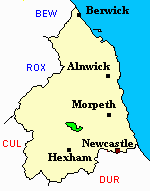
Thockrington
hide
Hide
hide
Hide
Hide
Hide
"THOCKRINGTON parish comprises the townships of Bavington Little, Carrycoats, Sweethope, and Thockrington, and is bounded by the parishes of Kirk Whelpington, Kirkharle, and Chollerton. It is about four miles in length by two miles and a half in breadth, and comprises an area of 6,943 acres. Its population in 1801, was 182; in 1811, 158; in 1821, 201; in 1831. 203; in 1841, 193; and in 1851, 173 souls. The land in this parish is chiefly used for grazing purposes." [From History, Topography, and Directory of Northumberland, Whellan, 1855].
Hide
- The 1851 Census Index (microfiche CN20) Falstone, Thorneyburn, Greystead, Bellingham, Corsenbridge, Wark, Thockrington, Kirkharle, Elsdon (part), Kirkwhelpington and Birtley (PRO piece HO107/2417 folios 1-292) (Type A) (Book) published by the https://www.ndfhs.org.uk/ may be of value to researchers interested in this parish.
- 1891 Northumberland – Kirkwhelpington (Corsenside, Redesdale, Birtley, Thockrington, West Harle, Kirkwhelpington, Coldwell, Kirkharle and Wark (PRO piece RG12/4253) (Type B) (Book) (Volume 63) published by the https://www.ndfhs.org.uk/ may be of value to researchers interested in this parish.
- Thockrington - Church Records - links and information.
- Transcriptions of Throckrington Bishops Transcripts Baptisms Marriages and Burials 1815 to 1834 and 1861 to 1862 can be found on the link below please scroll down page to find the parish required
- https://northumberlandparishregistertranscriptslocalhistory.wordpress.com/
- This area is within Northumberland West Registration District.
- Certificates of birth, death and marriage can be ordered from Northumberland County Council.
- The section of The National Gazetteer (1868) relating to this parish - transcribed by Colin Hinson.
- Ask for a calculation of the distance from Thockrington to another place.
- The history of Thockrington Parish is included in:- Northumberland County History Committee, History of Northumberland, Volume 4. Newcastle, A. Reid, 1897.
You can see maps centred on OS grid reference NY958800 (Lat/Lon: 55.114604, -2.066804), Thockrington which are provided by:
- OpenStreetMap
- Google Maps
- StreetMap (Current Ordnance Survey maps)
- Bing (was Multimap)
- Old Maps Online
- National Library of Scotland (Old Ordnance Survey maps)
- Vision of Britain (Click "Historical units & statistics" for administrative areas.)
- English Jurisdictions in 1851 (Unfortunately the LDS have removed the facility to enable us to specify a starting location, you will need to search yourself on their map.)
- Magic (Geographic information) (Click + on map if it doesn't show)
- GeoHack (Links to on-line maps and location specific services.)
- All places within the same township/parish shown on an Openstreetmap map.
- Nearby townships/parishes shown on an Openstreetmap map.
- Nearby places shown on an Openstreetmap map.