
Hide
--- TEST SYSTEM --- TEST SYSTEM --- TEST SYSTEM ---
Hide
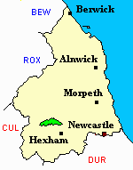
Simonburn
hide
Hide
hide
Hide
Hide
Hide
"SIMONBURN parish comprises the chapelry of Humshaugh, and the townships of Haughton and Simonburn. It was formerly remarkable as being the largest parish in the diocese of Durham, extending from the Roman Wall to Liddesdale, in Scotland, a distance of thirty-three miles, and embracing the present parishes of Simonburn, Bellingham, Falstone, Greystead, Thorneyburn, and Wark, which, in conformity with an act of parliament, passed in 1811, were erected into distinct rectories, in 1814, upon the death of Dr. Scott, the last incumbent of the ancient parish. Several parts of this extensive district have been drained, enclosed, and brought under cultivation, yet, the greater portion is still used as sheep-walks, &c. The country here presents a very varied aspect, and some parts are highly beautiful and romantic. It abounds in coal and ironstone, and iron appears to have been extensively wrought here in ancient times. The present parish contains 13,372 acres; the number of its inhabitants in 1801, was 900; in 1811, 956; in 1821, 1,030; in 1831, 1,135; in 1841, 1,029; and in 1851, 1,080 souls. The manorial rights are vested in the Commissioners of Greenwich Hospital, who are also the patrons of the different livings which have been formed out of the old parish. None but navy chaplains of ten years' service are eligible as rectors of the new parishes, and they are not allowed to hold any other preferment, though they are authorised to receive half pay, and the Commissioners of Greenwich Hospital are empowered to redeem the land-tax chargeable on the rectories." [From History, Topography, and Directory of Northumberland, Whellan, 1855].
Hide
- Northumberland County Record Office holds copies of Census Returns 1841 - 1891 and provides a useful User Guide
- The 1851 Census Index (microfiche CN18)Chollerton, Simonburn, Warden and Newbrough (PRO piece HO107/2415 folios 321-502) (Type A) (Book)
- The 1891 Census Northumberland Chollerton (West Acomb, Wall, Fallowfield, Cocklaw, Bingfield, Hallington, Chollerton, Barrasford, Chipchase, Great Swinburn, Colwell, Gunnerton, Simonburn, Hall Barnes, Humshaugh, Haughton, Black Carts and Rye Hill, Warden, Fourstones, Walwick, Newbrough and Warmley) (PRO piece RG12/4249) (Type B) (Book) (Volume 59) Both published by the https://www.ndfhs.org.uk/ may be of value to researchers interested in this parish.
- The Ancestral Indexes website provides information about Humshaugh, St Peter and Simonburn, St Mungo.
- St Mungo's church Simonburn dates from the Thirteenth Century the Lychgate was built by the tenants to the memory of John Hunter Allgood in 1885. The Rectory was built in 1666 with a three-storey front added in 1725 (The Rectory is now a private residence).
- "Until the early Nineteenth century St Mungos was one of the largest parishes in England covering about 260 square miles of the North Tyne Valley." extract from Churches of Newcastle and Northumberland by Geoffrey Purves The church has saxon origins although little remains of the original saxon church, the present one dating from the 13C. It has been rebuilt and restored several times the first in 1763 by Robert and William Newton, in 1863-4 by Anthony salvin and in 1875-77 by R J Johnson. There is a piscena, and a priests door dating from 13C an effigy of a former vicar Cuthbert Ridley c.1620 and the organ was aquired from York Minster in 1901.
- Simonburn - Church Records - links and information.
- Simonburn (Humshaugh) Bishops Transcripts Transcriptions for baptisms and burials 1820 to 1846 covering Humshaugh and Haughton and Chollerford can be found by following the link below and scrolling down the page to the relevant parish https://northumberlandparishregistertranscriptslocalhistory.wordpress.com/
- This area is within Northumberland West Registration District.
- Certificates of birth, death and marriage can be ordered from Northumberland County Council.
- Photographs of Chollerford from Les Bell's Northumberland Cam website.
- The Northumberland Communities website includes pages relating to Humshaugh. They provide "a range of learning resource material that reflects Northumberland's heritage, providing a base for studying the County's history. The website provides a starting point for understanding the development of communities in Northumberland. It also seeks to illustrate the range of sources for family and local history research that are available via Northumberland Archives Service."
- The section of The National Gazetteer (1868) relating to this parish - transcribed by Colin Hinson.
- Ask for a calculation of the distance from Simonburn to another place.
- The history of Humshaugh Parish is included in:- Northumberland County History Committee, History of Northumberland, Volume 15. Newcastle, A. Reid, 1940. (Available on fiche from Ancestral Indexes).
- The history of Simonburn Parish is included in Northumberland County History Committee, History of Northumberland, Volume 15. Newcastle, A. Reid, 1940. (Available on fiche from Ancestral Indexes).
The original village was sited at Nunwick. this was demolished in the Eighteenth Century. and re-sited to its present location see: The Northumberland Village Book produced by the Northumberland Federation of Women's Institutes. 1994 (Countryside Books ISBN 1 85306 302 9)
- Simonburn - Maps - links and information.
You can see maps centred on OS grid reference NY844730 (Lat/Lon: 55.05147, -2.245029), Simonburn which are provided by:
- OpenStreetMap
- Google Maps
- StreetMap (Current Ordnance Survey maps)
- Bing (was Multimap)
- Old Maps Online
- National Library of Scotland (Old Ordnance Survey maps)
- Vision of Britain (Click "Historical units & statistics" for administrative areas.)
- English Jurisdictions in 1851 (Unfortunately the LDS have removed the facility to enable us to specify a starting location, you will need to search yourself on their map.)
- Magic (Geographic information) (Click + on map if it doesn't show)
- GeoHack (Links to on-line maps and location specific services.)
- All places within the same township/parish shown on an Openstreetmap map.
- Nearby townships/parishes shown on an Openstreetmap map.
- Nearby places shown on an Openstreetmap map.