
Hide
--- TEST SYSTEM --- TEST SYSTEM --- TEST SYSTEM ---
Hide
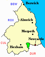
Ovingham
hide
Hide
hide
Hide
Hide
Hide
"OVINGHAM is a parish comprising the townships of Dukeshagg. Eltringham, Harlow-hill, Hedley, Hedley-Woodside, Horsley, Mickley, Nafferton, Ovingham, Ovington, Prudhoe, Prudhoe Castle, Rouchester, Spittle, Welton, Whittle, and Wylam. It is bounded by the parishes of Stamfordham, Heddon-on-the-Wall and Bywell St. Andrew and St. Peter, except on the south-east, where it is separated from the County of Durham by the Stanley and Milkhouse Burn. It is about seven miles in length by five in breadth, and comprises an area of 15,740 acres. Its population in 1801, was 2,628; in 1811, 2,810; in 1821, 2,742; in 1831, 3,019; in 1841, 3,418; and in 1851, 3,962 souls. The parish is interesected by the river Tyne, and is beautifully diversified by gentle elevations." [From History, Topography, and Directory of Northumberland, Whellan, 1855]
Hide
- The Story of Ovingham on Tyne by Frank Atkinson published by Northern Books, 2001, ISBN 0 953 5730 1 X.
- Mid Tyne villages of Northumberland a history in photographs Douglas Mennear 1993
Northumberland Record Office hold records for
- Ovingham Civil Cemetery: - Burial Registers 1879-1994, Purchased Graves Registers 1880-1955 and Grave Spaces Register 1879-1984.
- Prudhoe Civil Cemetery: - Burial Registers 1903-1984 and Burials Grant Books 1912-1956.
- Northumberland County Record Office holds copies of Census Returns 1841 - 1891 and provides a useful User Guide
- The 1851 Census Index (microfiche CN14 and CN15) Bywell, Ovingham, Shotley, Blanchland and Whittonstall (PRO piece HO107/2414 folios 1-268) (Type A) (Book)
- The 1891 Census Northumberland – Bywell (Broomley, Healey, High Fotherley, Espershields, Whittonstall, Newlands, Bywell, Styford, Newton, Stelling, Ovington, Newton Hall, Welton, Broomhaugh, Riding, Newbiggin, Blanchland, Shotley Low Quarter, Nafferton, Ovingham, Wylam, Hedley, Dukershagg and part of Prudhoe) (PRO piece RG12/4244) (Type B) (Book) (Volume 54) BOTH published by the https://www.ndfhs.org.uk/ may be of value to researchers interested in this parish.
- The parish church is dedicated to St Mary the Virgin and was consecrated about the year 1050. It is thought that it was built on the site of an even earlier Christian meeting place marked by a standing cross, a fragment of which is under the church pulpit. The building has three distinct architectural styles - a Saxon tower, a Norman doorway and early English Nave and Chancel. The registers date from 1679. Part of the former vicarage, located to the south of the church, dates from around 1378. In 1823 a Chapel of Ease dedicated to St George was built in the village of Mickley and this became a distinct parish in 1867. Ovingham Parish was further subdivided with the formation of the parishes of Prudhoe, St Mary Magdalene in 1880 and Wylam, St Oswin in 1886.
- The Ancestral Indexes website provides information about Mickley, St George, Prudhoe, St Mary and Wylam, St Oswin.
- Offa's Church: St Mary the Virgin Ovingham, 1,300 years of Christian History, (St Mary the Virgin Church) 1984
- Ovingham - Church Records - links and information.
- This area is divided between Northumberland West Registration District and Northumberland Central Registration District.
- Certificates of birth, death and marriage can be ordered Locally from Northumberland County Council.
- Photographs of Wylam and Whittle Dene Reservoirs from Les Bell's Northumberland Cam website.
- Prudhoe Castle photographed by Ray Urwin.
- The Northumberland Communities website includes pages relating to Ovingham and Prudhoe and Wylam. They provide "a range of learning resource material that reflects Northumberland's heritage, providing a base for studying the County's history. The website provides a starting point for understanding the development of communities in Northumberland. It also seeks to illustrate the range of sources for family and local history research that are available via Northumberland Archives Service."
- The section of The National Gazetteer (1868) relating to this parish - transcribed by Colin Hinson.
- Ask for a calculation of the distance from Ovingham to another place.
- The history of Ovingham Parish is included in:- Northumberland County History Committee, History of Northumberland, Volume 12. Newcastle, A. Reid, 1926. (Available on fiche from Ancestral Indexes).
- Information on the History of Prudhoe provided by Prudhoe Community Partnership.
- Ovingham - Maps - links and information.
You can see maps centred on OS grid reference NZ083625 (Lat/Lon: 54.957414, -1.871795), Ovingham which are provided by:
- OpenStreetMap
- Google Maps
- StreetMap (Current Ordnance Survey maps)
- Bing (was Multimap)
- Old Maps Online
- National Library of Scotland (Old Ordnance Survey maps)
- Vision of Britain (Click "Historical units & statistics" for administrative areas.)
- English Jurisdictions in 1851 (Unfortunately the LDS have removed the facility to enable us to specify a starting location, you will need to search yourself on their map.)
- Magic (Geographic information) (Click + on map if it doesn't show)
- GeoHack (Links to on-line maps and location specific services.)
- All places within the same township/parish shown on an Openstreetmap map.
- Nearby townships/parishes shown on an Openstreetmap map.
- Nearby places shown on an Openstreetmap map.
- Horsley War Memorial - names and photographs by Ray Urwin.