
Hide
--- TEST SYSTEM --- TEST SYSTEM --- TEST SYSTEM ---
Hide
Newcastle, All Saints
hide
Hide
hide
Hide
Hide
Hide
"ALL SAINTS CHURCH is situated on the brow of a steep bank, on the south side of Silver-street, at the foot of Pilgrim-street. It was erected on 1796, at a cost of £27,000, on the site of the former church of All Saints, which was erected previous to the year 1284, but the precise date is not known. It is an elliptical structure of 86 feet by 72, and in the Grecian Style of architecture, the spire having an elevation of 202 feet. This elegant edifice is constructed of freestone, and the pews are all formed of mahogany. ... The register commences in 1600." [From History, Topography, and Directory of Northumberland, Whellan, 1855]
Hide
- The 1851 Census Index (microfiche CN4, CN5) and 1851Census Northumberland – Newcastle, All Saints (PRO piece HO107/2407 folios 1-731) (Type A) (Book) published by the Northumberland and Durham Family History Society
- 1871 Census Index (microfiche MS426, MS427 and MS429) published by the Northumberland and Durham Family History Society
- Census 1891 Northumberland – Newcastle, All Saints (Part 1) (PRO piece RG12/4209) (Type B) (Book) (Volume 19) published by the Northumberland and Durham Family History Society
- Census 1891 Northumberland – Newcastle, All Saints (Part 2) (PRO piece RG12/4210) (Type B) (Book) (Volume 20) published by the Northumberland and Durham Family History SocietyCensus 1891 Northumberland – Newcastle, All Saints (Part 3) (PRO piece RG12/4211) (Type B) (Book) (Volume 21) published by the Northumberland and Durham Family History Society
- Census 1891 Northumberland – Newcastle, All Saints (Part 4) (PRO piece RG12/4212) (Type B) (Book) (Volume 22) published by the Northumberland and Durham Family History Society
- Individual booklets of the 1891 Census are available for Byker and the Westgate area of Newcastle published by the Northumberland and Durham Family History Society
- Newcastle on Tyne Local Studies Centre holds copies of 1851 - 1891 Census for All Saints, Byker, St Andrew, St Nicholas, Westgate, Walker, Longbenton, Killingworth and Weetslade. They also provide a useful User Guide No 2 Census Records
- Newcastle, All Saints - Church History - links and information.
- Newcastle, All Saints - Church Records - links and information.
Newcastle All Saints registration District www.ukbmd.org.uk/REG/districts/newcastle upon Tyne.html
- The section of The National Gazetteer (1868) relating to this parish - transcribed by Colin Hinson.
- Ask for a calculation of the distance from Newcastle, All Saints to another place.
- The history of Byker and Heaton is included in:- Northumberland County History Committee, History of Northumberland, Volume 13. Newcastle, A. Reid, 1930. (Available on fiche from Ancestral Indexes).
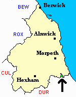
You can see maps centred on OS grid reference NZ252640 (Lat/Lon: 54.969988, -1.607892), Newcastle, All Saints which are provided by:
- OpenStreetMap
- Google Maps
- StreetMap (Current Ordnance Survey maps)
- Bing (was Multimap)
- Old Maps Online
- National Library of Scotland (Old Ordnance Survey maps)
- Vision of Britain (Click "Historical units & statistics" for administrative areas.)
- English Jurisdictions in 1851 (Unfortunately the LDS have removed the facility to enable us to specify a starting location, you will need to search yourself on their map.)
- Magic (Geographic information) (Click + on map if it doesn't show)
- GeoHack (Links to on-line maps and location specific services.)
- All places within the same township/parish shown on an Openstreetmap map.
- Nearby townships/parishes shown on an Openstreetmap map.
- Nearby places shown on an Openstreetmap map.