
Hide
--- TEST SYSTEM --- TEST SYSTEM --- TEST SYSTEM ---
Hide
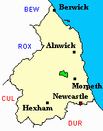
Netherwitton
hide
Hide
hide
Hide
Hide
Hide
"NETHER WITTON PAROCHIAL CHAPELRY. This Chapelry comprises the townships of Coat Yards, Ewesley, Healey and Comb Hill, Nether Witton, Nunnykirk, Ritton, and Colt Park, and Ritton White House. It is bounded by the parishes of Rothbury, Long Horsley, and Hartburn, to the latter of which it is annexed for ecclesiastical purposes, and consists chiefly of a fine rich vale, which comprises an area of 7,723 acres. Its population in 1801, was 494; in 1811, 439; in 1821, 460; in 1831, 520; in 1841, 464; and in 1851, 489 souls." [From History, Topography, and Directory of Northumberland, Whellan, 1855].
"WITTON (NETHER), a parish in the ... county of NORTHUMBERLAND, comprising the townships of Coat-Yards, or Coal-yards, Ewesley, Healy with Comb-Hill, Nether Witton, Nunnikirk, Ritton-Coltpark, and Ritton-Whitehouse, ..." [Samuel Lewis Topographical Dictionary of England 1831 © Mel Lockie]
Hide
- Northumberland County Record Office holds copies of Census Returns 1841 - 1891 and provides a useful User Guide
- The 1851 Census Index (microfiche CN21 and CN27) Hartburn, Netherwitton, Longhorsley, Hebron, Mitford and Meldon (PRO piece HO107/2418 folios 1-145) (Type B) (Book) published by the https://www.ndfhs.org.uk/ may be of value to researchers interested in this parish.
- Netherwitton - Church Records - links and information.
- This area is divided between Northumberland North Second Registration District and Northumberland Central Registration District.
- Certificates of birth, death and marriage can be ordered from Northumberland County Council.
- Photographs of Oldpark Wood and Rayburn Lake from Les Bell's Northumberland Cam website.
- The section of The National Gazetteer (1868) relating to this parish - transcribed by Colin Hinson.
- Ask for a calculation of the distance from Netherwitton to another place.
- The history of Netherwitton Parish is included in:- Hodgson, J., History of Northumberland, Part 2, Volume 1. Newcastle, 1827. (Available on fiche from Ancestral Indexes).
- Netherwitton - Maps - links and information.
You can see maps centred on OS grid reference NZ083921 (Lat/Lon: 55.22311, -1.871281), Netherwitton which are provided by:
- OpenStreetMap
- Google Maps
- StreetMap (Current Ordnance Survey maps)
- Bing (was Multimap)
- Old Maps Online
- National Library of Scotland (Old Ordnance Survey maps)
- Vision of Britain (Click "Historical units & statistics" for administrative areas.)
- English Jurisdictions in 1851 (Unfortunately the LDS have removed the facility to enable us to specify a starting location, you will need to search yourself on their map.)
- Magic (Geographic information) (Click + on map if it doesn't show)
- GeoHack (Links to on-line maps and location specific services.)
- All places within the same township/parish shown on an Openstreetmap map.
- Nearby townships/parishes shown on an Openstreetmap map.
- Nearby places shown on an Openstreetmap map.