
Hide
--- TEST SYSTEM --- TEST SYSTEM --- TEST SYSTEM ---
Hide
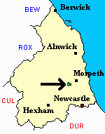
Meldon
hide
Hide
hide
Hide
Hide
Hide
"MELDON parish is situated in the north-west corner of Castle Ward, and comprises an area of 993 acres. The number of its inhabitants in 1801 was 54; in 1811, 129; in 1821, 129; in 1831, 114; in 1841, 152 and in 1851, 144 souls. John Cookson, Esq., of Meldon Hall, is lord of the manor and owner of the soil. Meldon was anciently a member of the barony of Mitford, and seems to have been a place of some importance, for we find here the remains of a large strong building, with extensive gardens, and in Meldon Park the traces of several other edifices have been discovered. This place was formerly the property of the ancient family of Fenwick, from whom it was transferred by marriage to the Derwentwaters, in which family it continued till the attainder of James, the third Earl, when it was forfeited to the crown. It was afterwards granted to Greenwich Hospital, and was subsequently sold by the Commissioners of the Hospital to Isaac Cookson, Esq., alderman of Neweastle, for the sum of 56,900 guineas." [From History, Topography, and Directory of Northumberland, Whellan, 1855].
Hide
- Northumberland County Record Office holds copies of Census Returns 1841 - 1891 and provides a useful User Guide
- The 1851 Census Index (microfiche CN21) Hartburn, Netherwitton, Longhorsley, Hebron, Mitford and Meldon (PRO piece HO107/2418 folios 1-145) (Type B) (Book) published by the https://www.ndfhs.org.uk/ may be of value to researchers interested in this parish.
- Meldon - Church Records - links and information.
- This area is within Northumberland Central Registration District.
- Certificates of birth, death and marriage can be ordered from Northumberland County Council.
- Photographs of Meldon from Les Bell's Northumberland Cam website.
- The section of The National Gazetteer (1868) relating to this parish - transcribed by Colin Hinson.
- Ask for a calculation of the distance from Meldon to another place.
- The history of Meldon Parish is included in:- Hodgson, J., History of Northumberland, Part 2, Volume 2. Newcastle, 1832. (Available on fiche from Ancestral Indexes).
You can see maps centred on OS grid reference NZ121841 (Lat/Lon: 55.151285, -1.811627), Meldon which are provided by:
- OpenStreetMap
- Google Maps
- StreetMap (Current Ordnance Survey maps)
- Bing (was Multimap)
- Old Maps Online
- National Library of Scotland (Old Ordnance Survey maps)
- Vision of Britain (Click "Historical units & statistics" for administrative areas.)
- English Jurisdictions in 1851 (Unfortunately the LDS have removed the facility to enable us to specify a starting location, you will need to search yourself on their map.)
- Magic (Geographic information) (Click + on map if it doesn't show)
- GeoHack (Links to on-line maps and location specific services.)
- All places within the same township/parish shown on an Openstreetmap map.
- Nearby townships/parishes shown on an Openstreetmap map.
- Nearby places shown on an Openstreetmap map.