
Hide
--- TEST SYSTEM --- TEST SYSTEM --- TEST SYSTEM ---
Hide
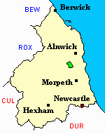
Longframlington
hide
Hide
hide
Hide
Hide
Hide
"LONG FRAMLINGTON is a chapelry, township, and village, comprising an area of 4,962 acres, and its rateable value is £2,324. Its population in 1801, was 471; in 1811, 508; in 1821, 563; in 1831, 543; in 1841, 549; and in 1851, 549 souls. The manor of Long Framlington, previous to the reign of Henry VIII., was the property of the Eslington family, on the extinction of which, the estate was sold in lots, and is now the property of the Duke of Northumberland and a number of freeholders. The land of this chapelry is generally of a good quality. On the north-western extremity is a long narrow tract containing about 1,000 acres of the wildest and most dreary moorland in the county. Here are a number of cairns composed of loose stones, and the road called the Devil's Causeway passes near this place, where there are large heaps of scoriœ, probably produced by the Romans in melting ironstone. Coal, limestone, and freestone, are the principal mineral productions" [From History, Topography, and Directory of Northumberland, Whellan, 1855].
"FRAMLINGTON (LONG), a parish in the ... county of NORTHUMBERLAND, comprising the townships of Brinkburn High ward, Brinkburn Low ward, and Long Framlington, ..." [Samuel Lewis Topographical Dictionary of England 1831 © Mel Lockie]
" .........Brinkburn has been separated from the parochial chapelry of Long Framlington, with which it was returned prior to 1841." [From History, Topography, and Directory of Northumberland, Whellan, 1855].
Hide
- Northumberland County Record Office holds copies of Census Returns 1841 - 1891 and provides a useful User Guide
- The 1851 Census Index (microfiche CN27)
- 1891 Census Wooler (Screnwood, Alnham, Prendwick, Unthank, Netherton, North and South Side, Great and Little Ryle, Callaley and Yetlington, Lorbottle, Whittingham, Snitter, High and Low Trewitt, Cartington, Thropton, Warton, Flotterton Mount Healey, Rothbury, Whitton, Newtown, Tosson, Bickerton, Caistron, Fallowlees, Hollinghill, Hesleyhurst Row, Brinkburn High and Low Ward, Longframlington, Todburn, Wingates, Ritton Colt Park, Ritton White House, Ewesley, Healey and Combe Hill, Nunneykirk, Coatyards, Greenleighton, Harwood Fairnley, Hartington, Hartington Hall and Rothley) (PRO piece RG12/4272) (Type B) (Book) (Volume 82) BOTH published by the https://www.ndfhs.org.uk/ may be of value to researchers interested in this parish.
- Longframlington - Church Records - links and information.
- This area is within Northumberland North Second Registration District.
- Certificates of birth, death and marriage can be ordered from Northumberland County Council.
- The Northumberland Communities website includes pages relating to Longframlington. They provide "a range of learning resource material that reflects Northumberland's heritage, providing a base for studying the County's history. The website provides a starting point for understanding the development of communities in Northumberland. It also seeks to illustrate the range of sources for family and local history research that are available via Northumberland Archives Service."
- The section of The National Gazetteer (1868) relating to this parish - transcribed by Colin Hinson.
- Ask for a calculation of the distance from Longframlington to another place.
- The history of Longframlington Parish is included in:- Northumberland County History Committee, History of Northumberland, Volume 7. Newcastle, A. Reid, 1904.
You can see maps centred on OS grid reference NU131010 (Lat/Lon: 55.302928, -1.795207), Longframlington which are provided by:
- OpenStreetMap
- Google Maps
- StreetMap (Current Ordnance Survey maps)
- Bing (was Multimap)
- Old Maps Online
- National Library of Scotland (Old Ordnance Survey maps)
- Vision of Britain (Click "Historical units & statistics" for administrative areas.)
- English Jurisdictions in 1851 (Unfortunately the LDS have removed the facility to enable us to specify a starting location, you will need to search yourself on their map.)
- Magic (Geographic information) (Click + on map if it doesn't show)
- GeoHack (Links to on-line maps and location specific services.)
- All places within the same township/parish shown on an Openstreetmap map.
- Nearby townships/parishes shown on an Openstreetmap map.
- Nearby places shown on an Openstreetmap map.