
Hide
--- TEST SYSTEM --- TEST SYSTEM --- TEST SYSTEM ---
Hide
Longbenton
hide
Hide
hide
Hide
Hide
Hide
"LONG BENTON parish comprises the townships of Killingworth, Long Benton, Walker, and Weetslade, whose united area is 9,040 acres. Its population in 1801, was 3,355; in 1811, 4,358; in 1821, 5,547; in 1831, 6,613; in 1841, 8,711; and in 1851, 9,205 souls. The parish is bounded on the north by Earsdon, Cramlington, snd Stannington, on the west by All Saints' and Gosforth parishes, on the south by the Tyne, and on the east by the parishes of Tynemouth and Wallsend. It contains extensive collieries, foundries, quarries, gunpowder-works, &c. -upwards of 1,300 persons are employed in the collieries alone. The soil in this district is very fertile, and the parish is intersected by the York, Newcastle and Berwick Railway." [From History, Topography, and Directory of Northumberland, Whellan, 1855].
Hide
- Bygone days of Longbenton Benton Forest hall West Moor and Killingworth W G Elliot 2000
- History of Longbenton Church of England School D J Scott 1980
- A History of the county of Northumberland by John C Hodgeson 1840 volume 13 includes Longbenton
Owen Brannigan,O.B.E. International Opera Singer 10 March 1908-9 May 1973 born in Annitsford Northumberland, and buried in St John the Baptist RC Church Annitsford. he performed most frequently with English Opera at Glyndebourne saddlers wells and Covent Garden, He was involved in a serious car accident from which he never fully recovered and died of pneumonia in 1973, he married Mary Ashley in 1933 and had two children
- Northumberland County Record Office hold copies of Census Returns 1841 - 1891 and provide a useful User Guide
- The 1851 Census Index (microfiche CN10, CN11)Longbenton, Walker, Killingworth and Weetslade (PRO piece HO107/2411 folios 1-288) (Type B) (Book)
- 1891 Census Northumberland – Longbenton 4A (PRO piece RG12/4231) (Type B) (Book) (Volume 41) Longbenton 4B (Parts of Longbenton and Walker, and West Moor) (PRO piece RG12/4232) (Type B) (Book) (Volume 42) Longbenton 4C (PRO piece RG12/4233) (Type B) (Book) (Volume 43) BOTH published by the https://www.ndfhs.org.uk/ may be of value to researchers interested in this parish.
- A list of ships and crews in port during the 1881 census provided by Bob Sanders.
| Holy Family, Killingworth, Roman Catholic |
- The Ancestral Indexes website provides information about Burradon, The Good Shepherd and Dudley, St Paul. There is also information about Killingworth, St John under the headings Church and History; about Longbenton, St Bartholomew under the headings Church, History and Non-Parochial Records; and about Walker, Christ Church under the headings Church, History, Monumental Inscriptions and Non-Parochial Records.
- Longbenton - Church Records - links and information.
- Newcastle central Library Local Studies section holds copies of the following
- Longbenton Births marriages and burials 1840 - 1851 transcribed by George Bell
- Longbenton Births marriages and burials 1852 - 1861 transcribed by George Bell
- Longbenton Births marriages and Burials 1862 - 1971 transcribed by George Bell [shelf ref 929.3 L849]
- This area is divided between North Tyneside Registration District and Newcastle upon Tyne Registration District.
- The section of The National Gazetteer (1868) relating to this parish - transcribed by Colin Hinson.
- Ask for a calculation of the distance from Longbenton to another place.
- The history of Longbenton Parish is included in:- Northumberland County History Committee, History of Northumberland, Volume 13. Newcastle, A. Reid, 1930. (Available on fiche from Ancestral Indexes).
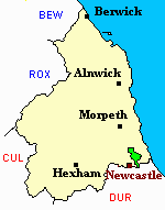
- Longbenton - Maps - links and information.
You can see maps centred on OS grid reference NZ272692 (Lat/Lon: 55.016262, -1.576217), Longbenton which are provided by:
- OpenStreetMap
- Google Maps
- StreetMap (Current Ordnance Survey maps)
- Bing (was Multimap)
- Old Maps Online
- National Library of Scotland (Old Ordnance Survey maps)
- Vision of Britain (Click "Historical units & statistics" for administrative areas.)
- English Jurisdictions in 1851 (Unfortunately the LDS have removed the facility to enable us to specify a starting location, you will need to search yourself on their map.)
- Magic (Geographic information) (Click + on map if it doesn't show)
- GeoHack (Links to on-line maps and location specific services.)
- All places within the same township/parish shown on an Openstreetmap map.
- Nearby townships/parishes shown on an Openstreetmap map.
- Nearby places shown on an Openstreetmap map.