
Hide
--- TEST SYSTEM --- TEST SYSTEM --- TEST SYSTEM ---
Hide
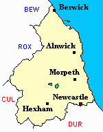
Kirkharle
hide
Hide
hide
Hide
Hide
Hide
"KIRKHARLE parish comprises the townships of Harle (Little), Harle (West), and Kirkharle, and is bounded by the parishes of Kirkwhelpington, Thockrington, and Hartburn. The townships of Harle (Little), and Harle (West), were added to this parish by an order of the Queen in council, in 1847, and severed from the parish of Kirkwhelpington, to which they formerly belonged. At the same time and by the same order the township of Hawick, in Kirkharle parish, was transferred to that of Kirkwhelpington. Kirkharle parish comprises an area of 3,502 acres, and its population in 1801, was 281; in 1811, 337, in 1821, 304; in 1831, 286; in 1841, 299; and in 1851, 253 souls." [From History, Topography, and Directory of Northumberland, Whellan, 1855].
"KIRKHEATON, a chapelry in the parish of KIRKHARLE, north-eastern division of TINDALE ward, county of NORTHUMBERLAND ....." [Samuel Lewis Topographical Dictionary of England 1831 © Mel Lockie]
Hide
- Northumberland County Record Office hold copies of Census Returns 1841 - 1891 and provides a useful User Guide
- The 1851 Census Index (microfiche CN20) Falstone, Thorneyburn, Greystead, Bellingham, Corsenbridge, Wark, Thockrington, Kirkharle, Elsdon (part), Kirkwhelpington and Birtley (PRO piece HO107/2417 folios 1-292) (Type A) (Book)
- 1891 Census Northumberland – Kirkwhelpington (Corsenside, Redesdale, Birtley, Thockrington, West Harle, Kirkwhelpington, Coldwell, Kirkharle and Wark (PRO piece RG12/4253) (Type B) (Book) (Volume 63) BOTH published by the https://www.ndfhs.org.uk/ may be of value to researchers interested in this parish.
- Kirkharle - Church Records - links and information.
- This area is within Northumberland West Registration District.
- Certificates of birth, death and marriage can be ordered from Northumberland County Council.
- The section of The National Gazetteer (1868) relating to this parish - transcribed by Colin Hinson.
- Ask for a calculation of the distance from Kirkharle to another place.
- The history of Kirkharle Parish is included in:- Hodgson, J., History of Northumberland, Part 2, Volume 1. Newcastle, 1827. (Available on fiche from Ancestral Indexes).
You can see maps centred on OS grid reference NY976816 (Lat/Lon: 55.128754, -2.039101), Kirkharle which are provided by:
- OpenStreetMap
- Google Maps
- StreetMap (Current Ordnance Survey maps)
- Bing (was Multimap)
- Old Maps Online
- National Library of Scotland (Old Ordnance Survey maps)
- Vision of Britain (Click "Historical units & statistics" for administrative areas.)
- English Jurisdictions in 1851 (Unfortunately the LDS have removed the facility to enable us to specify a starting location, you will need to search yourself on their map.)
- Magic (Geographic information) (Click + on map if it doesn't show)
- GeoHack (Links to on-line maps and location specific services.)
- All places within the same township/parish shown on an Openstreetmap map.
- Nearby townships/parishes shown on an Openstreetmap map.
- Nearby places shown on an Openstreetmap map.