
Hide
--- TEST SYSTEM --- TEST SYSTEM --- TEST SYSTEM ---
Hide
Horton
hide
Hide
hide
Hide
Hide
Hide
"HORTON is a parochial chapelry comprising the townships of Bebside. Cowpen, Hartford East, Hartford West, and Horton, whose united area is 5,550 acres. It is bounded on the north by the river Blyth, on the west by the parish of Stannington, on the south by Earsdon parish and Cramlington chapelry, and on the east by the parish of Earsdon and the port of Blyth. The number of its inhabitants in 1801, was 1,197; in 1811, 1,449; in 1821, 2,099; in 1831, 2,423 in 1841, 2,838; and in 1851, 4,449 souls. This chapelry abounds in coal and stone, and the soil is a strong clay, which produces excellent crops. Until 1768 it formed a portion of the parish of Woodhorn, but at that period it was made into a parochial chapelry, and obtained all the privileges of a distinct parish." [From History, Topography, and Directory of Northumberland, Whellan, 1855]
"HORTON, a parish in the eastern division of CASTLE ward, county of NORTHUMBERLAND, comprising the townships of Bebside, Cowpen, East Hartford, West Hartford, and Horton, ........Horton formed part of the parish of Woodhorn until the year 1768, when it was severed from it......." [Samuel Lewis Topographical Dictionary of England 1831 © Mel Lockie]
Hide
- Burial Registers 1877-1971 and Burials Grant Books 1878-1967 for Cowpen Civil Cemetery are available at Northumberland Archives Service.
- The 1851 Census Index (microfiche CN13) published by the Northumberland and Durham Family History Society may be of value to researchers interested in this parish.
- A list of ships and crews in port during the 1881 census provided by Bob Sanders.
- Horton, St Mary was originally built in the 12th century but was completely rebuilt in 1827 and restored in 1903. It formed part of Woodhorn Parish until 1768 when it became a separate parish. It stands on a hill beside the B1505 road about 3 miles south west of Blyth (OS reference NZ275797). A chapel of ease, Blyth St Mary, was built in 1864 at the west end of Blyth market; this became a parish church in 1897. Another church in Horton Parish, Newsham St Bede, had its origins around 1916 and served the mining villages of Newsham and New Delaval. As the population moved, so did the church, and the present building is the fourth. It is located on Newcastle Road, Blyth and was consecrated in 1957.
- The Ancestral Indexes website provides information about Blyth, St Mary. There is also information about Horton, St Mary under the heading History.
- Horton - Church Records - links and information.
- This area is within Northumberland Central Registration District.
- Certificates of birth, death and marriage can be ordered from Northumberland County Council.
Order Certificates.
- Photographs of Blyth from Les Bell's Northumberland Cam website.
- Photographs of Blyth from the FreeFoto.com website.
- The Northumberland Communities website includes pages relating to Blyth. They provide "a range of learning resource material that reflects Northumberland's heritage, providing a base for studying the County's history. The website provides a starting point for understanding the development of communities in Northumberland. It also seeks to illustrate the range of sources for family and local history research that are available via Northumberland Archives Service."
- The section of The National Gazetteer (1868) relating to this parish - transcribed by Colin Hinson.
- Ask for a calculation of the distance from Horton to another place.
- The history of Horton Parish is included in Hodgson, J., History of Northumberland, Part 2, Volume 2. Newcastle, 1832, and Northumberland County History Committee, History of Northumberland, Volume 9. Newcastle, A. Reid, 1909.
- Horton - Maps - links and information.
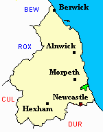
You can see maps centred on OS grid reference NZ275797 (Lat/Lon: 55.110945, -1.57046), Horton which are provided by:
- OpenStreetMap
- Google Maps
- StreetMap (Current Ordnance Survey maps)
- Bing (was Multimap)
- Old Maps Online
- National Library of Scotland (Old Ordnance Survey maps)
- Vision of Britain (Click "Historical units & statistics" for administrative areas.)
- English Jurisdictions in 1851 (Unfortunately the LDS have removed the facility to enable us to specify a starting location, you will need to search yourself on their map.)
- Magic (Geographic information) (Click + on map if it doesn't show)
- GeoHack (Links to on-line maps and location specific services.)
- All places within the same township/parish shown on an Openstreetmap map.
- Nearby townships/parishes shown on an Openstreetmap map.
- Nearby places shown on an Openstreetmap map.
- Horton Parish was part of Tynemouth Poor Law Union. The Union Workhouse was located in Preston Lane, North Shields. Some useful records are held at Tyne and Wear Archives Service.
- Peter Higginbotham has provided details, a map, plan and photograph of Tynemouth Workhouse.