
Hide
--- TEST SYSTEM --- TEST SYSTEM --- TEST SYSTEM ---
Hide
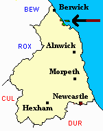
Holy Island
hide
Hide
hide
Hide
Hide
Hide
"HOLY ISLAND is a parish, eomprising the townships of Holy Island, Fenham, and Goswick, whose united area is 8,296 acres, and its population in 1801, was 601; in 1811, 675; in 1821, 760; in 1831, 836; in 1841, 809; and in 1851, 908 souls." [From History, Topography, and Directory of Northumberland, Whellan, 1855].
Hide
- Northumberland Country Record Office holds copies of Census Returns 1841 - 1891 and provides a useful User Guide
- The 1851 Census Index (microfiche CN25) Ancroft, Holy Island, Kyloe and Scremerston (PRO piece HO107/2421 folios 1-142) (Type B) (Book)
- 1891 Census Northumberland – Norhamshire and Islandshire (Buckton, Fenwick, Fenham, Goswick, Beal, Holy Island, Berrington, Kyloe, Ancroft, Cheswick, Haggerston, Scremerston, Horncliffe, Loan End, Longridge, Thornton, Shoreswood, Felkington, Norham Mains, Norham, Grindon, Duddo, Twizell, Tillmouth, Heaton, Cornhill, ship, Unity of Boston) (PRO piece RG12/4269) (Type B) (Book) (Volume 79) BOTH published by the https://www.ndfhs.org.uk/ may be of value to researchers interested in this parish
- Glenn Bailey has supplied name indexes for the Holy Island census returns of 1851, 1861, and 1871 and will supply full details of entries on request.
- A list of ships and crews in port during the 1881 census provided by Bob Sanders.
- Holy Island - Church Records - links and information.
- This area is within Northumberland North First Registration District.
- Certificates of birth, death and marriage can be ordered from Northumberland County Council.
- Holy Island - Description and Travel - links and information.
- The section of The National Gazetteer (1868) relating to this parish - transcribed by Colin Hinson.
- Ask for a calculation of the distance from Holy Island to another place.
You can see maps centred on OS grid reference NU048439 (Lat/Lon: 55.68893, -1.924839), Holy Island which are provided by:
- OpenStreetMap
- Google Maps
- StreetMap (Current Ordnance Survey maps)
- Bing (was Multimap)
- Old Maps Online
- National Library of Scotland (Old Ordnance Survey maps)
- Vision of Britain (Click "Historical units & statistics" for administrative areas.)
- English Jurisdictions in 1851 (Unfortunately the LDS have removed the facility to enable us to specify a starting location, you will need to search yourself on their map.)
- Magic (Geographic information) (Click + on map if it doesn't show)
- GeoHack (Links to on-line maps and location specific services.)
- All places within the same township/parish shown on an Openstreetmap map.
- Nearby townships/parishes shown on an Openstreetmap map.
- Nearby places shown on an Openstreetmap map.