
Hide
--- TEST SYSTEM --- TEST SYSTEM --- TEST SYSTEM ---
Hide
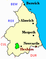
Haydon Bridge
hide
Hide
hide
Hide
Hide
Hide
"HAYDON parochial chapelry, the property of the Commissioners of Greenwich Hospital, and others, is divided for highway purposes into the quarters or divisions of Brokenheugh, Deanraw, Ellerington, and Lipwood. It contains 13,688 acres, and its rateable value is £14,106. The number of its inhabitants in 1801, was 1,084; in 1811, 1,347; in 1821, 1,574; in 1831, 1,746; in 1841, 1,908; and in 1851, 2,085 souls. The manor of Haydon was formerly the property of Anthony, Lord Lucy, of Cockermouth, who, in 1344 obtained a charter from Edward III., in which permission was granted to hold a weekly market here on Tuesdays, and an annual fair on the feast of St. Mary Magdalen, and the three following days, but these privileges have long been disused. This chapelry is intersected by the Newcastle and Carlisle Railway, which has a station here, near to which are the Haydon Bridge Irons Works, established in 1843, and extensively carried on by Messrs. Coaltas Dodsworth and Co. There are also mills for the smelting of lead ore, at Langley, worked by Messrs. Shield and Co., and at Grindon Hill, a Lead Mining Company has been recently formed. On Ellfoot Hill, a cist vaen, containing some ashes, was discovered by Mr. Thomas Pickering in 1851, and several ancient silver coins were lately found in an adjoining field." [From History, Topography, and Directory of Northumberland, Whellan, 1855].
"HAYDON, a chapelry in the parish of WARDEN, north-western division of TINDALE ward, county of NORTHUMBERLAND, ..... The village of Haydon- Bridge, situated on both sides of the South Tyne river, is in this chapelry........" [Samuel Lewis Topographical Dictionary of England 1831 © Mel Lockie]
"HAYDON, (or Haydon-bridge), a chapelry in the parish of Warden, .... The chapelry contains the hamlets of Brockenheugh, Lipwood, Ellerington, Chesterwood, Langley, and Deanrow...... " The National Gazetteer of Great Britain and Ireland (1868) Colin Hinson ©2003]
Hide
- The 1851 Census Index (microfiche CN17) Allendale and Haydon Bridge (PRO piece HO107/2415 folios 1-320) (Type A) (Book) published by the https://www.ndfhs.org.uk/ may be of value to researchers interested in this parish.
- Northumberland County Record Office holds copies of Census Returns 1841 - 1891 and provides a useful User Guide
- The Ancestral Indexes website provides information about Haydon Old Church.
- Haydon Bridge - Church Records - links and information.
- This area is within Northumberland West Registration District.
- Certificates of birth, death and marriage can be ordered locally from Northumberland County Council.
- Photographs of Haydon Bridge from Les Bell's Northumberland Cam website.;
- The Haydon News Website .
- The Northumberland Communities website includes pages relating to Haydon Bridge. They provide "a range of learning resource material that reflects Northumberland's heritage, providing a base for studying the County's history. The website provides a starting point for understanding the development of communities in Northumberland. It also seeks to illustrate the range of sources for family and local history research that are available via Northumberland Archives Service."
- The section of The National Gazetteer (1868) relating to this parish - transcribed by Colin Hinson.
- Ask for a calculation of the distance from Haydon Bridge to another place.
- The history of Haydon Bridge Parish is included in:- Hodgson, J., History of Northumberland, Part 2, Volume 3. Newcastle, 1840. (Available on fiche from Ancestral Indexes).
You can see maps centred on OS grid reference NY842644 (Lat/Lon: 54.973959, -2.248361), Haydon Bridge which are provided by:
- OpenStreetMap
- Google Maps
- StreetMap (Current Ordnance Survey maps)
- Bing (was Multimap)
- Old Maps Online
- National Library of Scotland (Old Ordnance Survey maps)
- Vision of Britain (Click "Historical units & statistics" for administrative areas.)
- English Jurisdictions in 1851 (Unfortunately the LDS have removed the facility to enable us to specify a starting location, you will need to search yourself on their map.)
- Magic (Geographic information) (Click + on map if it doesn't show)
- GeoHack (Links to on-line maps and location specific services.)
- All places within the same township/parish shown on an Openstreetmap map.
- Nearby townships/parishes shown on an Openstreetmap map.
- Nearby places shown on an Openstreetmap map.
- A transcript of Haydon Bridge War Memorial provided by Ancestral Indexes.