
Hide
--- TEST SYSTEM --- TEST SYSTEM --- TEST SYSTEM ---
Hide
Guizance
hide
Hide
hide
Hide
Hide
Hide
"GUYZANCE, or GUYSON, is a township and village in this [Shilbottle] parish, the property of the Duke of Northumberland; Robert Delisle, Esq. the heirs of the late Thomas Fenwick, Esq., and Thomas Tate, Esq. The rateable value is £l,671 10s., and the tithes, which are the properly of Thomas Tate, Esq., are valued at £130 per annum. The number of inhabitants in 1801, was 172; in 1811, 186; in 1821, 173; in 1831, 197; in 184l, 205; and in 1851, 213 souls. THE VILLAGE of Guyzance is situated seven miles south by east of Alnwick. There was formerly a priory here, which was annexed to Alnwick Abbey, by Eustace Fitz John. We find from Tanner's Monastica that it was endowed with a portion of the tithes, and two bovates of land, but as to any other portion of its history we possess no records. The remains of the old chapel are still here, with the burying ground, in which the Tate family are still interred. BANK HOUSE, the seat of Thomas Tate, Esq., is situated about a mile north of the village." [From History, Topography, and Directory of Northumberland, Whellan, 1855].
Hide
- Northumberland County Record Office holds copies of Census Returns 1841 - 1891 and provides a useful User Guide
The Felton and Swarland Local History Society have published the following:
- Index of Census Returns Vol 1, 1841 - 1851
- Index of Census Returns Vol 2, 1861 - 1871
- Index of Census Returns Vol 3, 1881 - 1891
(The above volumes cover the villages of Acton, Bockenfield, Elyhaugh, Eshott, Felton, Guyzance, Hazon, Newton on the Moor Swarland and East and West Thirston. In addition, Vol 2 has a complete burial record, from 1819, of St Wilfrid's Chapel, Guyzance as an appendix and Vol 3 has a strays listing for 1851 from surrounding Enumeration Districts of people giving their birthplace in the Felton district.)
- The 1851 Census Index (microfiche CN24, CN31)
- 1891 census Warkworth (Felton Greens, Glantlees, Swarland, Elyhaugh, Newton on the Moor, Hazon and Hartlaw, Whittle, Shilbottle, Guyzance, Brotherwick, Walkmill, High and Low Buston, Stirton Grange, Birling and Warkworth) (PRO piece RG12/4261) (Type B) (Book) (Volume 71) BOTH published by the https://www.ndfhs.org.uk/ may be of value to researchers interested in this parish.
Church of England Records.
- An Index of Monumental Inscriptions of Acklington Church and Burial Register of Guyzance Chapel is available from the Felton and Swarland L.H.S.
Adjacent Parishes.
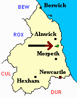
- The following parishes are adjacent to Guizance:- Felton, Shilbottle, Warkworth.
- This area is within Northumberland North Second Registration District.
- Certificates of birth, death and marriage can be ordered from Northumberland County Council.
- The section of The National Gazetteer (1868) relating to this parish - transcribed by Colin Hinson.
- Ask for a calculation of the distance from Guizance to another place.
- The history of Brainshaugh is included in:- Northumberland County History Committee, History of Northumberland, Volume 5. Newcastle, A. Reid, 1899.
You can see maps centred on OS grid reference NU202037 (Lat/Lon: 55.326991, -1.683397), Guizance which are provided by:
- OpenStreetMap
- Google Maps
- StreetMap (Current Ordnance Survey maps)
- Bing (was Multimap)
- Old Maps Online
- National Library of Scotland (Old Ordnance Survey maps)
- Vision of Britain (Click "Historical units & statistics" for administrative areas.)
- English Jurisdictions in 1851 (Unfortunately the LDS have removed the facility to enable us to specify a starting location, you will need to search yourself on their map.)
- Magic (Geographic information) (Click + on map if it doesn't show)
- GeoHack (Links to on-line maps and location specific services.)
- All places within the same township/parish shown on an Openstreetmap map.
- Nearby townships/parishes shown on an Openstreetmap map.
- Nearby places shown on an Openstreetmap map.