
Hide
--- TEST SYSTEM --- TEST SYSTEM --- TEST SYSTEM ---
Hide
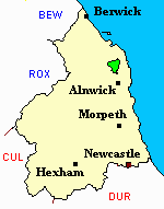
Ellingham
hide
Hide
hide
Hide
Hide
Hide
"ELLINGHAM is a parish comprising the townships of Charlton North, Charlton South, Chathill, Doxford, Ellingham, and Preston, whose united area is 9,124 acres. It is bounded on the north by Bambrough parish, on the west and south, by Eglingham parish and Coquetdale Ward, and on the east by Embleton. It is about five and a half miles long by five miles broad, and its population in 1801, was 749; in 1811, 691; in 1821, 801; in 1831, 953; in 1841, 861; and in 1851, 936 souls. Coal and lime are abundant in this parish." [From History, Topography, and Directory of Northumberland, Whellan, 1855].
Hide
- A History of Northumberland Vol 2 by Edward Bateson 1895 available to view at the Local Studies Centre Newcastle City Library [shelf ref. LOCAS]
- Northumberland County Record Office holds copies of Census Returns 1841 - 1891 and provides a useful User Guide
- 1891Census Northumberland – Embleton (Edlingham, Eglingham, Longhoughton, Craster, Dunstan, Embleton, Newton by the Sea, Rock and Rennington (PRO piece RG12/4265) (Type B) (Book) (Volume 75) published by thehttps://www.ndfhs.org.uk/ may be of value to researchers interested in this parish.
- The Ancestral Indexes website provides information about South Charlton, St James.
- Ellingham - Church Records - links and information.
- The register of Ellingham a transcription of the earliest register by G.G. Baker Cresswell 1905 available at the Local Studies Centre Newcastle City Library [Shelf ref. L929.3 E46]
- This area is divided between Northumberland North First Registration District and Northumberland North Second Registration District.
- Certificates of birth, death and marriage can be ordered from Northumberland County Council.
- The section of The National Gazetteer (1868) relating to this parish - transcribed by Colin Hinson.
- Ask for a calculation of the distance from Ellingham to another place.
- The history of Ellingham Parish is included in:- Northumberland County History Committee, History of Northumberland, Volume 2. Newcastle, A. Reid, 1895.
Ellingham Hall
Built by Sir john Haggerston in the Seventeenth Century on the site of an earlier possibly medieval property. The hall was enlarged by his successor Edward Haggerston but suffered severe fire damage that destroyed most of the East wing. in World War Two it was used by the Women's Land Army who cultivated the Tennis Courts and used parts of the building as storage. from 1955 to 1988 it was used as a preparatory school for boys. it was bought by Property Developers in 1989, but the economic crash of that year prevented any development and it was compulsory purchased. It lay empty until 1995 when it was purchased by the present owners Helen and Aiden Ruff, who have restored and refurbished the hall and is now used as a venue for weddings, meetings, holidays.
- Ellingham - Maps - links and information.
You can see maps centred on OS grid reference NU161231 (Lat/Lon: 55.501538, -1.746011), Ellingham which are provided by:
- OpenStreetMap
- Google Maps
- StreetMap (Current Ordnance Survey maps)
- Bing (was Multimap)
- Old Maps Online
- National Library of Scotland (Old Ordnance Survey maps)
- Vision of Britain (Click "Historical units & statistics" for administrative areas.)
- English Jurisdictions in 1851 (Unfortunately the LDS have removed the facility to enable us to specify a starting location, you will need to search yourself on their map.)
- Magic (Geographic information) (Click + on map if it doesn't show)
- GeoHack (Links to on-line maps and location specific services.)
- All places within the same township/parish shown on an Openstreetmap map.
- Nearby townships/parishes shown on an Openstreetmap map.
- Nearby places shown on an Openstreetmap map.