
Hide
--- TEST SYSTEM --- TEST SYSTEM --- TEST SYSTEM ---
Hide
Eglingham
hide
Hide
hide
Hide
Hide
Hide
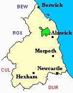
"EGLINGHAM parish is bounded on the north by Glendale Ward, on the west by the parishes of Ingram and Ilderton, on the south by Alnwick, Edlingham, and Whittingham parishes, and on the east by Bambrough Ward. It is about nine miles in length, by four and a half in breadth, and comprises an area of 23,361 acres. Its population in 1801, was 1,536; in 1811, 1,538; in 1821, 1,666; in 1831, 1,805; in 1841, 1,832; and in 1851, 2,000 souls. It comprises 16 townships, which exhibit a great variety of soil and scenery, from the sterile moor to the fertile and highly cultivated valley, and possesses a mineral spring, tinctured with sulphuric acid, which issues from an old drift for the draining of coalpits; as also a lake covering nine acres, called Kimmer Lough, abounding in perch and pike, the latter of which attain to a great size. There are some vestiges of British and Roman encampments, and the ruins of an old border tower. Lime freestone, and coal are abundant in this parish." [From History, Topography, and Directory of Northumberland, Whellan, 1855].
"EGLINGHAM, a parish in the .... county of NORTHUMBERLAND, comprising the townships of Bassington, Beamy, New Bewick, Old Bewick, Brandon, Branton, Crawley, Eglingham, Hareup, Hedgeley, East Lilburn, West Lilburn, Titlington, and Wooperton,......" [Samuel Lewis Topographical Dictionary of England 1831 © Mel Lockie]
Hide
- A History of the County of Northumberland by J Hodgeson 1840 Volume 14 includes Eglingham
- Northumberland County Record Office holds copies of Census Returns 1841 - 1891 and provides a useful User Guide
- The 1851 Census Index (microfiche CN32, CN33 and CN35) Alnwick and Eglingham (part) (PRO piece HO107/2419 folios 280-557) (Type B) (Book) Embleton, Edlington, Whittingham, Eglingham (part), Longhoughton, Howick and Ellingham (PRO piece HO107/2419 folios 564-820) (Type B) (Book)
- 1891Census Northumberland – Embleton (Edlingham, Eglingham, Longhoughton, Craster, Dunstan, Embleton, Newton by the Sea, Rock and Rennington (PRO piece RG12/4265) (Type B) (Book) (Volume 75) BOTH published by the https://www.ndfhs.org.uk/ may be of value to researchers interested in this parish.
- Newcastle Central Library Local Studies Section has the following books available to view
- Index to 1851 census of Northumberland volume 25 part 2 [shelf ref.L312 (1)]
- Index to 1891 census of Northumberland volume 75 [shelf ref L312 (2)]
- A new investigation of Old Bewick Church by G. Bettess, published in History of the Berwickshire Naturalists' Club vol. 46, part 3 (1995), pp. 223-236 - includes information on the history of Old Bewick church, together with a recent survey of the site.
- The Ancestral Indexes website provides information about Old Bewick, Holy Trinity.
- Eglingham - Church Records - links and information.
- The following books are available to view and Newcastle Central Library Local Studies Section
- Eglingham and Ellingham baptisms marriages and Burials 1813 - 1839 transcribed by George Bell and Carol Yellowly [shelf ref 929.3 E31]
- The registers of Eglingham transcribed by K A Martin [shelf ref 929.3 E31]
- This area is within Northumberland North Second Registration District.
- Certificates of birth, death and marriage can be ordered from Northumberland County Council.
- The section of The National Gazetteer (1868) relating to this parish - transcribed by Colin Hinson.
- Ask for a calculation of the distance from Eglingham to another place.
- The history of Eglingham Parish is included in:- Northumberland County History Committee, History of Northumberland, Volume 14. Newcastle, A. Reid, 1935. (Available on fiche from Ancestral Indexes).
- Eglingham - Maps - links and information.
You can see maps centred on OS grid reference NU079202 (Lat/Lon: 55.47543, -1.876431), Eglingham which are provided by:
- OpenStreetMap
- Google Maps
- StreetMap (Current Ordnance Survey maps)
- Bing (was Multimap)
- Old Maps Online
- National Library of Scotland (Old Ordnance Survey maps)
- Vision of Britain (Click "Historical units & statistics" for administrative areas.)
- English Jurisdictions in 1851 (Unfortunately the LDS have removed the facility to enable us to specify a starting location, you will need to search yourself on their map.)
- Magic (Geographic information) (Click + on map if it doesn't show)
- GeoHack (Links to on-line maps and location specific services.)
- All places within the same township/parish shown on an Openstreetmap map.
- Nearby townships/parishes shown on an Openstreetmap map.
- Nearby places shown on an Openstreetmap map.
Atkinson, Thomas
Barron, Bertram R
Blyth, Andrew
Brewis, Robert
Brown, John
Cairns, Peter
Davison, Norman
Dunn, Thomas