
Hide
--- TEST SYSTEM --- TEST SYSTEM --- TEST SYSTEM ---
Hide
Edlingham
hide
Hide
hide
Hide
Hide
Hide
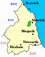
"EDLINGHAM parish is bounded on the north by Eglingham, on the west by Whittingham, on the south by Long Framlington, and on the east by Alnwick. It is about three and a half miles in length by two and a half in breadth, and comprises an area of 12,348 acres. The parish contains the townships of Abberwick, Bolton, Broom Park, Edlingham, Learchild, and Lemmington. Its population in 1801, was 638; in 1811, 667; in 1821, 666; in 1831, 568; in 1841, 659; and in 1851, 742 souls." [From History, Topography, and Directory of Northumberland, Whellan, 1855].
Hide
- Northumberland County Record Office hold copies of Census Returns 1841 - 1891 and provides a useful User Guide
- The 1851 Census Index (microfiche CN33) Embleton, Edlington, Whittingham, Eglingham (part), Longhoughton, Howick and Ellingham (PRO piece HO107/2419 folios 564-820) (Type B) (Book) published by The Northumberland and Durham Family History Society may be of value to researchers interested in this parish.
- 1891Census Northumberland – Embleton (Edlingham, Eglingham, Longhoughton, Craster, Dunstan, Embleton, Newton by the Sea, Rock and Rennington (PRO piece RG12/4265) (Type B) (Book) (Volume 75) published by the Northumberland and Durham Family History Society may be of value to researchers interested in this parish.
The church of St John the Baptist dates largely from the 11th and 12th centuries, with a remarkable fortified tower added c.1300.
- Bolton Chapel:- The Ancestral Indexes website provides information under the headings Church and Monumental Inscriptions.
- Edlingham - Church Records - links and information.
- A full transcript of the Bishops Transcripts for Edlingham 1760 - 1837 can be found using the link below please scroll down the list to find the parish required
- https://northumberlandparishregistertranscriptslocalhistory.wordpress.com/
- This area is within Northumberland North Second Registration District.
- Certificates of birth, death and marriage can be ordered locally from Northumberland County Council.
- Edlingham Castle photographed by Ray Urwin.
- Photographs of Edlingham from Les Bell's Northumberland Cam website.
- The section of The National Gazetteer (1868) relating to this parish - transcribed by Colin Hinson.
- Ask for a calculation of the distance from Edlingham to another place.
- The history of Bolton Chapelry is included in:- Northumberland County History Committee, History of Northumberland, Volume 7. Newcastle, A. Reid, 1904.
- The history of Edlingham Parish is included in Northumberland County History Committee, History of Northumberland, Volume 7. Newcastle, A. Reid, 1904.
- Edlingham - Maps - links and information.
You can see maps centred on OS grid reference NU108109 (Lat/Lon: 55.392135, -1.831197), Edlingham which are provided by:
- OpenStreetMap
- Google Maps
- StreetMap (Current Ordnance Survey maps)
- Bing (was Multimap)
- Old Maps Online
- National Library of Scotland (Old Ordnance Survey maps)
- Vision of Britain (Click "Historical units & statistics" for administrative areas.)
- English Jurisdictions in 1851 (Unfortunately the LDS have removed the facility to enable us to specify a starting location, you will need to search yourself on their map.)
- Magic (Geographic information) (Click + on map if it doesn't show)
- GeoHack (Links to on-line maps and location specific services.)
- All places within the same township/parish shown on an Openstreetmap map.
- Nearby townships/parishes shown on an Openstreetmap map.
- Nearby places shown on an Openstreetmap map.