
Hide
--- TEST SYSTEM --- TEST SYSTEM --- TEST SYSTEM ---
Hide
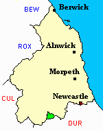
Blanchland
hide
Hide
hide
Hide
Hide
Hide
"BLANCHLAND, or HIGH QUARTER [of Shotley Parish], is a chapelry, township and village, the property of Lord Crewe's trustees. The township contains 3,728 acres of land, and its rateable value is £735 5s. The number of inhabitants in 1801, was 366; in 1811, 518; in 1821, 412; in 1831, 454; in 1841, 476; and in 1851, 491 souls. The VILLAGE of Blanchland is situated in a narrow, deep, green vale, on the north side of the Derwent, nine miles south by east of Hexham. Walter de Bolbeck, in 1175, founded an abbey here in honour of the Blessed Virgin, for twelve Præmonstratensian canons, with liberty to add to their number." [From History, Topography, and Directory of Northumberland, Whellan, 1855].
Hide
- Northumberland County Record Office holds copies of Census Returns 1841 - 1891 and produces a useful User Guide
- The 1851 Census Index (microfiche CN15) Bywell, Ovingham, Shotley, Blanchland and Whittonstall (PRO piece HO107/2414 folios 1-268) (Type A) (Book)
- The 1891 Census Northumberland – Bywell (Broomley, Healey, High Fotherley, Espershields, Whittonstall, Newlands, Bywell, Styford, Newton, Stelling, Ovington, Newton Hall, Welton, Broomhaugh, Riding, Newbiggin, Blanchland, Shotley Low Quarter, Nafferton, Ovingham, Wylam, Hedley, Dukershagg and part of Prudhoe) (PRO piece RG12/4244) (Type B) (Book) (Volume 54) BOTH published by the https://www.ndfhs.org.uk/ may be of value to researchers interested in this parish.
- The Ancestral Indexes website provides information about Blanchland, St Mary.
- Blanchland - Church Records - links and information.
- This area is within Northumberland West Registration District.
- Certificates of birth, death and marriage can be ordered from Northumberland County Council.
- Photographs of Blanchland from Les Bell's Northumberland Cam website.
- One of the Most Perfect Villages of England", a photograph from Mirror Image.
- The section of The National Gazetteer (1868) relating to this parish - transcribed by Colin Hinson.
- Ask for a calculation of the distance from Blanchland to another place.
- The history of Blanchland Parish is included in:- Northumberland County History Committee, History of Northumberland, Volume 6. Newcastle, A. Reid, 1902.
You can see maps centred on OS grid reference NY966503 (Lat/Lon: 54.847495, -2.054475), Blanchland which are provided by:
- OpenStreetMap
- Google Maps
- StreetMap (Current Ordnance Survey maps)
- Bing (was Multimap)
- Old Maps Online
- National Library of Scotland (Old Ordnance Survey maps)
- Vision of Britain (Click "Historical units & statistics" for administrative areas.)
- English Jurisdictions in 1851 (Unfortunately the LDS have removed the facility to enable us to specify a starting location, you will need to search yourself on their map.)
- Magic (Geographic information) (Click + on map if it doesn't show)
- GeoHack (Links to on-line maps and location specific services.)
- All places within the same township/parish shown on an Openstreetmap map.
- Nearby townships/parishes shown on an Openstreetmap map.
- Nearby places shown on an Openstreetmap map.