
Hide
--- TEST SYSTEM --- TEST SYSTEM --- TEST SYSTEM ---
Hide
St Michael Queenhithe
hide
Hide
hide
Hide
Hide
Hide
"ST. MICHAEL, Queenhithe, the church of, named from its saint and situation, stands on the north side of Upper Thames-street, opposite Queenhithe; which was formerly called Corn-hithe, as all the corn brought from the western parts of the county was landed here. The earliest mention of this church was under the name of St. Michael de Cornhithe in 1181. . . The ancient church having been destroyed by the fire of London, the present structure was erected in its stead, by Sir Christopher Wren in 1677. It consists of a well proportioned body, lighted by two series of windows; the tower is plain, with a well proportioned spire, terminated by a ship by way of a vane, 135 feet from the ground. On its rebuilding after the great fire the parish of Trinity the Less was united to it by act of parliament. . . The present rector is the Rev T. L. Strong, who was instituted by the Dean and Chapter of St. Paul's in 1822." [James Elmes. A Topographical Dictionary of London and its Environs (1831) - transcribed by Brian Randell]
Hide
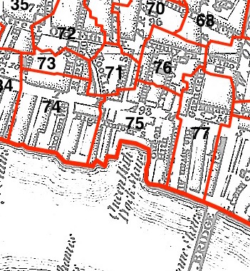
This parish - no. 75 in the above map - is located in Queenhithe Ward.
The church was destroyed in 1666, rebuilt by Wren, demolished 1875.
The parish was later united with St James Garlickhithe 1875.
Hide
London Metropolitan Archive holdings for St Michael Queenhithe.
Bartholomew Fish of Queenhithe - in the Mr Pepys' Small Change website.
Online Parish Register Images and Indexes for St Michael Queenhithe parish are provided by, or at various subscription sites via, the FamilySearch wiki.
Non-Church of England denominations identified in St Michael Queenhithe with Holy Trinity the Less include: Lutheran and Roman Catholic (German) [LDS FamilySearch Wiki].
Wikipedia page on St Michael Queenhithe.
- Ask for a calculation of the distance from St Michael Queenhithe to another place.
Summary history of St Michael Queenhithe parish, from the Worshipful Company of Parish Clerks.
Public Houses, Inns & Taverns of the parish of St Michael Queenhithe - provides "information from census records, trade directories, etc."
You can see maps centred on OS grid reference TQ323808 (Lat/Lon: 51.510911, -0.095396), St Michael Queenhithe which are provided by:
- OpenStreetMap
- Google Maps
- StreetMap (Current Ordnance Survey maps)
- Bing (was Multimap)
- Old Maps Online
- National Library of Scotland (Old Ordnance Survey maps)
- Vision of Britain (Click "Historical units & statistics" for administrative areas.)
- English Jurisdictions in 1851 (Unfortunately the LDS have removed the facility to enable us to specify a starting location, you will need to search yourself on their map.)
- Magic (Geographic information) (Click + on map if it doesn't show)
- GeoHack (Links to on-line maps and location specific services.)
- All places within the same township/parish shown on an Openstreetmap map.
- Nearby townships/parishes shown on an Openstreetmap map.
- Nearby places shown on an Openstreetmap map.
Surnames from the 1881 census in the St Michael Queenhithe district.
Clerical career summaries for the parish of (i) St Michael Queenhithe and (ii) St Michael Queenhithe With Holy Trinity The Less, from the Clergy of the Church of England Database website.
Sources for listings of taxpayer names for St Michael Queenhithe parish, listed on the LDS FamilySearch wiki.