
Hide
--- TEST SYSTEM --- TEST SYSTEM --- TEST SYSTEM ---
Hide
Sutton St. James
hide
Hide
hide
Hide
hide


Hide
Hide
Hide
- Many parish records can be found at the Spalding Library.
- The Library at Holbeach may also prove useful in your research.
Evelyn SIMAK has a photograph of St James' churchyard on Geo-graph, taken in January, 2011.
- Sutton St. James was part of the Long Sutton sub-district of the Holbeach Registration District.
- Check our Census Resource page for county-wide resources.
- The table below gives census piece numbers, where known:
| Census Year | Piece No. |
|---|---|
| 1841 | H.O. 107 / 611 |
| 1851 | H.O. 107 / 2097 |
| 1861 | R.G. 9 / 2326 |
| 1871 | R.G. 10 / 3326 |
| 1891 | R.G. 12 / 2566 |
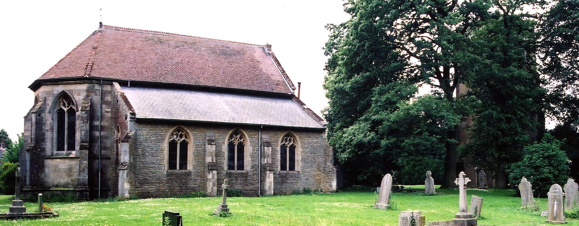
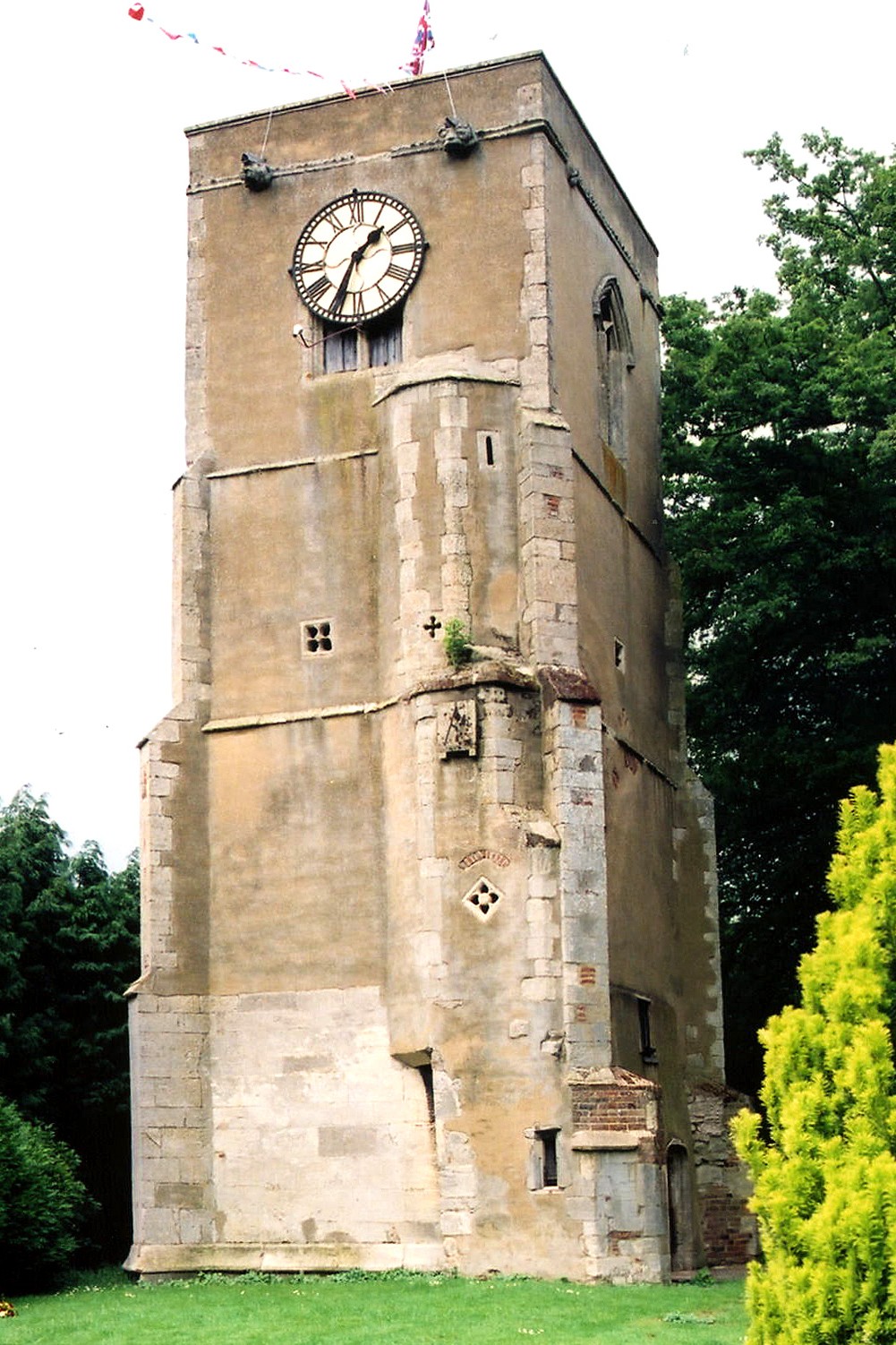
- The Anglican parish church is dedicated to Saint James.
- Sutton St. James used to be a chapelry of Long Sutton before being formed into its own parish.
- The original church was built in 1302.
- The tower was added in the 15th century.
- Major parts of the church were destroyed during Cromwell's Protectorate but were rebuilt much later in 1879. There is a 22-yard gap between the Tower and the Chancel where the Nave once connected them. The Nave was not replaced.
- The church chancel end wall was rebuilt in 1894.
- An organ was instaled in 1910.
- The church seats 170.
- The clock was installed in the tower in 1920 to commemorate those who died in the First World War.
- Evelyn SIMAK has a photograph of St. James' Church on Geo-graph, taken in January, 2011.
- Here is a photograph of St. James Church, taken by Ron COLE (who retains the copyright):
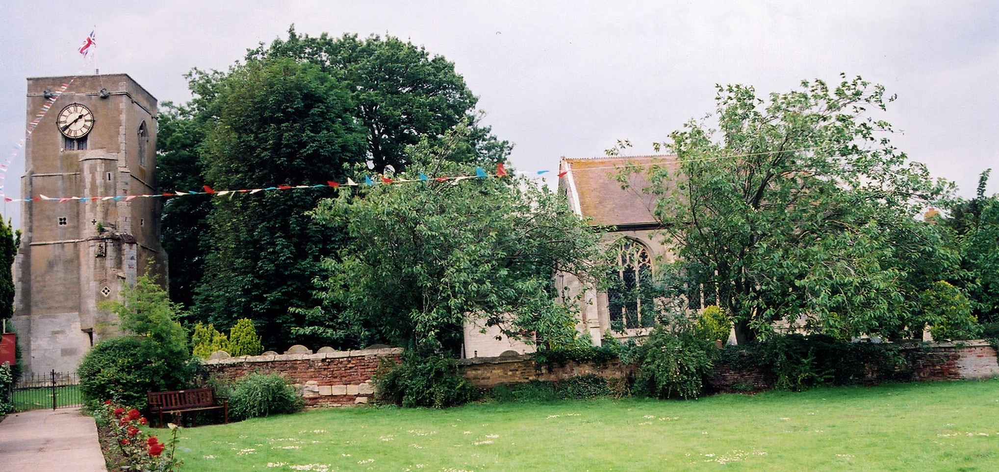
- Here is another photograph of St. James Church (with the tower behind the tree on the right), taken by Ron COLE (who retains the copyright):
- And here is the tower of St. James Church, taken by Ron COLE (who retains the copyright):
- Anglican parish registers exist from 1570.
- Sutton St. James is in the East Elloe Deanery, for which several indexes exist.
- We have a partial parish register extract in a pop-up text file for you. Your additions and corrections are welcome.
- The Wesleyan Methodists built a chapel here in 1841, as did the General Baptists in 1813.
- For information and assistance in researching these chapels, see our non-conformist religions page.
- Check our Church Records page for county-wide resources.
- The parish was in the Long Sutton sub-district of the Holbeach Registration District.
- Check our Civil Registration page for sources and background on Civil Registration which started in July, 1837.
Sutton St. James is a parish and a village about 102 miles north of London, 3 miles south of the A17 trunk road that runs between King's Lynn and Holbeach. Gedney parish lies to the north and west and Tydd St. Mary parish to the east. The area is marshy fenland, drained by several small canals and the larger South Holland Main Drain.
If you are planning a visit:
- The Sutton St. James Parish Council has a list of current events and activities, including sightseeing locations.
- Adrian S. PYE has a photograph of the village sign on Geo-graph, taken in January, 2011.
- Visit our touring page for visitor services.
- Ask for a calculation of the distance from Sutton St. James to another place.
- There is a an apparently medieval "Preaching" cross about a mile west of the church at the intersection of Fisher's Gate and Broad Gate roads. Tony BENNETT hsa a photograph of the Cross at Sutton St James on Geo-graph, taken in October, 2008. It is known as "St. Ives's Cross" and dates from the 14th century.
- Alex McGREGOR has a photograph of The Hat and Feathers Pub. on Geo-graph, taken in October, 2017.
- See our Maps page for additional resources.
You can see maps centred on OS grid reference TF396184 (Lat/Lon: 52.745202, 0.066621), Sutton St. James which are provided by:
- OpenStreetMap
- Google Maps
- StreetMap (Current Ordnance Survey maps)
- Bing (was Multimap)
- Old Maps Online
- National Library of Scotland (Old Ordnance Survey maps)
- Vision of Britain (Click "Historical units & statistics" for administrative areas.)
- English Jurisdictions in 1851 (Unfortunately the LDS have removed the facility to enable us to specify a starting location, you will need to search yourself on their map.)
- Magic (Geographic information) (Click + on map if it doesn't show)
- GeoHack (Links to on-line maps and location specific services.)
- All places within the same township/parish shown on an Openstreetmap map.
- Nearby townships/parishes shown on an Openstreetmap map.
- Nearby places shown on an Openstreetmap map.
- Adrian S. PYE has a photograph of the church clock memorial on Geo-graph, taken in January, 2011.
- In addition to the church clock, a tablet was placed in the church as a memorial to the men of the parish who perished in World War I.
- Major Henry Charles Hynman ALLANBY of the Seaforth Highlanders owned land in the parish during World War One but did NOT live here.
- See the Roll of Honour website for a complete list from 1914 through 1918.
- The name Sutton is from the Old English suth+tun, or "southern village".
A. D. Mills, "A Dictionary of English Place-Names," Oxford University Press, 1991.
- This place was an ancient Chapelry of Long Sutton in Lincolnshire and became a modern Civil Parish in December, 1866.
- The parish was in the ancient Elloe Wapentake in the South Holland district in the parts of Holland.
- You can examine the parish governance at Sutton St. James Parish Council, but they are not staffed to answer family history questions.
- For today's district governance, visit the South Holland District Council site.
- In March, 1884, this Civil Parish was reduced in size when the Hundred Road area was transfered to Sutton St. Mary Civil Parish.
- Bastardy cases would be heard in the Elloe (Spalding) petty session hearings.
- After the Poor Law Amendment Act reforms of 1834, the parish became part of the Holbeach Poor Law Union.
- The parish combined its various charities into a trust and used the charity income to build dwellings for the poor.
- A school was built in the village in 1859. It was enlarged in 1893 to hold up to 166 children. The school is on Bells Drove and it has a website that is currently (2011) under construction.
- For more on researching school records, see our Schools Research page.