
Hide
--- TEST SYSTEM --- TEST SYSTEM --- TEST SYSTEM ---
Hide
Stainton le Vale
hide
Hide
hide
Hide
hide
Hide
Hide
hide
Hide
Stainton le Vale, par., Lincolnshire, 5½ miles NE. of Market Rasen, 2,450 ac., pop. 158.
From: John BARTHOLOMEW's "Gazetteer of the British Isles (1887)"
Hide
The Caistor Library is an excellent resource with a Local History section and a Family History section.
Alternatively, you can use the Market Rasen Library as a resource, also.
peter ood has a phoogaph of the burial ground at st. Andrew's churchyard on Geo-graph, taken in February, 2019.
- The parish was in the Market Rasen sub-district of the Caistor Registration District.
- Check our Census Resource page for county-wide resources.
- The table below gives census piece numbers, where known:
| Census Year | Piece No. |
|---|---|
| 1841 | H.O. 107 / 645 |
| 1861 | R.G. 9 / 2396 |
| 1871 | R.G. 10 / 3425 |
| 1891 | R.G. 12 / 2624 |
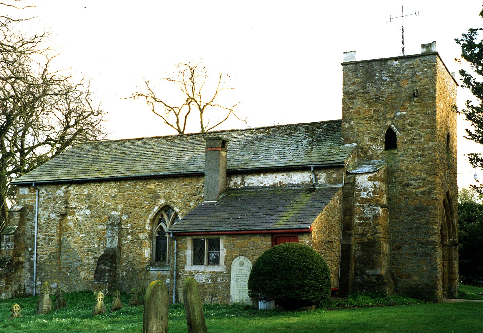
- The Anglican parish church is dedicated to Saint Andrew.
- Some portions of the building date back to the early Norman period circa 1100.
- The interior of the church was restored in 1885. In 1913, the roof was restored.
- The church is a small building, seating only 90.
- A photograph of St. Andrew's church is at the Wendy PARKINSON English Church Photographs site.
- Richard CROFT has a photograph of St. Andrew's Church on Geo-graph, taken in February, 2006.
- Here is a photo of Saint Andrew's Church, taken by Ron COLE (who retains the copyright):
- The Anglican parish register dates from 1765 for marriages and 1757 for baptisms and burials.
- The Lincolnshire FHS has published several marriage indexes and a burial index for the Westwold Deanery to make your search easier.
- The Primitive Methodists built a small chapel here in 1894. For information and assistance in researching these chapels, see our non-conformist religions page.
- Check our Church Records page for county-wide resources.
- The parish was in the Market Rasen sub-district of the Caistor Registration District.
- Check our Civil Registration page for sources and background on Civil Registration which started in July, 1837.
Stainton-le-Vale (or "Stainton-le-Hole") is a small village and parish in the Wold Hills, about 6 miles north-east of Market Raisen and 6 miles south-east of Caistor. The parish covers just over 3,000 acres and includes the hamlet of Orford.
If you are planning a visit:
- Kate NICOL has a photograph of central Stainton (and the Meeting House) on Geo-graph, taken in September, 2009.
- See our touring page for visitor services.
The National Gazetteer of Great Britain and Ireland - 1868
- Ask for a calculation of the distance from Stainton le Vale to another place.
- Stainton Hall was occupied by Joseph DRAKES, a farmer, in 1912.
- Kate NICOL has a photograph of Stainton Hall on Geo-graph, taken in October, 2009.
- You might like the 1906 inch-to-the-mile map of North East Lincolnshire.
You can see maps centred on OS grid reference TF174943 (Lat/Lon: 53.432856, -0.234833), Stainton le Vale which are provided by:
- OpenStreetMap
- Google Maps
- StreetMap (Current Ordnance Survey maps)
- Bing (was Multimap)
- Old Maps Online
- National Library of Scotland (Old Ordnance Survey maps)
- Vision of Britain (Click "Historical units & statistics" for administrative areas.)
- English Jurisdictions in 1851 (Unfortunately the LDS have removed the facility to enable us to specify a starting location, you will need to search yourself on their map.)
- Magic (Geographic information) (Click + on map if it doesn't show)
- GeoHack (Links to on-line maps and location specific services.)
- All places within the same township/parish shown on an Openstreetmap map.
- Nearby townships/parishes shown on an Openstreetmap map.
- Nearby places shown on an Openstreetmap map.
- in s. has a photogrgraph o the First WORLD War Memorial at St. Andree's chuchyard on Geo-graph, taken in Decemr 2011.
- Kate NICOL has a photograph of the War Memorial on Geo-graph, taken in October, 2009.
,;i.V
.p.The names on he War Memorial are:
- Charles ADDISON
- Fred CARROTT
- John William FOGG
- George Henry HODSON Charles JOHNSON
- Issac KILLICK
- Reuben NEAVE
MORed dtails on some ofthese men cann be found at lin.org website..
- This place was an ancient parish in Lincoln county and became a modern Civil Parish when those were established.
- The parish was in the southern division of the ancient Walshcroft Wapentake in the West Lindsey district in the parts of Lindsey.
- Kelly's 1913 Directory of Lincolnshire places the parish in the East Lindsey division of the county.
- Today's district governance is provided by the West Lindsey District Council.
- Bastardy cases would be heard on the 1st Tuesday each month at the Market Rasen petty session hearings.
- As a result of the 1834 Poor Law Amendment Act, this parish became part of the Caistor Poor Law Union.
- A Public Elementary School was built here prior to 1911. It could hold up to 40 students.
- ths school reportedly closed in 1934.
- For more on researching school records, see our Schools Research page.