
Hide
--- TEST SYSTEM --- TEST SYSTEM --- TEST SYSTEM ---
Hide
Rothwell
hide
Hide
hide
Hide
hide


Hide
Hide
Rothwell, par. and vil., Lincolnshire, 2½ miles SE. of Caistor, 2,690 ac., pop. 260; P.O.
From: John BARTHOLOMEW's "Gazetteer of the British Isles (1887)"
Hide
The Caistor Library is an excellent resource with a Local History section and a Family History section.
- The parish was in the Caistor sub-district of the Caistor Registration District.
- Check our Census Resource page for county-wide resources.
- The table below gives census piece numbers, where known:
| Census Year | Piece No. |
|---|---|
| 1841 | H.O. 107 / 642 |
| 1851 | H.O. 107 / 2114 |
| 1861 | R.G. 9 / 2392 |
| 1871 | R.G. 10 / 3421 |
| 1891 | R.G. 12 / 2621 |
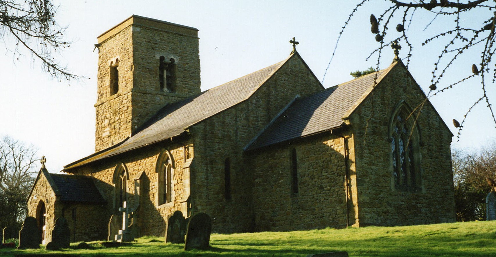
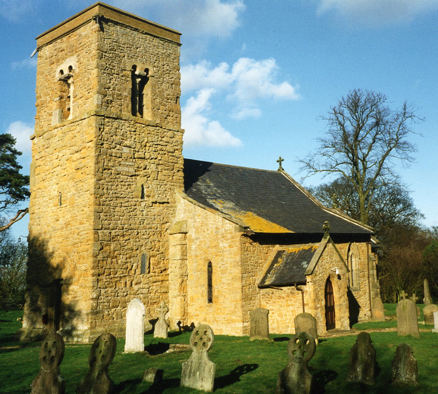
- The Anglican parish church is dedicated to Saint Mary Magdalen.
- Major parts of the church date from the Norman period.
- The church was repaired and enlarged in 1849.
- The Church is Grad I listed with English Heritage.
- The church seats 140.
- There is a photograph of St. Mary Magdalen Church on the Wendy PARKINSON Church Photos web site.
- Here are two photographs of St. Mary Magdalen Church, taken by Ron COLE (who retains the copyright):
- The Anglican parish register dates from 1562.
- The Lincolnshire FHS has published several marriage indexes and a burial index for the Westwold Deanery to make your search easier.
- Check our Church Records page for county-wide resources.
- The parish was in the Caistor sub-district of the Caistor Registration District.
- Check our Civil Registration page for sources and background on Civil Registration which began in July, 1837.
This small village and its parish sit about 2.5 miles south-east of Caistor and 9 miles north of Market Rasen. The parish covers just over 2,870 acres and is primarily good agricultural land.
If you are planning a visit:
- John FIRTH has a photograph of the Village Sign on Geo-graph, taken in July, 2010.
- J. THOMAS also has a photograph of the old Village Sign on Geo-graph, taken in April, 2014.
- See our touring page for visitor services.
The National Gazetteer of Great Britain and Ireland - 1868
"ROTHWELL, a parish in the wapentake of Bradley-Haverstoe, parts of Lindsey, county Lincoln, 2½ miles S.E. of Caistor, its post town, and 5 E. of Moortown. The village, which is of small extent, is situated on the Wolds, and is chiefly agricultural. The Laceby hounds meet in this parish. The tithes were commuted for land under an Enclosure Act in 1765. The living is a rectory* in the diocese of Lincoln, value £250. The church, dedicated to St. Mary Magdalene, has a tower containing three bells. The church was restored and enlarged in 1849. There is a free school for both sexes."
- Ask for a calculation of the distance from Rothwell to another place.
- Joseph NICKERSON (born April 1914 in Thoresway, LIN) was the founder of Nickerson Seeds, headquartered in the parish and after whom the village pub is named (The website author has not found a pub with that name). Nickerson was author of a A Shooting Man’s Creed, a field memoir with a foreword by Gerald Grosvenor, 6th Duke of Westminster published in 1989 by Quiller Publishing.
- Richard CROFT has a photograph of the Blacksmith's Arms on Geo-graph, taken in March, 2006.
- See our Maps page for additional resources.
You can see maps centred on OS grid reference TF151996 (Lat/Lon: 53.480546, -0.267039), Rothwell which are provided by:
- OpenStreetMap
- Google Maps
- StreetMap (Current Ordnance Survey maps)
- Bing (was Multimap)
- Old Maps Online
- National Library of Scotland (Old Ordnance Survey maps)
- Vision of Britain (Click "Historical units & statistics" for administrative areas.)
- English Jurisdictions in 1851 (Unfortunately the LDS have removed the facility to enable us to specify a starting location, you will need to search yourself on their map.)
- Magic (Geographic information) (Click + on map if it doesn't show)
- GeoHack (Links to on-line maps and location specific services.)
- All places within the same township/parish shown on an Openstreetmap map.
- Nearby townships/parishes shown on an Openstreetmap map.
- Nearby places shown on an Openstreetmap map.
There are six names on the Rothwell War Memorial. See the complete list on the Roll-of-Hnour website.
- This place ws an ancient parish in Lincoln county and became a modern Civil Parish when those were established.
- The parish was in the ancient Bradley Haverstoe Wapentake in the West Lindsey district in the parts of Lindsey.
- You may contact the Rothwell Parish Council regarding civic or political issues, but they are NOT staffed to do family history lookups for you.
- Kelly's 1900 Directory of Lincolnshire places the parish, perhaps erroneously, in the North Lindsey division of the county.
- Today's district governance is provided by the West Lindsey District Council.
- Bastardy cases would be heard in the Caistor petty session hearings on the fourth Wednesday of each month and nearly every Saturday.
- After the Poor Law Amendment Act reforms of 1834, the parish became part of the Caistor Poor Law Union.
- A school was built here in 1856 and enlarged in 1895 to hold 90 children.
- A School Board of 5 members was formed in the parish in December, 1874.
- For more on researching school records, see our Schools Research page.