
Hide
--- TEST SYSTEM --- TEST SYSTEM --- TEST SYSTEM ---
Hide
Reepham
hide
Hide
hide
Hide
hide


Hide
Hide
“REEPHAM, (or Repham), a parish in the wapentake of Lawress, parts of Lindsey, county Lincoln, 4 miles N.E. of Lincoln, its post town, and 3 N.W. of the Five-mile railway station. It is a station on the Lincoln and Hull line of railway. The village, which is of small extent, is wholly agricultural. The Burton hounds are kennelled in this parish. The impropriate tithes belong to the Mercers' Company of London. The living is a vicarage* in the diocese of Lincoln, value £176, in the patronage of the Mercers' Company. The church, dedicated to SS. Peter and Paul, is an ancient structure. The parochial charities produce about £1 10s. per annum. There is a school of recent erection, which is partially supported by the vicar.
”
from The National Gazetteer of Great Britain and Ireland - 1868
Hide
- The Reepham Cemetery is located on Hawthorn Road.
- J. THOMAS has a photograph of Reepham Cemetery on Geo-graph, taken in September, 2014.
| Hawthorn Road, Reepham, Cemetery |
- The parish was in the Home sub-district of the Lincoln Registration District.
- We have a text file which is a partial 1891 census extract for the parish.
- Check our Census Resource page for county-wide resources.
- The table below gives census piece numbers, where known:
| Census Year | Piece No. |
|---|---|
| 1841 | H.O. 107 / 642 |
| 1861 | R.G. 9 / 2357 |
| 1871 | R.G. 10 / 3369 |
| 1891 | R.G. 12 / 2589 |
| Hawthorn Road, Reepham, Cemetery |
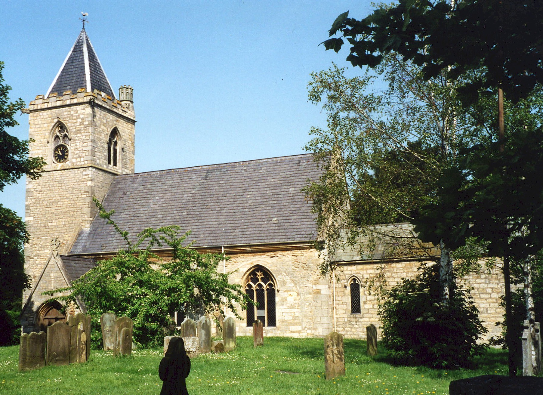
- The Anglican parish church is dedicated to Saints Peter and Paul.
- The church was restored in 1862.
- The church seats 230 people.
- Here is a photo of Saints Peter and Paul Church, taken by (and copyright of) Wendy PARKINSON.

- Here is a photo of St. Peter and St. Paul Church, taken by Ron COLE (who retains the copyright):
- The Anglican parish register dates from 1653.
- The Lincolnshire FHS has a Loan Library service which has the parish registers on microfiche for Baptisms from 1653 to 1814 and Marriages from 1755 to 1812.
- The LFHS has published several marriage and burial indexes for the Lawres Deanery to make your search easier.
- There was a Wesleyan Methodist chapel built here prior to 1900. For information and assistance in researching this chapel, see our non-conformist religions page.
- Check our Church Records page for county-wide resources.
- The parish was in the Home sub-district of the Lincoln Registration District.
- Check our Civil Registration page for sources and background on Civil Registration which began in July, 1837.
This village and parish is 4.5 miles eastnortheast of Lincoln parish and city and north of Fiskerton and Cherry Willingham parishes. The parish covers about 1,800 acres.
The village of Reepham is about a mile south of the Roman Road which is now the A158 trunk road. The old railway still runs through the village. If you are planning a visit:
- Check for bus service from the Linconshire Road Car Company of Lincoln.
- See our touring page for visitor services.
The National Gazetteer of Great Britain and Ireland - 1868
- Ask for a calculation of the distance from Reepham to another place.
- See our Maps page for additional resources.
You can see maps centred on OS grid reference TF036735 (Lat/Lon: 53.248416, -0.448799), Reepham which are provided by:
- OpenStreetMap
- Google Maps
- StreetMap (Current Ordnance Survey maps)
- Bing (was Multimap)
- Old Maps Online
- National Library of Scotland (Old Ordnance Survey maps)
- Vision of Britain (Click "Historical units & statistics" for administrative areas.)
- English Jurisdictions in 1851 (Unfortunately the LDS have removed the facility to enable us to specify a starting location, you will need to search yourself on their map.)
- Magic (Geographic information) (Click + on map if it doesn't show)
- GeoHack (Links to on-line maps and location specific services.)
- All places within the same township/parish shown on an Openstreetmap map.
- Nearby townships/parishes shown on an Openstreetmap map.
- Nearby places shown on an Openstreetmap map.
- This place was an ancient Chapelry in Lincoln county and became a modern Civil Parish around 1830.
- The parish was in the ancient Lawress Wapentake in the West Lindsey (or Gainsborough) district and parts of Lindsey.
- In April, 1935, the parish was enlarged by 5 acres by gaining part of Nettleham parish.
- Today's district governance is provided by the West Lindsey District Council.
- Bastardy cases would be heard in the Lincoln South petty session hearings.
- In 1880, Ann CROSBY left the interest from £100 for the poor of the parish. The interest was distributed each December 15th.
- As a result of the 1834 Poor Law Amendment Act, the parish became part of the Lincoln Poor Law Union.
- Unfortunately, no poorlaw records for Reepham have been archived.
Year Inhabitants 1801 183 1811 196 1831 295 1841 341 1871 377 1891 396 1901 387 1911 370 1921 332 1931 394 1971 990
- There was a National School built before 1900, which could hold up to 80 children. Average attendance in 1900 was 55.
- For more on researching school records, see our Schools Research page.