
Hide
--- TEST SYSTEM --- TEST SYSTEM --- TEST SYSTEM ---
Hide
Newton by Toft
hide
Hide
hide
Hide
hide


Hide
Hide
Newton by Toft, par., Lincolnshire, 4 miles SW. of Market Rasen, 1,004 ac., pop. 75.
From: John BARTHOLOMEW's "Gazetteer of the British Isles (1887)"
Hide
The Caistor Library is an excellent resource with a Local History section and a Family History section.
Alternatively, you can use the nearby Market Rasen Library as a resource, as well.
- The parish was in the Market Rasen sub-district of the Caistor Registration District.
- Check our Census Resource page for county-wide resources.
- The table below gives census piece numbers, where known:
| Census Year | Piece No. |
|---|---|
| 1841 | H.O. 107 / 641 |
| 1851 | H.O. 107 / 2115 |
| 1871 | R.G. 10 / 3426 |
| 1891 | R.G. 12 / 2624 |
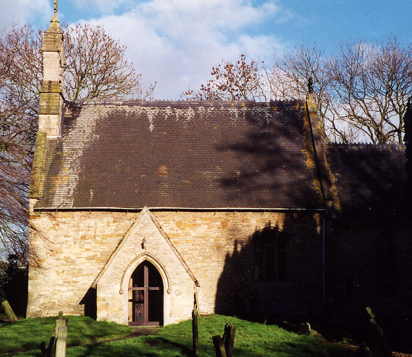
- The Anglican parish church is dedicated to Saint Michael and was built in the Norman period.
- The church was rebuilt in 1860.
- The church seats only about 80.
- A photograph of Saint Michael's Church is at the Wendy PARKINSON English Church Photographs site.
- Richard CROFT has a photograph of St. Michael's Church on Geo-graph, taken in June, 2006.
- Here is a photograph of St. Michael's Church, taken by Ron COLE (who retains the copyright):
- The Anglican parish register dates from 1592.
- The Lincolnshire FHS has published several marriage indexes and a burial index for the Westwold Deanery to make your search easier.
- The Wesleyan Methodists built a chapel here before 1900.
- For information and assistance in researching these chapels, see our non-conformist religions page.
- Check our Church Records page for county-wide resources.
- The parish was in the Market Rasen sub-district of the Caistor Registration District.
- Check our Civil Registration page for sources and background on Civil Registration which began in July, 1837.
Newton-by-Toft is a village and a parish, 4 miles west of Market Rasen and about 11 miles northeast of the City of Lincoln. The parish covers 1,009 acres. Faldingworth parish lies to the south.
If you are planning a visit:
- The Toft Newton Reservoir lies due west of the village. Richard CROFT has a photograph of the Toft Newton Reservoir on Geo-graph, taken in June, 2006.
- j. HANNAM-BRIGGS has a photograph of the Village Sign on Geo-graph, taken in June, 2013 by Julain GUFFOGG.
You could offer your artistic talent and marketting skills to give them a more attractive sign.
- See our touring page for visitor services.
The National Gazetteer of Great Britain and Ireland - 1868
"NEWTON-BY-TOFT, a parish in the N. division of the wapentake of Walshcroft, parts of Lindsey, county Lincoln, 4 miles S.W. of Market-Rasen, its railway station and post town. The parish, which is inconsiderable, is wholly agricultural. The tithes have been commuted for a rent-charge of £172 12s., and the glebe comprises 21 acres. The living is a rectory in the diocese of Lincoln, value £60. The church, dedicated to St. Michael, is a stone structure, and was rebuilt in 1860. The charities produce about £15 per annum, being the endowment of Holdsworth's school. The Wesleyans have a place of worship. Percival Spearman Wilkinson, Esq., is lord of the manor."
- Ask for a calculation of the distance from Newton by Toft to another place.
- See our Maps page for additional resources.
You can see maps centred on OS grid reference TF050874 (Lat/Lon: 53.373037, -0.42323), Newton by Toft which are provided by:
- OpenStreetMap
- Google Maps
- StreetMap (Current Ordnance Survey maps)
- Bing (was Multimap)
- Old Maps Online
- National Library of Scotland (Old Ordnance Survey maps)
- Vision of Britain (Click "Historical units & statistics" for administrative areas.)
- English Jurisdictions in 1851 (Unfortunately the LDS have removed the facility to enable us to specify a starting location, you will need to search yourself on their map.)
- Magic (Geographic information) (Click + on map if it doesn't show)
- GeoHack (Links to on-line maps and location specific services.)
- All places within the same township/parish shown on an Openstreetmap map.
- Nearby townships/parishes shown on an Openstreetmap map.
- Nearby places shown on an Openstreetmap map.
- The name Newton is a very common name, coming from the Old English niwe+tun, or "new estate or village".
A. D. Mills, "A Dictionary of English Place-Names," Oxford University Press, 1991.
- This place was an ancient parish in Lincoln county and it became a modern Civil Parish when those were established.
- The parish was in the ancient Walshcroft Wapentake in the West Lindsey district in the parts of Lindsey in the 19th century.
- Kelly's 1913 Directory of Lincolnshire places the parish, perhaps erroneously, in the East Lindsey district of the county.
- Today's district governance is provided by the West Lindsey District Council.
- Bastardy cases would be heard on the 1st Tuesday each month at the Market Rasen petty session hearings.
- As a result of the 1834 Poor Law Amendment Act, this parish became part of the Caistor Poor Law Union.
- A Public Elementary School was built here in 1874 to hold up to 50 children. Average attendance in 1899 was 12.
- Ian S. has a photograph of the Old School House on Geo-graph, taken in February, 2014.
- For more on researching school records, see our Schools Research page.