
Hide
--- TEST SYSTEM --- TEST SYSTEM --- TEST SYSTEM ---
Hide
Mavis Enderby
hide
Hide
hide
Hide
hide


Hide
Hide
“MAVIS ENDERBY, a parish in the soke of Bolingbroke, parts of Lindsey, county Lincoln, 2 miles N.W. of Spilsby, its post town, and 7 N.W. of the railway station at Firsby, on the Boston and Great Grimsby branch of the Great Northern line. It is situated under the Wolds. The living is a rectory in the diocese of Lincoln, value £400. The church is an ancient structure, dedicated to St. Michael, and contains some monumental tablets of the Best family. A house here was formerly a monastic establishment belonging to Revesby Abbey. The register commences in 1561. The parochial charities produce about £6 per annum. Thomas Coltman, Esq., is lord of the manor. The tithes were commuted for land and a corn-rent under an Enclosure Act in 38 George III. at which time 9 acres were allotted to the poor.
”
from The National Gazetteer of Great Britain and Ireland - 1868
Hide
- The parish was in the Spilsby sub-district of the Spilsby Registration District.
- The North Lincolnshire Library holds the census returns for 1841 and 1881.
- Check our Census Resource page for county-wide resources.
- The table below gives census piece numbers, where known:
| Census Year | Piece No. |
|---|---|
| 1841 | H.O. 107 / 640 |
| 1851 | H.O. 107 / 2109 |
| 1861 | R.G. 9 / 2374 & 2375 |
| 1871 | R.G. 10 / 3392A & 3393A |
| 1891 | R.G. 12 / 2603 |
| Mavis Enderby, Methodist (Wesleyan) |
- The parish used to have an old religious house which was attached to the Abbey at Revesby.
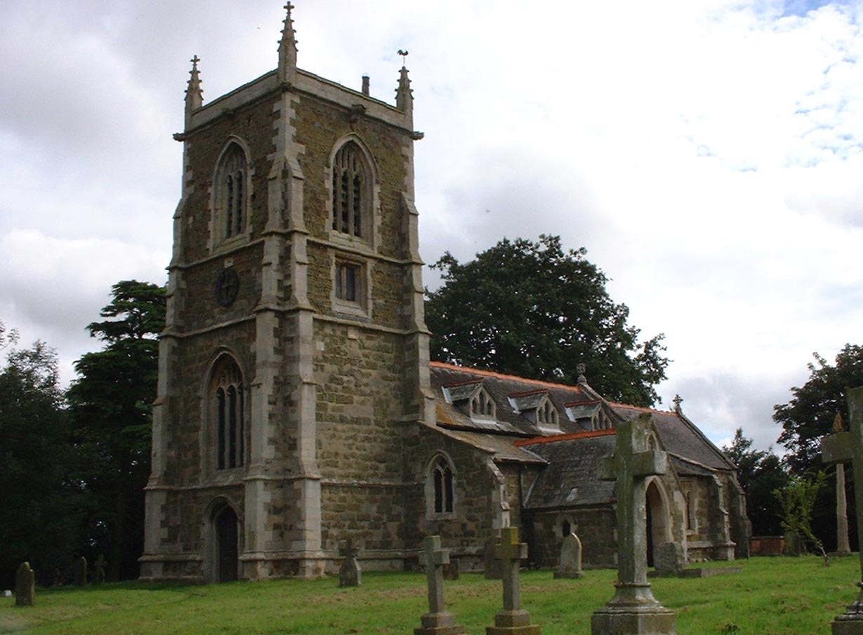
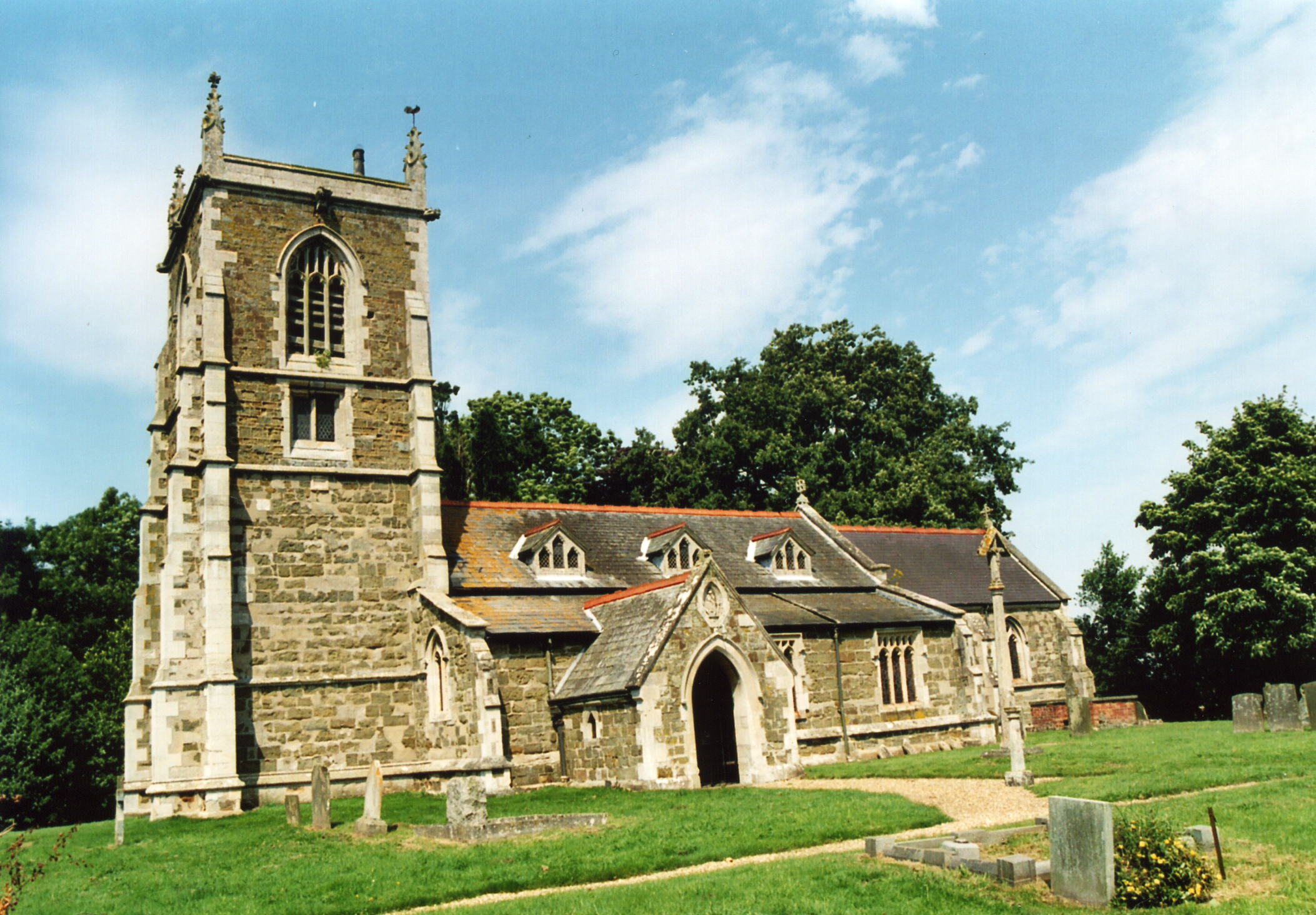
- The Anglican parish church is dedicated to Saint Michael.
- The church is built of green sandstone and has a tower with three bells.
- The church chancel was rebuilt in 1871 and the rest restored in 1878.
- The church seats 150.
- Here is a photo of the church, taken by (and copyright of) Norma CLARE.
- Here is a photo of St. Michael's Church, taken by Ron COLE (who retains the copyright):
- The Anglican parish register dates from 1579.
- The Lincolnshire FHS has published several marriage indexes and a burial index for the Bolingbroke Deanery to make your search easier.
- The Wesleyan Methodists built a chapel here in 1876. For information and assistance in researching this chapel, see our non-conformist religions page.
- Check our Church Records page for county-wide resources.
- The parish was in the Spilsby sub-district of the Spilsby Registration District.
- Check our Civil Registration page for sources and background on Civil Registration which started in July, 1837.
Mavis Enderby is both a village and a parish in the Wold Hills, about 3 miles west of Spilsby and 7 miles east of Horncastle. Raithby parish lies to the east and Old Bolingbroke parish to the southwest. The parish covers just over 1,150 acres today.
Mavis Enderby is a small village. If you are planning a visit:
- By automobile, take the B1195 arterial road west out of Spilsby.
- Visit the village information site for additional information.
- See our touring page for more sources.
The National Gazetteer of Great Britain and Ireland - 1868
- Ask for a calculation of the distance from Mavis Enderby to another place.
- Mavis Enderby was held by William Malebrisse in 1202.
- The parish used to celebrate an Enderby Feast on or about Michaelmas Day.
- David HITCHBORNE has a photograph of the Sundial on Geo-graph, taken in 2008. At least you can tell the time on sunny days. The church clock, at last report, was in need of repairs as was the weather vane.
- See our "Maps" page for additional resources.
You can see maps centred on OS grid reference TF362665 (Lat/Lon: 53.178418, 0.03665), Mavis Enderby which are provided by:
- OpenStreetMap
- Google Maps
- StreetMap (Current Ordnance Survey maps)
- Bing (was Multimap)
- Old Maps Online
- National Library of Scotland (Old Ordnance Survey maps)
- Vision of Britain (Click "Historical units & statistics" for administrative areas.)
- English Jurisdictions in 1851 (Unfortunately the LDS have removed the facility to enable us to specify a starting location, you will need to search yourself on their map.)
- Magic (Geographic information) (Click + on map if it doesn't show)
- GeoHack (Links to on-line maps and location specific services.)
- All places within the same township/parish shown on an Openstreetmap map.
- Nearby townships/parishes shown on an Openstreetmap map.
- Nearby places shown on an Openstreetmap map.
- The name is rendered as "Endrebi" in the 1068 Domesday Book and again as "Endrebi" in 1115.
- The village is given as "Enderby Malbys" in 1302. Malbys was later shortened to Mavis.
- The parish was in the East division of the ancient Bolingbroke Wapentake in the East Lindsey division of the county, in the parts of Lindsey.
- The parish has also been listed as being in the Soke of Bolingbroke.
- For today's district governance, see the East Lindsey District Council.
- The Common Lands were enclosed here in 1798. A little over 4 acres were reserved for the poor.
- As a result of the 1834 Poor Law Amendment Act, the parish became part of the Spilsby Poor Law Union.
- Bastardy cases would be heard in the Spilsby petty session hearings every other Monday.
- We have a parial list of Settlement examinations that might mention a relative of yours
- Read about Martha LOWE and some of her children by William CLARKE, as provided by a relative, Denny LOWE, who resides in Langley, BC, Canada.
Year Inhabitants 1801 125 1831 203 1841 311 1851 207 1871 176 1881 140 1891 140 1901 121 1911 101 1931 105 1971 58
- In 1881, there was only an infant school here. Older students attended school in Raithby.
- For more on researching school records, see our Schools Research page.