
Hide
--- TEST SYSTEM --- TEST SYSTEM --- TEST SYSTEM ---
Hide
Kirkby cum Osgodby
hide
Hide
hide
Hide
hide


Hide
Hide
Kirkby cum Osgodby, par., Lincolnshire, 3½ miles NW. of Market Rasen, 1,710 ac., pop. 374.
From: John BARTHOLOMEW's "Gazetteer of the British Isles (1887)"
Hide
The Caistor Library is an excellent resource with a Local History section and a Family History section.
Alternatively, you can use the Market Rasen Community Library as a resource, also.
- Here is photo of St. Andrew's Church, showing the church graveyard, taken by Ron COLE (who retains the copyright):
ian S. has a photograph of overgrown St Andrew's Graveyard on Geo-graph, taken in January, 2018.
Ian S> also has a photograph of the cemetery at Kirk HIll, just east of the village on geo-graph, taken in January, 2018.
- The parish was in the Market Rasen sub-district of the Caistor Registration District.
- Check our Census Resource page for county-wide resources.
- The table below gives census piece numbers, where known:
| Census Year | Piece No. |
|---|---|
| 1841 | H.O. 107 / 638 |
| 1851 | H.O. 107 / 2115 |
| 1861 | R.G. 9 / 2395 |
| 1871 | R.G. 10 / 3425 |
| 1891 | R.G. 12 / 2624 |
| St Andrew, Kirkby cum Osgodby, Church of England |
| St Denys, Kirkby cum Osgodby, Church of England |
| St Joseph, Kirkby cum Osgodby, Roman Catholic |
- The Anglican parish church at Osgodby was dedicated to Saint Denis (Spelling variations of "Denis" abound).
- That church fell into decay some centuries ago.
- The Anglican parish church at Kirkby was dedicated to Saint Andrew.
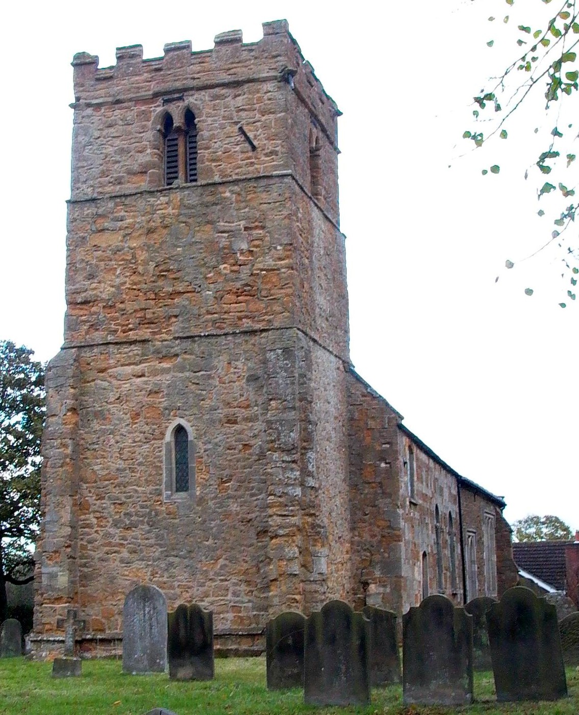
- St. Andrew's church appears to be of Norman origin, built prior to 1398.
- St. Andrew's was completely restored in 1900 and modernized in 1923.
- St. Andrew's seats 205.
- A photograph of St. Andrew's Church is at the Wendy PARKINSON English Church Photographs site.
- Richard CROFT has a photograph of St. Andrew's Church on Geo-graph, taken in February, 2006.
- Here is a photo of St. Andrew's Church, taken by Ron COLE (who retains the copyright):
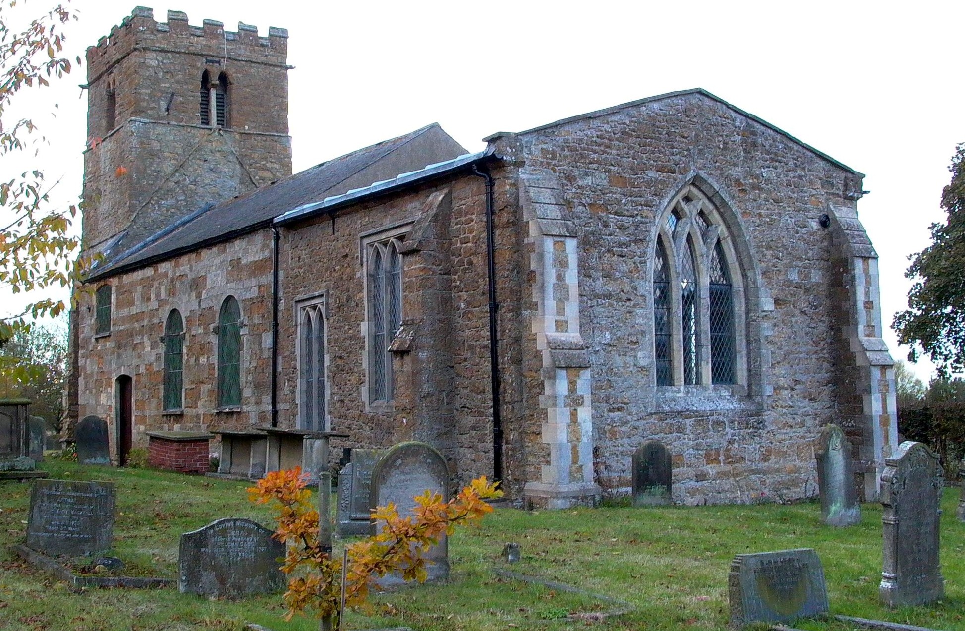
- Here is second photo of St. Andrew's Church, taken by Ron COLE (who retains the copyright):
- The Anglican parish register of St. Andrew's dates from 1555.
- There is a carving of Margaret WILDBORE in St. Andrew's church as seen on Julian P. GUFFOGG"S photograph on Geo-graph, taken in May, 2017.
- We have a handful of entries in our parish register extract. Your additions to this are welcome.
- The Lincolnshire FHS has published several marriage indexes and a burial index for the Westwold Deanery to make your search easier.
- There was a Catholic chapel erected in Osgodby in 1791 Ian S. has a photograph of Our Lady and St Joseph chapel on Geo-graph, taken in January, 2018.
- There was a Wesleyan Methodist chapel built in 1840 and a Wesleyan Reformers' chapel in 1854. The Primitive Methodists also had a chapel prior to 1871. For more on researching these chapel records, see our non-conformist religions page.
- Check our Church Records page for county-wide resources.
- The parish was in the Market Rasen sub-district of the Caistor Registration District.
- Check our Civil Registration page for sources and background on Civil Registration which began in July, 1837.
This village and parish are near Market Rasen and about 8 miles south-west of Caistor. The parish contains two neighborhing villages, Kirkby and Osgodby. The parish covers about 1,700 acres.
If you are planning a visit:
- Ian S. has a photograph of the Osgodby Village Sign on Geo-graph, taken in January, 2018.
- See our touring page for visitor services.
The National Gazetteer of Great Britain and Ireland - 1868
- Ask for a calculation of the distance from Kirkby cum Osgodby to another place.
- See our Maps page for additional resources.
You can see maps centred on OS grid reference TF064927 (Lat/Lon: 53.420378, -0.400411), Kirkby cum Osgodby which are provided by:
- OpenStreetMap
- Google Maps
- StreetMap (Current Ordnance Survey maps)
- Bing (was Multimap)
- Old Maps Online
- National Library of Scotland (Old Ordnance Survey maps)
- Vision of Britain (Click "Historical units & statistics" for administrative areas.)
- English Jurisdictions in 1851 (Unfortunately the LDS have removed the facility to enable us to specify a starting location, you will need to search yourself on their map.)
- Magic (Geographic information) (Click + on map if it doesn't show)
- GeoHack (Links to on-line maps and location specific services.)
- All places within the same township/parish shown on an Openstreetmap map.
- Nearby townships/parishes shown on an Openstreetmap map.
- Nearby places shown on an Openstreetmap map.
Pat COOK provides letters written by Joe SMITH starting from just before the Great War until his death in 1916. These are letters to his devoted mother, telling of his enlistment and life in the Royal Navy, his training, uniform, girl friends, sleeping in a hammock, and stories of life on the ship. Please enjoy Joe's letters home.
The War Memorial was dedicated on Good Friday in 1921.
The names recorded on the War Memorial are;
- Atkinson, A.
- Codd, E.
- Codd, J.
- Cox, S.
- Eaton, H.
- Rhodes, J.
- Sharp, F.
- Smith, J, W.
- West, H.
- Wilkinson, C. H.
There is additional data on these men and others at the Roll-of-Honour website.
- The name Osgodby was ancienty called Angotby.
- Some locals pronounce the name Osgodby as "Osgarby".
- This place was an ancient parish in Lincoln county and became a modern Civil Parish when those were established.
- The parish was in the ancient Walshcroft Wapentake in the West Lindsey district in the parts of Lindsey.
- Osgodby was anciently parished with Tealby, but was annexed to Kirkby in 1737 because the village church had fallen into decay.
- In April, 1936, the Civil Parish of Kirkby was abolished and a new parish called Osgodby Civil Parish was established.
- Today's district governance is provided by the West Lindsey District Council.
- Bastardy cases would be heard on the 1st Tuesday each month at the Market Rasen petty session hearings.
- The moor and Common Lands here were enclosed in 1804.
- As a result of the 1834 Poor Law Amendment Act, the parish became part of the Caistor Poor Law Union.
Population figures vary widely. Some are for just Kirkby, some for the combined parish area.
Year Inhabitants 1801 123 1811 168 1831 136 1841 124 1871 438 1881 374 1891 353 1911 337
- A National School was erected at Kirkby in 1822, but was closed by 1870.
- An Infant School was erected at Osgodby in 1868.
- See our Schools page for more information on researching school records.