
Hide
--- TEST SYSTEM --- TEST SYSTEM --- TEST SYSTEM ---
Hide
Hackthorne
hide
Hide
hide
Hide
hide


Hide
Hide
hide
Hide
“HACKTHORN, a parish in the E. division of the wapentake of Aslacoe, parts of Lindsey, county Lincoln, 7 miles N.E. of Lincoln, its post town, and 10 S.W. of Market Rasen. This place is very small, but of great antiquity, a church and village having existed here long before the Norman conquest. Stone is quarried, though of very inferior quality. The Roman road from Lincoln to Barton-upon-Humber passed about 2 miles from the village. The tithes were commuted for land under an Enclosure Act in 1778. The living is a vicarage* annexed to the rectory of Cold Hanworth, in the diocese of Lincoln, value £260. The church, dedicated to St. Michael, is an ancient structure, built about the time of the Conquest, on the site of a more ancient one. At the S. and W. entrances are fine Norman arches. Hackthorn Hall is the seat of Robert Amcotts, Esq., who is lord of the manor. Here are two schools supported by subscription."
”
from The National Gazetteer of Great Britain and Ireland - 1868
Hide
- The parish was in the North-East sub-district of the Lincoln Registration District.
- Check our Census Resource page for county-wide resources.
- The table below gives census piece numbers, where known:
| Census Year | Piece No. |
|---|---|
| 1841 | H.O. 107 / 636 |
| 1861 | R.G. 9 / 2364 |
| 1871 | R.G. 10 / 3376 |
| 1891 | R.G. 12 / 2596 |
| Hackthorne, Methodist (Wesleyan) |
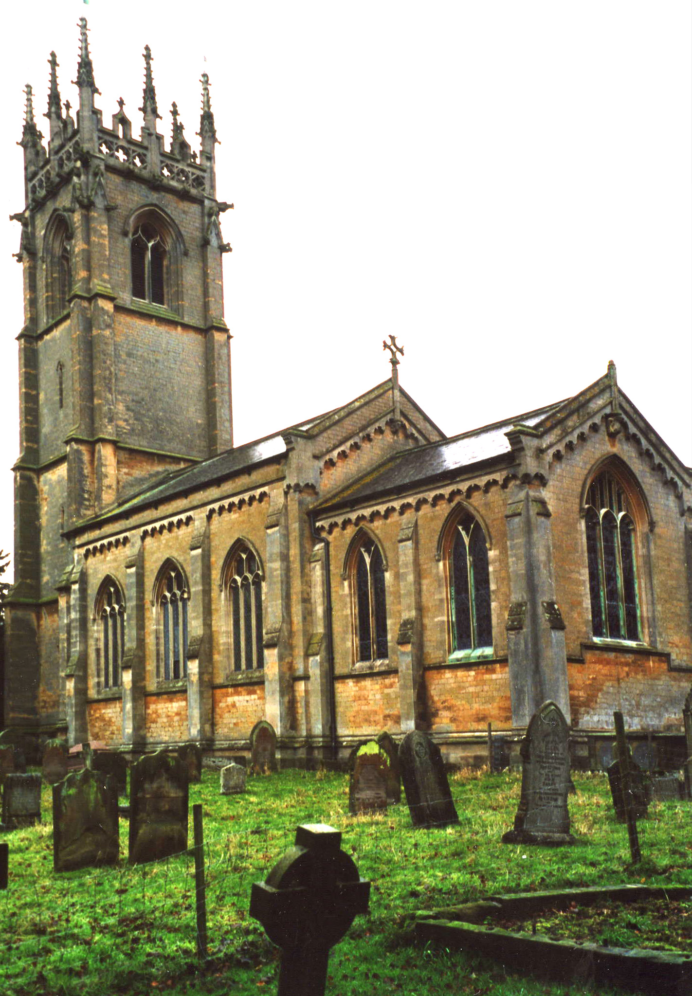
- The Anglican parish church is dedicated to Saint Michael and All Angels.
- The original church is gone, but its replacement was rebuilt from many of the same stones in 1849.
- The church seats 150.
- A photograph of Saint Michael's church is at the Wendy PARKINSON English Church Photographs site.
- David HITCHBORNE has a photograph of the church interior at Geo-graph, taken in 2004.
- Here is a photo of Saint Michael's Church, taken by (and copyright of) Ron COLE.
- The parish register dates from 1653.
- The Lincolnshire FHS has a Loan Library service which has the parish registers on microfiche for Baptisms from 1653 to 1812 and Marriages from 1653 to 1813.
- The LFHS has published several marriage indexes and a burial index for the Lawres Deanery to make your search easier.
- The Wesleyan Methodists built a chapel here before 1900. For information and assistance in researching this chapel, see our non-conformist religions page.
- Check our Church Records page for county-wide resources.
- The parish was in the North-East sub-district of the Lincoln Registration District.
- Check our Civil Registration page for sources and background on Civil Registration which began in July, 1837.
Hackthorne is both a village and a parish 7 miles north of the city of Lincoln. Welton parish lies to the south and Spridlington parish to the north. The parish covers about 2,600 acres.
Hackthorne village (also spelled Hackthorn) is the source of a small rivulet which runs east, eventually feeding the River Witham. If you are planning a visit:
- Take the A15 north out of Lincoln. The turnoff for Hackthorn(e) will be about 6 miles outside of Lincoln.
- See our touring page for more sources.
The National Gazetteer of Great Britain and Ireland - 1868
- Ask for a calculation of the distance from Hackthorne to another place.
- Hackthorne Hall was built around 1790 in a 100-acre park. It was the residence of the CRACROFT family.
- There is a photograph of Hackthorn Hall on Geo-graph, taken in 2008.
- See our Maps page for additional resources.
You can see maps centred on OS grid reference SK996825 (Lat/Lon: 53.329848, -0.505886), Hackthorne which are provided by:
- OpenStreetMap
- Google Maps
- StreetMap (Current Ordnance Survey maps)
- Bing (was Multimap)
- Old Maps Online
- National Library of Scotland (Old Ordnance Survey maps)
- Vision of Britain (Click "Historical units & statistics" for administrative areas.)
- English Jurisdictions in 1851 (Unfortunately the LDS have removed the facility to enable us to specify a starting location, you will need to search yourself on their map.)
- Magic (Geographic information) (Click + on map if it doesn't show)
- GeoHack (Links to on-line maps and location specific services.)
- All places within the same township/parish shown on an Openstreetmap map.
- Nearby townships/parishes shown on an Openstreetmap map.
- Nearby places shown on an Openstreetmap map.
- Richard CROFT has a photograph of the War Memorial on Geo-graph, taken in 2008.
David HITCHBORNE has a photograph of the brass plate Roll of Honour inside the church on Geo-graph, taken in May, 2004.
For the list of names on the War Memorial, see the Roll of Honour site.
- This place was an ancient parish in Lincoln county and became a modern Civil Parish when those were eastablished.
- The parish was in the eastern division of the ancient Aslacoe Wapentake in the West Lindsey district in the parts of Lindsey.
- Today's district governance is provided by the West Lindsey District Council.
- Bastardy cases would be heard in the Lincoln (Bail and Close) petty session hearings on the 1st and 3rd Friday of every month.
- As a result of the Poor Law Amendment Act reforms of 1834, the parish became part of the Lincoln Poor Law Union.
- A school was built here around 1870 and enlarged in 1887 for students of both this parish and nearby Cold Hanworth.
- For more on researching school records, see our Schools Research page.