
Hide
--- TEST SYSTEM --- TEST SYSTEM --- TEST SYSTEM ---
Hide
St.Michaels Parish Boundaries
hide
Hide
Hide
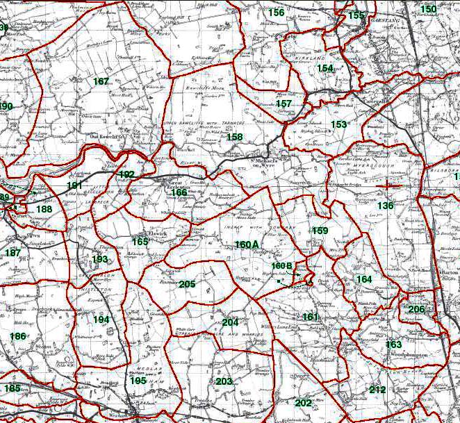
157 - Tarnacre, 158 - Upper Rawcliffe, 159 - Sowerby, 160A - Inskip, 160B - Carr House Green Common, 161 - Catforth, 212 - Bartle, 163 - Woodplumpton, 164 - Eaves, 165 - Elswick, 166 - Great Eccleston, 167 - Out Rawcliffe
This map is extracted from:
Kain, R.J.P., Oliver, R.R., Historic Parishes of England and Wales: an Electronic Map of Boundaries before 1850 with a Gazetteer and Metadata [computer file]. Colchester, Essex: History Data Service, UK Data Archive [distributor], 17 May 2001. SN: 4348.
Acknowledgement is made to R.J.P. Kain, R.R Oliver, the Economic and Social Research Council, the History Data Service and the UK Data Archive.