Hide
--- TEST SYSTEM --- TEST SYSTEM --- TEST SYSTEM ---
Hide
Prestwich
hide
Hide
Hide
hide
Hide
hide


Hide
Hide
PRESTWICH, a small town, a township, and a sub-district, in Manchester district, and a parish partly also in Oldham and Bury districts, Lancashire. The town stands 1¼ mile E N E of the river Irwell, 1½ E by N of Clifton-Junction r. station, and 4 N N W of Manchester; contains numerous good residences; and has a post-office under Manchester, two churches, two Wesleyan chapels, a Jewish cemetery, a national school, a British school, a workhouse, the Lancashire lunatic asylum, and charities £164. St. Bartholomew's church is later English; consists of nave, aisles, two terminal chapels, and a chancel, with a tower 85 feet high; and contains a fine reredos erected in 1865, and several handsome monuments. St. Margaret's church was founded in 1848, by the Duchess of Cambridge. One of the Wesleyan chapels was built in 1867 The national school was built in 1866, at a cost of about £2,800; and is in the early English style, with high-pitched roof and brick tower. The lunatic asylum stands in the centre of extensive grounds; is a range of structures in brick, with stone facings; underwent enlargement about 1862; and has accommodation for about 1,000 patients. The workhouse is one of three for Manchester district; and, at the census of 1861, had 66 in-mates. The township comprises 1,906 acres. Real property, £21,725. Pop. in 1851, 4,096; in 1861, 5,288. Houses, 973. The sub-district contains also Great Heaton and Little Heaton townships, and comprises 3,281 acres. Pop. in 1851, 5,046; in 1861, 6,285. Houses, 1,168. The parish contains also the townships of Pilkington, Oldham, Chadderton, Tonge, Alkrington, Royton, and Crompton; and is ecclesiastically cut into the sections of Prestwich, Hollinwood, Ringley, Prestolee, Oldham, St. Mary, O., St. Peter, O., St. James, Chadderton, St. John, C., St. Matthew, Coldhurst, East Crompton, Glodwick, Werneth, Waterhead, Royton, Shaw, Unsworth, and Tonge-with-Alkrington. Acres, 21,625. Pop. in 1851, 94,470; in 1861, 117,961. Houses, 23,039. The living of Prestwich is a rectory united with the chapelry of St. Margaret, and all the other livings are p.curacies, in the diocese of Manchester. Value of the rectory, £1,230.* Patron, the Earl of Wilton. The other livings are noticed in the articles on their own several localities.
John Marius Wilson, Imperial Gazetteer of England and Wales (1870-72)
Hide
Local studies information is held at Bury library.
Details about the census records, and indexes for Prestwich.
| Newtown St Congregational, Prestwich |
| Our Lady of Grace, Prestwich, Roman Catholic |
The Register Office covering the Prestwich area is Bury.
Old pictures of Prestwich.
The National Gazetteer of Great Britain and Ireland - 1868
"PRESTWICH, (or Prestwich cum Oldham) a parish and township in the hundred of Salford, county Lancaster, 4 miles N.W. of Manchester, its post town, and 5 S.E. of Bury. It is situated on the old turnpike road from Bury to Manchester, and contains the townships of Prestwich, Great-Heaton, Little-Heaton, Tonge-with-Alkrington, Oldham, Chadderton, Crompton, Royton, and Pilkington, most of which are described under their several heads. A large portion of the inhabitants are employed in the cotton mills. [See Oldham.] The county lunatic asylum is a range of brick buildings faced with stone. It includes a chapel, erected in 1851. Near the centre of the parish is a Jewish cemetery, formed in 1841. The living is a rectory with the curacy of St. Margaret's annexed, in the diocese of Manchester, value £1,230. The church, dedicated to St. Bartholomew, is an ancient structure of red sandstone, with a lofty square tower containing a clock and six bells. Adjoining it is the Wilton chapel, containing several monuments to the Earls of Wilton. The parochial charities produce about £40 per annum. On a site presented by the Earl of Wilton, stands St. Margaret's Chapel, the foundation-stone of which was laid by the Duchess of Cambridge, in 1848. There are numerous district churches, also National, British, and infant schools. Among the principal residences are Butt-Hill, Prestwich Lodge, Headlands, and Wood Hill. T. Drinkwater, Esq., is lord of the manor and principal landowner."
- Ask for a calculation of the distance from Prestwich to another place.
In 1835 the parish of Prestwich contained the townships of Prestwich, Pilkington, Unsworth, Little Heaton, Great Heaton,

View maps of Prestwich and places within its boundaries.
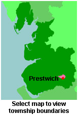
View a map of the boundaries of this town/parish.
You can see maps centred on OS grid reference SD817035 (Lat/Lon: 53.527793, -2.277801), Prestwich which are provided by:
- OpenStreetMap
- Google Maps
- StreetMap (Current Ordnance Survey maps)
- Bing (was Multimap)
- Old Maps Online
- National Library of Scotland (Old Ordnance Survey maps)
- Vision of Britain (Click "Historical units & statistics" for administrative areas.)
- English Jurisdictions in 1851 (Unfortunately the LDS have removed the facility to enable us to specify a starting location, you will need to search yourself on their map.)
- Magic (Geographic information) (Click + on map if it doesn't show)
- GeoHack (Links to on-line maps and location specific services.)
- All places within the same township/parish shown on an Openstreetmap map.
- Nearby townships/parishes shown on an Openstreetmap map.
- Nearby places shown on an Openstreetmap map.
The Workhouse site has an interesting description of Prestwich workhouse.
For probate purposes prior to 1858, Prestwich was in the Archdeaconry of Chester, in the Diocese of Chester. The original Lancashire wills for the Archdeaconry of Chester are held at the Lancashire Record Office.
You can also see Family History Societies covering the nearby area, plotted on a map. This facility is being developed, and is awaiting societies to enter information about the places they cover.
