
Hide
--- TEST SYSTEM --- TEST SYSTEM --- TEST SYSTEM ---
Hide
Preston Parish Boundaries
hide
Hide
Hide
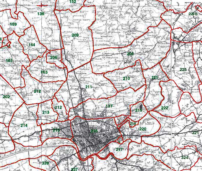
209 - Barton, 210 - Haighton, 211 - Broughton, 212 - Ingol 213 - Cottam, 214 - Lea, 215 - Ashton, 216 - Preston, 217 - Fishwick, 218 - Ribbleton Moor, 219 - Ribbleton, 220 - Brockholes, 221 - Grimsargh, 222 - Elston
Preston Township Boundaries
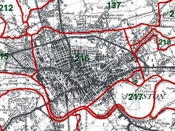
216 - Preston
This map is extracted from:
Kain, R.J.P., Oliver, R.R., Historic Parishes of England and Wales: an Electronic Map of Boundaries before 1850 with a Gazetteer and Metadata [computer file]. Colchester, Essex: History Data Service, UK Data Archive [distributor], 17 May 2001. SN: 4348.
Acknowledgement is made to R.J.P. Kain, R.R Oliver, the Economic and Social Research Council, the History Data Service and the UK Data Archive.