
Hide
--- TEST SYSTEM --- TEST SYSTEM --- TEST SYSTEM ---
Hide
Overton
hide
Hide
Hide
hide
Hide
hide
Hide
Hide
OVERTON, a village, a township, and a chapelry, in Lancaster parish, Lancashire. The village stands on the river Lune, within the peninsula between it and the sea, 2½ miles N N E of the river's month, and 3½ S W of Lancaster r. station; and occupies the site of a Roman settlement. The township contains also the hamlets of Sunderland and Saltmarshes, and bears the name of Overton and Sunderland. Acres, 6,314. Real property, £2,042. Pop. in 1851, 334; in 1861, 305. Houses, 67. The property is divided chiefly between two. The chapelry is conterminate with the township. The living is a p.curacy in the diocese of Manchester. Value, £155. Patron, the Vicar of Lancaster. The church is ancient and has an open turret.
John Marius Wilson, Imperial Gazetteer of England and Wales (1870-72)
Hide
| St Helen Church of England, Overton |
Details about the census records, and indexes for Overton.
| St Helen Church of England, Overton |
| St Bernard Roman Catholic, Overton |
The Register Office covering the Overton area is Lancaster.
The National Gazetteer of Great Britain and Ireland - 1868
"OVERTON, a township in the parish of Lancaster, hundred of Lonsdale South of the Sands, county Lancaster, 5 miles S.W. of Lancaster, its post town. It is situated on Morecambe Bay at the river Lune's mouth. The township comprises the hamlets of Overton, Middleton, and Heaton-with-Oxcliffe. The living is a perpetual curacy in the diocese of Manchester, value £155, in the patronage of the Vicar of Lancaster. The church is an ancient structure with an open turret containing one bell. Overton was formerly a Roman settlement. It is joined with Sunderland to form a township."
"SUNDERLAND, a chapelry in the parish of Lancaster, county Lancaster, 3 miles S.W. of Lancaster. It is situated near Sunderland Point, and has a harbour in the Lane with 12 feet of water, opposite the Glasson basin. It is joined with Overton."
- Ask for a calculation of the distance from Overton to another place.
In 1835 Overton was a township in the parish of Lancaster.
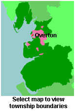
View maps of Overton and places within its boundaries.
View a map of the boundaries of this town/parish.
You can see maps centred on OS grid reference SD434571 (Lat/Lon: 54.006702, -2.864945), Overton which are provided by:
- OpenStreetMap
- Google Maps
- StreetMap (Current Ordnance Survey maps)
- Bing (was Multimap)
- Old Maps Online
- National Library of Scotland (Old Ordnance Survey maps)
- Vision of Britain (Click "Historical units & statistics" for administrative areas.)
- English Jurisdictions in 1851 (Unfortunately the LDS have removed the facility to enable us to specify a starting location, you will need to search yourself on their map.)
- Magic (Geographic information) (Click + on map if it doesn't show)
- GeoHack (Links to on-line maps and location specific services.)
- All places within the same township/parish shown on an Openstreetmap map.
- Nearby townships/parishes shown on an Openstreetmap map.
- Nearby places shown on an Openstreetmap map.
For probate purposes prior to 1858, Overton was in the Archdeaconry of Richmond, in the Diocese of Chester. The original Lancashire wills for the Archdeaconry of Richmond are held at the Lancashire Record Office.
You can also see Family History Societies covering the nearby area, plotted on a map. This facility is being developed, and is awaiting societies to enter information about the places they cover.