Hide
--- TEST SYSTEM --- TEST SYSTEM --- TEST SYSTEM ---
Hide
Haigh
hide
Hide
Hide
hide
Hide
hide
Hide
Hide
Haigh.-- township and vil., in par. and 2½ miles NE. of Wigan, SW. Lancashire, 2135 ac., pop. 1186; P.O., T.O.
John Bartholomew, Gazetteer of the British Isles (1887)
Hide
Local studies information is held at Wigan library.
| St David, Haigh, Church of England |
Details about the census records, and indexes for Haigh.
| St David, Haigh, Church of England |
| Our Lady of the Immaculate Conception, Haigh, Roman Catholic |
The Register Office covering the Haigh area is Wigan and Leigh.
"HAIGH is a township two miles north of Wigan, in that parish, and is one of the most interesting townships therein. Great quantities of cannel coal (mentioned above) is found here, and at Haigh-hall, the beautiful seat of the Earl of Balcarres & Baron Wigan, a summer house is made of it, said to have stood more than a hundred years, and in which ladies may seat themselves without danger to the purity of their most delicate vestures. Various toys are made from cannel, and when formed into boxes, plates, &c. it is susceptible of a polish as fine as black marble. This township contained, by the its census, 1,300 inhabitants."Royal National and Commercial Directory and Topography of the county of Lancashire - Pigot & Co. 1828
The National Gazetteer of Great Britain and Ireland - 1868
"HAIGH, a township and ecclesiastical district in the parish of Wigan, hundred of West Derby, county Lancaster, 2 miles N.E. of Wigan, its post town and railway station, and 17 N.W. of Manchester. It is situated near the river Douglas and the Leeds and Liverpool canal. The soil is clayey, and the land chiefly arable. The inhabitants are chiefly employed in the iron works and coal-mines, the latter producing the celebrated Cannel coal. There are also several cotton factories. This lace was for many generations the property of the ancient knightly family of the Bradshaighs of Haigh Hall. The living is a perpetual curacy in the diocese of Chester, value £150, in the patronage of the Rector of Wigan. The church is a plain stone edifice, dedicated to St. David, with a campanile turret containing a clock and one bell. The charities produce £194 per annum, of which £55 goes towards the support of Turner's school, and £137 for Lady Bradshaigh's almshouses. There is a chapel for Roman Catholics, and a National school for both sexes, also a Sunday-school. Haigh Hall, the magnificent seat of the Earl of Crawford, was built in the reign of Edward II. It stands in the midst of a well-wooded park, in which is situated a summerhouse built of Cannel coal, beautifully polished. The Earl of Crawford is lord of the manor."
- Ask for a calculation of the distance from Haigh to another place.
In 1835 Haigh was a township in the parish of Wigan.
Information about boundaries and administrative areas is available from A Vision of Britain through time.
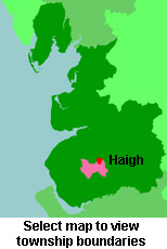
View a map of the boundaries of this town/parish.
You can see maps centred on OS grid reference SD597091 (Lat/Lon: 53.576498, -2.609816), Haigh which are provided by:
- OpenStreetMap
- Google Maps
- StreetMap (Current Ordnance Survey maps)
- Bing (was Multimap)
- Old Maps Online
- National Library of Scotland (Old Ordnance Survey maps)
- Vision of Britain (Click "Historical units & statistics" for administrative areas.)
- English Jurisdictions in 1851 (Unfortunately the LDS have removed the facility to enable us to specify a starting location, you will need to search yourself on their map.)
- Magic (Geographic information) (Click + on map if it doesn't show)
- GeoHack (Links to on-line maps and location specific services.)
- All places within the same township/parish shown on an Openstreetmap map.
- Nearby townships/parishes shown on an Openstreetmap map.
- Nearby places shown on an Openstreetmap map.
For probate purposes prior to 1858, Haigh was in the Archdeaconry of Chester, in the Diocese of Chester. The original Lancashire wills for the Archdeaconry of Chester are held at the Lancashire Record Office.
You can also see Family History Societies covering the nearby area, plotted on a map. This facility is being developed, and is awaiting societies to enter information about the places they cover.

