
Hide
--- TEST SYSTEM --- TEST SYSTEM --- TEST SYSTEM ---
Hide
Dalton-in-Furness
hide
Hide
Hide
hide
Hide
hide
Hide
Hide
DALTON-IN-FURNESS, a small town, a parish, and a sub-district in Ulverstone district, Lancashire. The town stands on the Furness railway, 1½ mile N of Furness abbey, and 5 SW of Ulverstone; is an ancient place, long the capital of Lower-Furness; consists of one street, spacious, antique, picturesque, and improved; and has a head post office, designated Dalton-in-Furness, Lancashire, a railway station, a chief inn, an ancient tower, a parish church, a Wesleyan chapel, and a free school. The tower crowns a rocky eminence on the west; and belonged to a castle, built in the time of Edward III., by the abbots of Furness, to guard the northern approach to the abbey. The church stands near the tower, and was rebuilt in 1825. Markets are held on Saturdays; and fairs on 6 June and 23 Oct. A hunt, called the "Dalton Rout" in the "Tatler, " was established here in 1703; but has gone into disuse. Romney, the painter, was a native. Pop., 2,812. Houses, 538. The parish includes also the townships of Hawcoat and Yarlside, the chapelries of Ireleth and Rampside, the hamlet of Biggar, and the islands of Peel, Barrow, Roa, and Walney. Acres, 16,364. Real property, £64,492; of which £4,025 are in mines, and £33,627 in railways. Pop., 9,152. Houses, 1,565. The property is much subdivided. Iron ore and limestone are plentiful: and mining and iron working are extensively carried on. Remains of a fortified-beacon occur on the eminence of High Haume. The living is a vicarage in the diocese of Carlisle. Value, £159.* Patron, the Duchy of Lancaster. The chapelries of Ireleth, Rampside, Barrow, and Walney are separate benefices. The sub-district contains three parishes. Acres, 25,158. Pop., 11,243.
John Marius Wilson, Imperial Gazetteer of England and Wales (1870-72)
Hide
Local studies information is held at Cumbria Record Office & Local Studies Library, Barrow.
The following books contain useful information about the history of Dalton in Furness and the surrounding area.
- J E Waltons A History of Dalton-in-Furness, published by Phillimore in 1984.
Details about the census records, and indexes for Dalton in Furness.
The Register Office covering the Dalton in Furness area is Barrow in Furness.
Dalton parish from Mannix & Co., History, Topography and Directory of Westmorland, 1851.
The National Gazetteer of Great Britain and Ireland - 1868
"IRELETH, a hamlet and chapelry in the parish of Dalton in Furness, hundred of Lonsdale North of the Sands, county Lancaster, 2 miles from Dalton, and 6 W. of Ulverston. The chapelry contains the villages of Lindale and Martin. It is situated on the river Dudden, and has a station at Lindale, on the Furness line of railway. The inhabitants are chiefly employed in the iron mines, of which there are a great number in the neighbourhood. The living is a perpetual curacy in the diocese of Carlisle, value £100, in the patronage of the Vicar of Dalton. The church is situated on rising ground overlooking the river Dudden. There are two parochial schools, one at Ireleth, and the other at Lindale."
"YARLESIDE, a division in the parish of Dalton-in-Furness, hundred of Lonsdale North of the Sands, county Lancaster, 3 miles S.W. of Dalton. It comprises several small villages and hamlets on the coast opposite Walney Island."
"KIRKBY-IRELETH, (or Irleth), a chapelry in the parish of Dalton-in-Furness, hundred of North Lonsdale, county Lancaster, 18 miles N.W. of Lancaster. It is situated near Morecombe Bay and the Furness line of railway. Iron ore and limestone are found. The living is a perpetual curacy in the diocese of Carlisle, value £100, in the patronage of the vicar."
"HAWCOAT, a hamlet in the parish of Dalton in Furness, hundred of Lonsdale North of the Sands, county Lancaster, 3 miles S.W. of Dalton, and 1½ mile N.W. of Furness Abbey railway station. In conjunction with the village of New Barns it forms a township. The soil is clayey loam, on a clay subsoil. There are some stone quarries. The village, which is small, is situated on an eminence commanding an extensive view, including the coast of Wales, the Isle of Man, the Fylde, and the town of Fleetwood. There is a National school at New Barns. The Duke of Buccleuch is lord of the manor."
John Marius Wilson, Imperial Gazetteer of England and Wales - 1870-2
- Ask for a calculation of the distance from Dalton-in-Furness to another place.
A description of the history of Dalton up to the end of the 19th century.
View maps of Dalton-in-Furness and places within its boundaries.
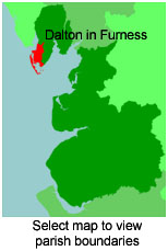
View a map of the boundaries of this town/parish.
You can see maps centred on OS grid reference SD216762 (Lat/Lon: 54.17573, -3.202139), Dalton-in-Furness which are provided by:
- OpenStreetMap
- Google Maps
- StreetMap (Current Ordnance Survey maps)
- Bing (was Multimap)
- Old Maps Online
- National Library of Scotland (Old Ordnance Survey maps)
- Vision of Britain (Click "Historical units & statistics" for administrative areas.)
- English Jurisdictions in 1851 (Unfortunately the LDS have removed the facility to enable us to specify a starting location, you will need to search yourself on their map.)
- Magic (Geographic information) (Click + on map if it doesn't show)
- GeoHack (Links to on-line maps and location specific services.)
- All places within the same township/parish shown on an Openstreetmap map.
- Nearby townships/parishes shown on an Openstreetmap map.
- Nearby places shown on an Openstreetmap map.
For probate purposes prior to 1858, Dalton in Furness was in the Archdeaconry of Richmond, in the Diocese of Chester. The original Lancashire wills for the Archdeaconry of Richmond are held at the Lancashire Record Office.
You can also see Family History Societies covering the nearby area, plotted on a map. This facility is being developed, and is awaiting societies to enter information about the places they cover.