
Hide
--- TEST SYSTEM --- TEST SYSTEM --- TEST SYSTEM ---
Hide
Layton with Warbreck
hide
Hide
Hide
Layton with Warbreck has now been swallowed up by Blackpool, which grew into a large town by the end of the 19th century.
Hide
hide
Hide
hide
Hide
Hide
LAYTON-WITH-WARBRECK, a township in Bispham parish, Lancashire; on the coast and on the Blackpool railway, 2½ miles SW of Poulton-le-Fylde. It contains the town of Blackpool. Acres, 3,241; of which 840 are water. Real property, £17,246; of which £150 are in gas works. Pop. in 1851, 2,564; in 1861, 3,907. Houses, 761. The manor belongs to J. T. Clifton, Esq. Knowle is the seat of Lord Edward F. Howard.
John Marius Wilson, Imperial Gazetteer of England and Wales (1870-72)
Hide
Local studies information is held at Blackpool library.
| Talbot Rd Cemetery, Layton |
Details about the census records, and indexes for Layton with Warbreck.
| St Mark, Layton, Church of England |
| Talbot Rd Cemetery, Layton |
| Salem, Layton, Primitive Methodist |
The Register Office covering the Layton with Warbreck area is Blackpool & Fylde.
The National Gazetteer of Great Britain and Ireland - 1868
"LAYTON-WITH-WARBRICK, a township in the parish of Bispham, county Lancaster, 2 miles S.W. of Poulton-le-Fylde. It is situated near the coast, and contains the village of Blackpool, which is much resorted to in the season as a bathing-place. Two schools are supported by subscription."
"LEYTON, a township in the parish of Bispham, hundred of Amounderness, county Lancaster, 2 miles S.W. of Poulton-le-Fylde. It is situated near the coast, and contains the village of Blackpool, which is resorted to in the summer as a bathing place."
"WARBRICK, a township in the parish of Bispham, hundred of Amounderness, county Lancaster, 2½ miles S.W. of Poulton-le-Fylde. It is situated on the coast, and includes the village of Blackpool. It is joined with Layton."
- Ask for a calculation of the distance from Layton with Warbreck to another place.
View maps of Layton and places within its boundaries.
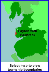
View a map of the boundaries of this town/parish.
You can see maps centred on OS grid reference SD318356 (Lat/Lon: 53.81206, -3.03713), Layton with Warbreck which are provided by:
- OpenStreetMap
- Google Maps
- StreetMap (Current Ordnance Survey maps)
- Bing (was Multimap)
- Old Maps Online
- National Library of Scotland (Old Ordnance Survey maps)
- Vision of Britain (Click "Historical units & statistics" for administrative areas.)
- English Jurisdictions in 1851 (Unfortunately the LDS have removed the facility to enable us to specify a starting location, you will need to search yourself on their map.)
- Magic (Geographic information) (Click + on map if it doesn't show)
- GeoHack (Links to on-line maps and location specific services.)
- All places within the same township/parish shown on an Openstreetmap map.
- Nearby townships/parishes shown on an Openstreetmap map.
- Nearby places shown on an Openstreetmap map.
For probate purposes prior to 1858, Layton with Warbreck was in the Archdeaconry of Richmond, in the Diocese of Chester. The original Lancashire wills for the Archdeaconry of Richmond are held at the Lancashire Record Office.
You can also see Family History Societies covering the nearby area, plotted on a map. This facility is being developed, and is awaiting societies to enter information about the places they cover.