
Hide
--- TEST SYSTEM --- TEST SYSTEM --- TEST SYSTEM ---
Hide
Hittisleigh
hide
Hide
hide
- Almanacs◬
- Archives & Libraries◬
- Bibliography◬
- Biography
- Business & Commerce Records◬
- Cemeteries◬
- Census
- Chronology◬
- Church History
- Church Records
- Churches
- Civil Registration◬
- Correctional Institutions◬
- Court Records◬
- Description & Travel
- Directories
- Emigration & Immigration◬
- Encyclopaedias & Dictionaries◬
- Folklore◬
- Gazetteers
- Genealogy◬
- Handwriting◬
- Heraldry◬
- Historical Geography◬
Hide
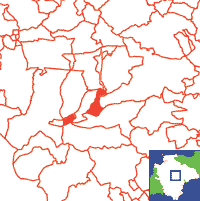
Click on map to view parish boundaries in detail.
Hide
Hide
hide
- History
- Jewish History◬
- Land & Property◬
- Language & Languages◬
- Manors◬
- Maps
- Medical Records◬
- Merchant Marine◬
- Military History◬
- Names, Geographical◬
- Names, Personal
- Newspapers◬
- Occupations◬
- Periodicals◬
- Politics & Government◬
- Poor Houses, Poor Law◬
- Population◬
- Probate Records◬
- Schools◬
- Social Life & Customs◬
- Societies◬
- Taxation◬
- Voting Registers◬
Hide
"HITTISLEIGH is a hilly parish of scattered houses, about 8 miles W.S.W. of Crediton, and 13 miles W. by N. of Exeter. It contains 109 souls, and 1155A. 3R. 11P. of land. C. Calmady, Esq., is lord of the manor, which was anciently held by the Talbots, Londons, and Shilstons, but the soil is all freehold, and belongs to the Hole, Pedlar, Haydon, Gorwyn, Webber, and other families. The Church (St. Andrew,) has a tower and three bells, and was newly seated in 1839-'40, at the cost of £12O. The rectory, valued in K.B. at £6. 2s. 1d., and in 1831 at £94, is in the gift of C. Calmady, Esq., and incumbency of the Rev. Richard Holland, M.A., of Spreyton. The glebe is 30A., and the parsonage house is a small building, erected about 12 years ago, on the site of the old one, which was destroyed by fire." [From White's Devonshire Directory (1850)]
Hittisleigh is in Wonford Hundred, and the Archdeaconry and Diocese of Exeter.
Hide
Spear, Brian. Another Devonshire Pirate, Devon Family Historian, vol. 182, (2022) p.23. [Edward Bellamy (1689-1717)]
Snetzler, M.F. North Devon Surname Index to the Census. Microfiche: M.F. Snetzler. [Covers 1881 census records for this parish]
Hittesleigh - from J. Stabb. Some Old Devon Churches (London: 1908-16).
Parish Registers going back to 1676 are held in the Devon Record Office.
Transcripts of the Parish Registers going back to 1676 are held in a special collection in the Westcountry Studies Library.
The Devon FHS publishes indexes covering (as of June 2004): Marriages 1754-1837 - for details see their Devon Parish List.
Entered into the IGI (as of Jan 1993): Parish Church Christenings 1676-1837, and Marriages 1678-1837.
The Deanery of Dunsford: An index of baptisms, marriages and burials in the parishes of Ashton, Bridford, Chagford, Cheriton Bishop, Christow, Doddiscombsleigh, Drewsteignton, Dunsford, Gidleigh, Hittisleigh, Holcombe Burnell, South Tawton, Spreyton, Tedburn St. Mary, Throwleigh and Whitestone. With photographs of the churches and extracts from White's Devonshire Directory 1850. CD-ROM, Exeter, Devon FHS (2009). [Ashton Bapt: 1813-1839, Mar: 1754-1837, Bur: 1740-1837; Bridford Bapt: 1813-1839, Mar: 1754-1837, Bur: 1800-1837; Chagford Bapt: 1813-1839, Mar: 1754-1837, Bur: 1813-1837; Cheriton Bishop Bapt: 1813-1840, Mar: 1754-1841, Bur: 1813-1837; Christow Bapt: 1813-1840, Mar: 1757-1844, Bur: 1813-1837; Doddiscombsleigh Bapt: 1813-1840, Mar: 1755-1836, Bur: 1780-1837; Drewsteignton Bapt: 1813-1839, Mar: 1754-1837, Bur: 1813-1837; Dunsford Bapt: 1813-1839, Mar: 1754-1837, Bur: 1813-1837; Gidleigh Bapt: 1813-1839, Mar: 1748-1812 (BT's), Mar: 1814-1837, Bur: 1813-1884; Hittisleigh Bapt: 1813-1840, Mar: 1754-1837, Bur: 1813-1839; Holcombe Burnell Bapt: 1813-1840, Mar: 1754-1836, Bur: 1753-1837; South Tawton Bapt: 1813-1839, Mar: 1754-1837, Bur: 1813-1837; Spreyton Bapt: 1803-1839, Mar: 1754-1837, Bur: 1800-1837; Tedburn St. Mary Bapt: 1813-1839, Mar: 1754-1837, Bur: 1813-1837; Throwleigh Bapt: 1813-1841, Mar: 1754-1837, Bur: 1813-1837; Whitestone Bapt: 1813-1840, Mar: 1754-1837, Bur: 1813-1837.]
Section on Hittisleigh from Samuel Lewis: A Topographical Dictionary of England (1831), provided by Mel Lockie.
Transcript of entry in White's Devonshire Directory of 1850.
The transcription of the section for this parish from the National Gazetteer (1868), provided by Colin Hinson.
- Ask for a calculation of the distance from Hittisleigh to another place.
The Early History of Some Farms in Hittisleigh, by Sophia Lambert.
Freeman, E.V. Footprints of medieval life in a mid-Devon district. Exeter Dioc. Arch. Soc. Trans. 3rd ser, vol.4 (1924) pp. 97-109.
View a map of the boundaries of this town/parish.
You can see maps centred on OS grid reference SX733954 (Lat/Lon: 50.744342, -3.797146), Hittisleigh which are provided by:
- OpenStreetMap
- Google Maps
- StreetMap (Current Ordnance Survey maps)
- Bing (was Multimap)
- Old Maps Online
- National Library of Scotland (Old Ordnance Survey maps)
- Vision of Britain (Click "Historical units & statistics" for administrative areas.)
- English Jurisdictions in 1851 (Unfortunately the LDS have removed the facility to enable us to specify a starting location, you will need to search yourself on their map.)
- Magic (Geographic information) (Click + on map if it doesn't show)
- GeoHack (Links to on-line maps and location specific services.)
- All places within the same township/parish shown on an Openstreetmap map.
- Nearby townships/parishes shown on an Openstreetmap map.
- Nearby places shown on an Openstreetmap map.
Hittisleigh contributors to a 1678 brief for the rebuilding of St Paul's Cathedral.