Hide
--- TEST SYSTEM --- TEST SYSTEM --- TEST SYSTEM ---
Hide
Highley St Mary
hide
Hide
hide
- Almanacs◬
- Archives & Libraries◬
- Bibliography◬
- Biography◬
- Business & Commerce Records◬
- Cemeteries◬
- Census◬
- Chronology◬
- Church History
- Church Records
- Civil Registration◬
- Correctional Institutions◬
- Court Records◬
- Description & Travel
- Directories◬
- Emigration & Immigration◬
- Encyclopaedias & Dictionaries◬
- Folklore◬
- Gazetteers
- Genealogy◬
- Handwriting◬
- Heraldry◬
- Historical Geography◬
Hide
hide
- History◬
- Jewish History◬
- Land & Property◬
- Language & Languages◬
- Manors◬
- Maps
- Medical Records◬
- Merchant Marine◬
- Military History◬
- Names, Geographical◬
- Names, Personal◬
- Newspapers◬
- Occupations◬
- Periodicals◬
- Politics & Government◬
- Poor Houses, Poor Law◬
- Population◬
- Probate Records◬
- Schools◬
- Social Life & Customs◬
- Societies◬
- Taxation◬
- Voting Registers◬
Hide
"HIGHTLEIGH, or Highley St. Mary. is an extra parochial farm and manor, on the hills adjoining Oakford parish, and the borders of Somerset, 4 miles W. by N. of Bampton. It had anciently a chapel, and its land and assessed taxes are collected by the parish officers of Stoodleigh. It belongs to the Trustees of the late Lord Rolle, and is occupied by Mr. Henry Maunder." [From White's Devonshire Directory (1850)]
In Witheridge Hundred. According to Peskett: "of vague ecclesiastical status, probably definable as extra-parochial on lapse of function of the medieval chapel (in ruins) . . . now incorporated in Oakford parish."
Hide
"There has been no residing Rector or Curate for a Century back . . .The Chappel the only place of Worship in the Parish is in ruins" - Episcopal visitation return 1744.
According to Peskett: "no registers; the inhabitants should be registered at Oakford, but Brushford, Somerset (distinguish Brushford, Devon) church was more accessible".
- Ask for a calculation of the distance from Highley St Mary to another place.
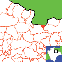
View a map of the boundaries of this town/parish.
You can see maps centred on OS grid reference SS917233 (Lat/Lon: 50.998867, -3.544734), Highley St Mary which are provided by:
- OpenStreetMap
- Google Maps
- StreetMap (Current Ordnance Survey maps)
- Bing (was Multimap)
- Old Maps Online
- National Library of Scotland (Old Ordnance Survey maps)
- Vision of Britain (Click "Historical units & statistics" for administrative areas.)
- English Jurisdictions in 1851 (Unfortunately the LDS have removed the facility to enable us to specify a starting location, you will need to search yourself on their map.)
- Magic (Geographic information) (Click + on map if it doesn't show)
- GeoHack (Links to on-line maps and location specific services.)
- All places within the same township/parish shown on an Openstreetmap map.
- Nearby townships/parishes shown on an Openstreetmap map.
- Nearby places shown on an Openstreetmap map.

